

eBook
Related collections and offers
Overview
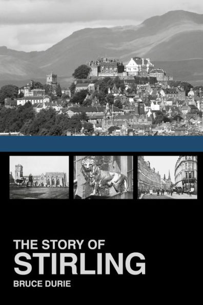
Written by well-known writer, broadcaster and genealogist Bruce Durie, this book tells the amazing story of Stirling's history from earliest times to the modern day. Some of the most pivotal moments in Scottish history occurred in the city's surroundings, including the Battle of Bannockburn – the greatest military victory in Scottish memory. But there is more to central Scotland's premier city than a battle, Robert Bruce and William Wallace. Illustrated with over 120 pictures – including 16 colour plates – and filled with curious, interesting and quirky facts throughout, The Story of Stirling will interest anyone who knows and loves this part of Scotland.

Product Details
| ISBN-13: | 9780750960403 |
|---|---|
| Publisher: | The History Press |
| Publication date: | 11/03/2014 |
| Sold by: | Barnes & Noble |
| Format: | eBook |
| Pages: | 160 |
| File size: | 7 MB |
| Age Range: | 18 Years |
About the Author
Read an Excerpt
The Story of Stirling
How a Rock Became a City
By Bruce Durie
The History Press
Copyright © 2014 Bruce DurieAll rights reserved.
ISBN: 978-0-7509-6040-3
CHAPTER 1
THE FIRST 600 MILLION YEARS
The Physical Geography of Stirling
In 1603 Scotland took over England, when James VI became James I. By the Union of Parliament in 1707, it was practically a client state of the Westminster Parliament. Almost 400 years later in 1998, the beginnings of re-separation were evident in Scottish devolution. But Scotland and England have always been very distinct. Even the very rocks from which they are made came from different parts of the world, brought together by plate tectonics. Today Scotland and England are firmly joined in the earth's temperate zone, but in the Cambrian period 550 million years ago, when multi-cellular life started to proliferate, they were both in the southern hemisphere.
To the south was what became England, Wales and southern Ireland, while 3,000 miles north was the American continent, and the rocks of Scotland. Newfoundland marks where one of the earth's great continental plates split apart about 600 million years ago and then collided again some 200 million years later. Scotland bumped into Europe, and stuck. The join occurs, interestingly, not far from where Hadrian's Wall was later built. Mud from the vanished ocean was squeezed and raised, becoming the hills of the Borders, while the collision threw up the Caledonian Mountains. Their eroded remains are now the Scottish Highlands which start not far north of Stirling.
The melting crust of 500 and 400 million years ago formed underground vats of molten rocks which cooled and became the characteristic granites. An ice cap developed at the South Pole and four-legged vertebrates evolved in the coal swamps near the equator, where Scotland was now positioned. Scotland carried on north past the equator until, in the Carboniferous era about 340 million years ago, corals lived in the tropical coastal seas and central Scotland was dominated by volcanoes, including the ones that formed the rocks of Edinburgh Castle and Stirling Castle. Volcanic lava produces fertile soil and the tropical forests eventually became Scotland's coal and oil.
By 260 million years ago, Britain had moved north again. The high lava plateaus and the great Scottish desert saw very little life, and there was no Atlantic Ocean. Reptiles spread across the face of the Pangaea supercontinent but the greatest extinction event ever wiped out 99 per cent of all life. Those reptiles that would later dominate as the dinosaurs started to develop in the coal swamps to fill the niche. Further land movements opened the Atlantic Ocean as the American plate drifted away, leaving behind the rock that became Scotland but pulling away its geological cousin, Newfoundland. By the time the large dinosaurs died out (or rather, evolved) 65 million years ago, volcanoes began to cool, leaving great crags of lava outcrops. Scotland was near its present position and the stage was set for the great Ice Age.
The Scottish mountains were then as high as the much younger Himalayas are now. But huge sweeps of ice gouged and scraped the land, eroding the mountains to the mere 3,000-foot stumps we see today. The landscape was still in the grip of frost 12,000 years ago, until the glaciers – moving rivers of ice – receded northwards, leaving behind a completely barren country. There were no trees, not even grass, but rainfall washing soil off the denuded hillsides into the newly formed lochs and valleys. Although the earth's average surface temperature has remained a more or less constant 20 ºC for most of the 3,600 million years life has existed, an ice age happens every 150 million years or so, with glacials and interglacials (cold and warm phases) lasting 100,000 years or so per cycle. The current interglacial began in perhaps 10,000 BCE(Before Common Era, that is before the year 0) and defined what we consider the Holocene (historical) epoch.
From the Stone Age to the Iron Age
Liberated of 300 feet of ice, the land lifted and as the melt water started to fill what would become the North Sea, the terrain of central Scotland was exposed. On their way to the ocean, the retreating glaciers had swept around and between the dolerite crags of Stirling Rock and Abbey Craig – site of the Wallace Monument – leaving flat marshes swept by the loops of the River Forth. The melting ice deposited its debris on the far side of the volcanic plug, leaving the distinctive crag and tail formations evident today.
Wind-blown seeds created vegetation and habitats where birds and other animals could live. Following the animals, human hunter-gatherer groups arrived, probably originating in Asia and passing through Europe before reaching Britain and Ireland. The climate was several degrees warmer than today so these peoples could live comfortably in caves or temporary structures while hunting the plentiful reindeer, mammoth and bison, which were eventually replaced by woodland species such as red deer and wild boar.
During the Neolithic period (4400–2000 BCE) there was very little difference between the Neolithic inhabitants and the incoming 'Beaker People'. But where did they get bronze? Scotland had several sources of both copper and gold. Copper was found in the Ochil Hills near Stirling and elsewhere, but bronze requires tin and the only source of this in Britain is in Cornwall. This indicates contact between Scotland and the south-west of England (as well as Ireland, where finished artifacts have been found).
A warrior aristocracy, now known as Celtic, appeared in about 700 BCE, or at least it is assumed they came. Just because we have Japanese cars, televisions and children's games does not mean the Japanese have invaded Britain. The Celts were not an ethnic group, but a culture and a language. Undoubtedly there was acculturation, with the techniques and practices of the Celts filtering into the lives of the Bronze Age inhabitants. One thing they certainly brought with them was the Iron Age and new weapons like swords and shields. As Winston Churchill put it, 'Men armed with iron entered Britain and killed the men of bronze.' This inevitably led to a need for easily defended settlements. The Celts, an enlightened, cultured people with a talent for metal-working and agriculture, introduced some typical structures – 'crannogs' (artificial islands usually found in lochs); 'duns' (oval or circular stone-walled forts); timber forts; and later hundreds of 'brochs' (large towers built of stone with internal walls divided into compartments). It is inconceivable that a natural citadel like Stirling rock would not be the site of a defended settlement.
At Julius Caesar's first invasion of Britain in 55 BCE, Scotland was divided between a number of warring Iron Age tribes, who spent their time raiding each other, growing oats and barley, raising sheep, fishing for river salmon and hunting deer. It would be half a dozen generations or so before the Romans reached Scotland and made their presence felt near Stirling. However, news of the vast army of well-disciplined warriors must have reached the people they would later write into their history as the Picts.
The Romans are Coming!
In Scotland the Romans left very little behind compared with the network of roads, aqueducts, camps and villas that cover England. Their dominion over Britain never extended much further north than Stirling, and their presence even that far was sporadic and fragile. However, they effectively caused the disparate tribes to forge themselves into more or less a nation, centred near Stirling, possibly in Fortriu (Forteviot). Pictland, if it ever existed as such, was a response to Roman aggression and led directly to the creation of the Scottish realm.
There is considerable evidence of Roman presence in Stirlingshire – a string of forts (praesidia), from the west coast to Camelon and Castlecary, a paved road along the same route then north through Stirling and, best known of all, the Antonine Wall. But it is not clear to what extent the Romans occupied Stirling itself. There are records of an inscription on a stone opposite the old gate of the castle, found by the eighteenth-century doctor and antiquarian Sir Robert Sibbald, but now obliterated. It read 'In Excv. Agit. Leg. II.', which Sibbald suggests is 'In excubias agitantes legionis secunda' – 'for the daily and nightly watch of the Second Legion'.
There is every reason why the Romans would have occupied the crag of the castle rock. If it were already a hill fort of the local Celtic tribes, it would need to be taken before the legions could proceed northwards. If unoccupied, it is unlikely the Romans would not have seen its defensive potential. Possibly the best evidence that it was already a fortified citadel is that the Romans did not include it in their string of defences along the isthmus between the rivers they called Glota (Clyde) and Bodotria (Forth) or in the Antonine Wall. Perhaps they had had to establish themselves a little way to the south in order to mount a campaign against it. They may, however, have sited a fort nearby at Allauna (sometimes identified with Bridge of Allan but possibly further north).
The Romans produced the first written accounts of the peoples of Scotland. In 79 CE(Common Era, that is after the year 0) the eleventh Roman Governor of Britannia, Gnaeus Julius Agricola, was ordered by Emperor Titus to advance north. Tacitus, Agricola's son-in-law, biographer and propagandist, recorded his various campaigns in the north in about 98 CE.
In the second century CE the geographer Ptolemy drew up the first known map of Scotland, which identified seventeen tribal territories, on what basis we do not know. Other descriptions show that the Romans regarded the 'barbarian' Picts with their customary mixture of fear, contempt and glimpses of awe. Dio Cassius wrote in 197 CEthat: 'They live in huts, go unclothed and unshod. They have a mainly democratic government, and are addicted to robbery. They can withstand hunger and cold and all hardships; they will retreat into their marshes and stand firm for days with only their heads above water, and in the forests they will live on barks and roots.' That may be.
The fact remains that the Romans made little headway into Scotland and never subdued it as they had the rest of Britain.
Agricola's legions may well have based themselves at Camelon, about 10 miles south of Stirling and near present-day Falkirk. From there his boats could bring supplies from the Forth by the River Carron. The Pictish Caledonian tribes around Stirling and further north, faced with imminent invasion by the most efficient military machine in the world, decided not to take it lying down as their cousins in the south of Britain largely had. According to Tacitus, the Caledonians 'turned to armed resistance on a large scale' – they attacked Roman forts, mounted skirmishing raids against the legions and, in one nocturnal surprise attack, very nearly wiped out the whole ninth legion. In any event, Agricola was retired and Lucullus named governor in his stead. All forts in the Forth and Clyde Valley were abandoned and the perimeter of the Empire was just north of the Cheviot hills. Later, this was consolidated into the Antonine Wall (see p. 16).
The Emergence of the Picts
Ptolemy identified as many as twelve different tribes inhabiting northern Britain at the time of the Roman invasions. It has been suggested that the presence of the Romans, in a sense, created the Picts, forcing the various northern tribes to unite into one confederation in self-defence, as happened with the Maeatae.
The names of the Pictish kingdoms come from various places and are roughly in accord with the foundation myth of seven Pictish kings descended from the 'first' Pict, known in Gaelic sources as Cruithne (also the Gaelic name for the Picts in general). One of these is no less an authority than St Columba, whose stanza appears in the eleventh-century Irish Lebor Bretnach (Book of Britain) and Lebor Gabála Érenn(Book of the Taking of Ireland):
Morsheiser do Cruithne clainn
raindset Albain i secht raind:
Cait, Ce, Cirig, cetach clann,
Fib, Fidach, Fotla, Fortrenn.
This might be translated as:
Seven of Cruithne's children
divided Alba into seven parts:
Cait, Ce, Cirig (Circinn, children with hundreds of possessions),
Fib, Fidach, Fotla and Fortriu.
Some of these names survive – for example Caithness (Cait), Atholl (Fotla), Glenfiddich (Fidach) and Fife (Fib). Fortriu – the Pictish kingdom that would have included Stirling – might be cognate with Verturiones (the Roman name for an earlier tribe) and with the name of the River Forth.
The Roman Legions Depart and Scotland Invents England
Faced with an alliance of Picts, Scots and Saxons, the Romans basically gave up trying to control the land north of Hadrian's Wall. In 411 CE the legions left to deal with the barbarian crisis at home. The Romanised Britons (who by now considered themselves more Roman than British) appealed constantly for help to no avail and eventually had to hire other 'barbarians' – in this case, the Angles and Saxons – to assist them. These Germanic tribes later settled and eventually dominated the land south of Hadrian's Wall. It is surely one of history's greatest ironies that the Roman civilisation all but disappeared and that the solution to Scottish tribal raids actually brought into Britain the very people who would create 'England'.
The power vacuum left by the Romans boiled for almost three centuries, culminating in the crushing victory of King Brudei and his Picts over King Ecgfrith of Northumbria in the mid-600s. The Northumbrian army was routed, most of them killed or enslaved, 'English' influence retreated south of the Forth and a unified state was starting to emerge in northern Britain. This would be consolidated over the next two centuries, culminating in the kingdom of Scotland under Kenneth MacAlpin, in which Stirling played so great a part.
Recently, Dark Age Stirling thrust itself into history when it was discovered that there had been a timber-laced fortress on Abbey Craig dating from 500 to 780 CE. Found while workmen were laying cables for floodlights at the Wallace Monument, the citadel has all the signs of a heavily fortified tribal capital. Stirling was clearly an important centre at just about the time Scotland as a political entity was coming into existence.
CHAPTER 2STIRLING CASTLE – FROM CITADEL TO ROYAL PALACE
A huge brooch, clasping Highlands and Lowlands together.
Alexander Smith, 1856
Stirling is the greatest of Scotland's castles. Superficially alike in shape and layout to its larger but less appealing cousin in Edinburgh, it occupies a similar position – atop a large volcanic crag – and for similar reasons. The castle dominates the skyline of the area and affords an uninterrupted view for miles around in every direction. It commands the lowest crossing point of the River Forth and the highest navigable point. The Romans knew this when they fortified Camelon so that their fleet could bring provisions up the River Carron to within a short distance. Its site is also near the shortest land distance between the Forth and Clyde, but to the west and north the marshes were practically impassable. Stirling Castle is therefore at the crossroads of both the strategic way north–south and the trade routes on land and water. For this reason, Stirling played a crucial part in the early forging of Scotland as a nation. Not for nothing has it been called 'the key to Scotland'.
Scotland and Alba
Some time before 850, the Picts of central and east Scotland and the Gaelic Scots of Dalriada (roughly present-day Argyll) came together as one nation. Scottish history is often depicted as starting with the death of Alpin and the ascendancy of his son Kenneth MacAlpin who ruled Dalriada from 834 and Pictavia from about 841 to 849, but this is more a convenience rather than an historical milestone. Almost nothing is known of Alpin, save his birth possibly in 810 and his crushing defeat of the Picts in 834. Kenneth, although never actually crowned king, is generally given credit for uniting the Scots and the Picts in 844 and history has dubbed him Kenneth I. In fact, there had been many intermarriages and alliances between the various Scot and Pictish tribes or kingdoms for centuries before and Kenneth also had a claim to the Pictish throne through matrilineal succession (his mother was a Pictish princess).
Legend tells that Kenneth besieged a stronghold at Stirling some time after 842, which suggests a fort already existed on the castle site, or perhaps at the Abbey Craig site mentioned on p. 13. One battle is said to be connected with a 'Gathering Stone' on land that once belonged to Airthrey Castle but is now owned by the University of Stirling. The Gathering Stone itself is wreathed in confusion. It is said to have been used either as a mustering point for the Picts in a battle with Alpin in 834, or his son Kenneth MacAlpin in 843, or raised as a monument to either of their victories. More likely, it is an older standing stone. There is no proven connection with the battle and no real evidence that a battle actually took place at Airthrey at all. However, this has not prevented the stone becoming the site and subject of a later struggle. In 2002 the university decided on the need for two new rugby pitches and, after consultations with Historic Scotland and Stirling Council planners, was given permission to lay these near the stone. The university has pledged to preserve and protect the stone, with a 15-metre 'exclusion zone' and a path to improve public access, but there was a vigorous protest at the time.
(Continues...)
Excerpted from The Story of Stirling by Bruce Durie. Copyright © 2014 Bruce Durie. Excerpted by permission of The History Press.
All rights reserved. No part of this excerpt may be reproduced or reprinted without permission in writing from the publisher.
Excerpts are provided by Dial-A-Book Inc. solely for the personal use of visitors to this web site.
Table of Contents
Contents
Title,Introduction,
one The First 600 Million Years,
two Stirling Castle – From Citadel to Royal Palace,
three The Coming of the Stewarts,
four The Shaping of Stirling Burgh,
five Guilds, Trades & Industry,
six A Most Desirable Destination,
seven The Twentieth Century,
epilogue Stirling Homecoming 2014 and Bannockburn 700,
Acknowledgements & Picture Credits,
Plates,
Copyright,