
In 1956 sea area Heligoland became German Bight. But why did the North Sea island, which for nearly a century had demonstrated its loyalty to Britain, lose its identity? How had this once peaceful haven become, as Admiral Jacky Fisher exclaimed 'a dagger pointed at England's heart'? Behind the renaming of Heligoland lies a catalogue of deceit, political ambition, blunder and daring. Heligoland came under British rule in the nineteenth century, a 'Gibraltar' of the North Sea. Then, in 1890, despite the islanders' wishes, Lord Salisbury announced his intention to swap it for Germany's presence in Zanzibar. The Prime Minister's decision unleashed a storm of controversy. Queen Victoria telegrammed from Balmoral to register her fury. During both world wars, it was used by Germany to control the North Sea, and RAF planes bombed the once-British territory. The story of Heligoland is more than an obscure footnote to the British Empire - it shows the significance of territory throughout history.
In 1956 sea area Heligoland became German Bight. But why did the North Sea island, which for nearly a century had demonstrated its loyalty to Britain, lose its identity? How had this once peaceful haven become, as Admiral Jacky Fisher exclaimed 'a dagger pointed at England's heart'? Behind the renaming of Heligoland lies a catalogue of deceit, political ambition, blunder and daring. Heligoland came under British rule in the nineteenth century, a 'Gibraltar' of the North Sea. Then, in 1890, despite the islanders' wishes, Lord Salisbury announced his intention to swap it for Germany's presence in Zanzibar. The Prime Minister's decision unleashed a storm of controversy. Queen Victoria telegrammed from Balmoral to register her fury. During both world wars, it was used by Germany to control the North Sea, and RAF planes bombed the once-British territory. The story of Heligoland is more than an obscure footnote to the British Empire - it shows the significance of territory throughout history.


Heligoland: The True Story of German Bight and the Island that Britain Forgot
336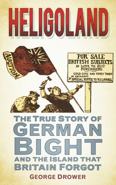
Heligoland: The True Story of German Bight and the Island that Britain Forgot
336eBook
Available on Compatible NOOK devices, the free NOOK App and in My Digital Library.
Related collections and offers
Overview
In 1956 sea area Heligoland became German Bight. But why did the North Sea island, which for nearly a century had demonstrated its loyalty to Britain, lose its identity? How had this once peaceful haven become, as Admiral Jacky Fisher exclaimed 'a dagger pointed at England's heart'? Behind the renaming of Heligoland lies a catalogue of deceit, political ambition, blunder and daring. Heligoland came under British rule in the nineteenth century, a 'Gibraltar' of the North Sea. Then, in 1890, despite the islanders' wishes, Lord Salisbury announced his intention to swap it for Germany's presence in Zanzibar. The Prime Minister's decision unleashed a storm of controversy. Queen Victoria telegrammed from Balmoral to register her fury. During both world wars, it was used by Germany to control the North Sea, and RAF planes bombed the once-British territory. The story of Heligoland is more than an obscure footnote to the British Empire - it shows the significance of territory throughout history.

Product Details
| ISBN-13: | 9780752472805 |
|---|---|
| Publisher: | The History Press |
| Publication date: | 10/21/2011 |
| Sold by: | INDEPENDENT PUB GROUP - EPUB - EBKS |
| Format: | eBook |
| Pages: | 336 |
| File size: | 588 KB |
| Age Range: | 18 Years |
About the Author
George Drower is a writer and historian. He is the author of the acclaimed Britain's Dependent Territories and the Overseas Territories Handbook; a number of political biographies; and articles on garden history for The Times, The Sunday Times, Traditional Homes and House & Garden. He has previously written the successful Boats, Boffins and Bowlines and Sails, Skippers and Sextants for The History Press.
Read an Excerpt
Heligoland
The True Story of German Bight and the Island that Britain Forgot
By George Drower
The History Press
Copyright © 2011 George DrowerAll rights reserved.
ISBN: 978-0-7524-7280-5
CHAPTER 1
HMS Explosion Arrives
Some 30 miles from the coasts of Schleswig-Holstein and Lower Saxony, Heligoland rises like a fist from the swirling waters of the North Sea. Its cliffs tower some 200 feet above sea level, their red sandstone vivid against the cold flatness. Nearby are Germany's East Frisian Islands (Borkum, Memmert, Juist, Norderney, Baltrum, Langeoog, Spiekeroog and Wangerooge), separated from the mainland by mud and sand flats. Strung parallel to the Lower Saxony coast, this chain of low-lying islands once formed an offshore bar stretching from Calais to the Elbe. Between the coastal islets stretch the muddy estuaries of the rivers Elbe, Ems, Weser and Eider. In this area, known as the Heligoland Bight, strong currents, high winds blowing down from the Arctic and relatively shallow waters combine to produce not only severe weather but also steep waves. Historically, in some winters the rivers would freeze over, and with the thaw large sheets of ice would tear free and flow downstream to the open sea. Even in medieval times such dangerous waters required daring and specialist piloting skills that very few locals other than the Heligolanders were perceived to possess. Centuries later those exceptionally grim sea conditions were vividly brought to the attention of British mariners in the spy novel The Riddle of the Sands by the famous adventure writer and yachtsman Erskine Childers.
By the late summer of 1807, during the Napoleonic wars, England's situation had become more dangerously isolated than ever. On land, Bonaparte's armies were sweeping across Europe, relentlessly shattering the powerful coalition the British Prime Minister, William Pitt the Younger, had constructed just two years earlier with Austria, Russia and Sweden. Austria was defeated at Austerlitz in 1805, Prussia partly broken at Jena in 1806, and the Russians overcome in East Prussia in July 1807. Under the terms of the momentous Treaty of Tilsit in July 1807, Napoleon demanded that Russia become an ally of France; its territories were much reduced and some occupied by French troops, as was what remained of the Lower Saxony part of Prussia. So swiftly did Napoleon's forces ride into Lower Saxony later that month that Sir Edward Thornton, Britain's plenipotentiary in Hamburg (effectively its ambassador) had to flee overland to Kiel, narrowly escaping capture. When, soon afterwards, French troops occupied Portugal and then Spain, Napoleon assumed that in some form or other he had secured control of the entire coastline of mainland Europe from the Adriatic to the Baltic.
So far, of all the forces ranged against Napoleon, only the Royal Navy had succeeded in making any significant strategic impact. The attacks on French shipping off Egypt at the Battle of the Nile in 1798 and on the Danish fleet at the Battle of Copenhagen in 1801 proved that Britain was able to make audaciously devastating strikes by sea. Forced by the destruction of the French and Spanish fleets at the Battle of Trafalgar in October 1805 to cancel his long-planned invasion of England, Napoleon decided to bide his time and rebuild his navy. In the meantime he devised an equally ambitious scheme that was intended to subjugate Britain by economic means. In November 1806 he decreed that the so-called 'continental system' was to be imposed along the entire coastline of Europe; this was intended to stop any of France's enemies, as well as neutral countries, from trading with Britain. By placing Britain under blockade, he hoped to ruin the international trade that formed the bedrock of her prosperity, and thus force her to accept his terms for peace. In January 1807 the British government retaliated by declaring a counter-blockade, by which Royal Navy warships would prevent vessels of any neutral country having commercial dealings with any French port, or with any port belonging to the allies of the French.
The stop and search duties this required British warships to undertake were, in certain significant respects, similar to other functions at which they were accomplished. Although such ships could often be subordinate in design to French ships, their signalling systems were more efficient and their discipline superior, making them formidable opponents in action. The skills involved in maintaining a maritime embargo they had perfected during the long years of blockading France's invasion fleet, most notably in the unforgiving seas off Brest and Boulogne. Nevertheless the additional burden of having to impose a counter-blockade against the entire continent greatly stretched the navy's resources. But Admiral Thomas Russell was determined to keep the might of his squadron concentrated on its job of blockading what remained of the Dutch fleet, sheltering near the island of Texel, and since March 1807 the only vessel he could spare to take station off the mouth of the Elbe was a solitary frigate.
The work was dangerous, but it had to be done. Such were the risks of sailing in bad weather so close to shore (which was unlit at night), the spectre of shipwreck was ever-present. Indeed, of the navy's total loss of 317 ships in the years 1803–15, 223 were either wrecked or foundered, the great majority on account of hostile natural elements. Notwithstanding the sea-keeping qualities of the Royal Navy's ships, their capacity for endurance was far from endless. Such was the merciless pounding of the seas on hulls, rigging and spars, Admiral Russell knew that scarcely a month would go by when he did not have to send one or more of his vessels to the safety of the home dockyards for repairs.
The royal dockyards had just about been able to cope with these casualties because as well as building new ships they also had the capacity to repair damaged vessels. From the Baltic they received virtually all the high-quality basic products required, such as timber, flax, hemp, tallow, pitch, tar, linseed, iron ore and other necessities. But all that was suddenly thrown into jeopardy in the summer of 1807 when Sir Edward Thornton sent reports to London indicating that France was planning to seize Denmark's fleet. As a neutral country, Denmark was in an invidious position between the warring factions. As a significant naval power, whose fleet had been rebuilt since 1801, she was regarded as a potential prize by both sides. On 21 July 1807, hearing – possibly via Talleyrand – that Napoleon and Alexander I of Russia were in the process of forming a maritime league against Britain in which Denmark would play a part, the War Minister Lord Castlereagh issued demands for the surrender of the Danish fleet.
Having battled around the Skagerrak in atrocious seas only to encounter frustrating calms in the Kattegat, Admiral Gambier's task force of twenty-one ships-of-the-line, carrying nearly 20,000 troops, eventually arrived off Copenhagen on 2 September. When the Danish government rejected calls for surrender, a heavy naval bombardment of the city began. The most fearsome weapons used by the British, to devastating effect, were bomb-vessels equipped with huge mortars that lobbed 10-inch diameter fragmentation shells. These burst on contact and cut down personnel indiscriminately. By 5 September some two thousand of Copenhagen's inhabitants had been killed, many more were wounded and, to bitter parliamentary criticism, the remains of the Danish fleet was seized and brought into the Yarmouth Roads. This brutal pre-emptive strike had been a flagrant breach of Denmark's neutrality, and it threatened to be politically disastrous. Soon the key states under French influence – Russia, Prussia and Austria – declared war on Britain. Significantly, on 17 August Denmark abandoned its neutrality and also declared war on Britain. The British had already been taking stock of Denmark's possessions, wondering which might be strategically useful, and Denmark's new stance soon focused British attention on Heligoland.
The fact that Britain had never before needed to fight a war in Europe on such a scale meant that a weakness now appeared in its campaigning. Numerous hitherto obscure parts of Europe were now suddenly of tremendous strategic value – but Britain had little or no intelligence about them. Rather astonishingly, although Heligoland was only some 290 miles from the Norfolk coast, scarcely anyone in Britain knew anything about the island, or even what it looked like. It seems quite probable that the only detailed chart of it the Admiralty had in its possession was a copy of one which had been made for the Hamburg Chamber of Commerce in 1787. This chart had recently been received from the second-in-command of Admiral Russell's flagship, HMS Majestic, Lieutenant Corbet D'Auvergne; he had acquired it from one Captain Dunbar, who happened to purchase it over the counter of a commercial ship's chandler during a visit to Copenhagen in 1806. Fortunately for Admiral Russell, Lieutenant D'Auvergne was not just an exceptionally enterprising officer. He happened to be the younger brother of Rear-Admiral Philip D'Auvergne, otherwise known as the Duke of Bouillon, who was at that time controlling a network of spies gathering intelligence for Britain via the Channel Islands. The Jersey-based Bouillons were Belgian aristocrats who well knew the frailty of small national entities, having fled to England as long ago as 1672 when they were deposed from their homeland by the French.
The scarcity of detailed knowledge about the south-east part of the North Sea was slightly more surprising because Britain had – albeit intermittently and fleetingly – made various contacts with Heligoland over many centuries. There is a possibility that the island even received its name from a seventh-century English missionary called St Willibrod. The first written reference to the island appeared in ad 98, when it was recorded under the name 'Hyrtha' by the Roman historian Tacitus. At the very end of the seventh century, after Willibrod's accidental arrival there after a shipwreck in about ad 699, it acquired the name Heligoland (meaning 'Holy Land'), possibly because Willibrod himself came from Lindisfarne, on Northumberland's Holy Island, or perhaps because it had been a sacred place of the old Norse heathen gods.
Although for innumerable years thereafter various Viking chiefs vied for sovereignty of the island, such a hold as they were able to achieve was often precarious and disinterested. As a consequence there were often lengthy phases when the Heligolanders were left alone, and so virtually governed themselves. In a sense King Canute the Great of Denmark increased the island's constitutional promiscuity. By virtue of his becoming King of England in 1017, Heligoland came within the ambit of the English Crown for the period of his reign, which ended in 1036. In so far as there were subsequent links they were occasional, almost entirely of a commercial nature, and took the form of trips made by small merchant ships between the island and London's Billingsgate Market. In Britain it was only such traders who knew of the existence of Heligoland, together with a few mariners who had sought shelter there in bad weather or had perhaps transhipped some cargo in its waters. This remained the situation for centuries. In 1553 Richard Chancellor, the pilot-general of the exploration vessel Bonaventure, en route via Russia to search for a northeast passage to India, noted its existence in his journal – but he only happened to catch sight of it from a distance when his ship was blown off course by a storm. In Napoleonic times there was great need for a wider knowledge of Heligoland but no one had ever bothered to write down – in any language – any sort of history or pilotage notes.
Another beguiling feature of Heligoland's capriciousness was its ever-changing geographical appearance. By Napoleonic times it had changed dramatically from just a few centuries earlier. About the year 800 it had become home to a civilisation as advanced as any in northern Europe, with several villages scattered over the island. Then covering some 24 sq. miles, it was wooded and fairly low-lying. In the south-west corner there was a huge mound, above which there towered two adjoining promontories, one of red stone and the other of white. Radiating outwards from the centre of the island were ten rivers. At the sources of the northernmost of those rivers were temples that had earlier been used for worshipping Tosla, Mars, Jupiter and Venus; in the south could be found a monastery and five churches. In inlets around the coastline were six anchorages, the three most important of which were on the leeward side of the island protected by three castles. But according to a map of Heligoland produced by the cartographer Johannes Mejerg in 1649, the gnawing away of the coastline by wave erosion and storms had been so voracious that by the year 1300 the sea had devoured all but 4 square miles of the hilly south-west corner of the island. All that remained at its fringes were the monastery, a church and the castle. By 1649 these too had vanished, leaving just an 'H'shaped island, half red and half white, from which extended sandy reefs shaped like giant lobster claws. And thus it stood until New Year's Eve 1720. That night there was an epic storm, and the sea surged through, permanently severing the narrow gypsum isthmus that had hitherto joined the western and eastern rocks. From then on Heligoland consisted of two distinct geographical sections, the main part of which was sometimes called Rock Island. Its low-lying dependency, just a few hundred yards to the east, was termed Sandy Island.
The final element in Heligoland's air of capriciousness was derived from the indefinability of its sovereignty. In 1714 Heligoland notionally became a possession of the Dukes of Schleswig-Holstein, who were Kings of Denmark. Danish rule was fairly remote and the Heligolanders were allowed the freedom to govern their own island as they thought best. Indeed in practical terms the ties that bound Heligoland, Denmark and Schleswig were slight. The island became a de facto No-Man's-Land, free to all, and afforded a welcome refuge for the people of other islands who were hounded by Danish tax-gatherers. The people made what they could by privateering, fishing and pilotage. Yet in Britain nothing was even known of the form of government which existed on the island. By Napoleonic times the Danish government had granted to Heligoland a few public works such as, in 1802, a fine cliff-side oak staircase joining the Lower and Upper Towns.
Thus, in early September 1807, when Lord Castlereagh was poised to order the seizure of the island, all he had to go on was Lieutenant D'Auvergne's chart of the waters around it. The whole map measured just 15 inches by 9, less than 3 square inches of which covered the main island. It showed a blur of houses, but crucially gave no indication of where any fortifications might be. This all left disturbing questions about how much conditions there might have altered since 1787 when the chart had been drawn. For example, had the lobster-shaped reefs around Heligoland moved? There were military questions too. How many guns was it armed with? How many troops was it garrisoned by, and how spirited a fight might they make in defending it? So far the only written information available to Castlereagh was Chancellor's reported sighting of the island as long ago as 1553! But, by extreme good fortune, the person best able to provide the sort of answers Castlereagh needed had just arrived in London.
Even by the standards of the best and brightest of the Foreign Office in that era, Sir Edward Thornton was an exceptionally talented diplomat. The son of a Yorkshire innkeeper, and later a tutor to the household of the Foreign Secretary, Thornton had distinguished himself in the United States as the British chargé d'affaires in Washington. Since 1805 he had been Britain's plenipotentiary to Hamburg and the Hanse towns, but through his enthusiasm for his duties he had extended his understanding of potentially significant places beyond Lower Saxony. In the process he had made it his business to learn about nearby Heligoland, even though it was a Danish possession. It was in that regard that by 20 July 1807 he was corresponding with the picket ship HMS Quebec, stationed by Admiral Russell in the Bight. On 14 August 1807, having made a dangerous overland journey from Kiel to the mouth of the Elbe, Thornton and three of his diplomatic officials escaped in a small boat into the Bight where they encountered the Quebec. As they clambered aboard, Thornton and his party were greeted by the frigate's captain, Viscount Falkland. Allowed to remain as guests, they could see for themselves how the warship struggled in those waters to go about her business of intercepting suspicious-looking merchant ships. The potentially immense strategic importance of Heligoland suddenly became apparent on 19 August when news was received from a passing ship that Denmark had declared war on Britain two days before.
(Continues...)
Excerpted from Heligoland by George Drower. Copyright © 2011 George Drower. Excerpted by permission of The History Press.
All rights reserved. No part of this excerpt may be reproduced or reprinted without permission in writing from the publisher.
Excerpts are provided by Dial-A-Book Inc. solely for the personal use of visitors to this web site.
Table of Contents
Contents
Introduction,1. HMS Explosion Arrives,
2. Gibraltar of the North Sea,
3. Rivalries in Africa,
4. Queen Victoria Opposes,
5. Swapped,
6. The Riddle of the Sands,
7. Churchill Prepares to Invade,
8. Project Hummerschere,
9. 'Big Bang',
10. The Islanders Return,
11. Forgotten Island,
Notes,
Bibliography,