

People Habitat: 25 Ways to Think About Greener, Healthier Cities
304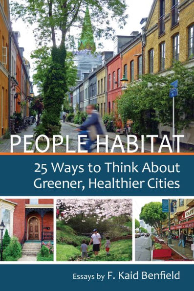
People Habitat: 25 Ways to Think About Greener, Healthier Cities
304Overview
People Habitat explores topics as diverse as “green” housing developments that are no such thing, the tricky matter of gentrifying inner cities, why people don’t walk much anymore, and the relationship between cities and religion. Written with intellect, insight, and from-the-heart candor, each real-world story in People Habitat will make you see our communities in a new light.

Product Details
| ISBN-13: | 9780989751117 |
|---|---|
| Publisher: | Island Press |
| Publication date: | 12/10/2013 |
| Sold by: | Barnes & Noble |
| Format: | eBook |
| Pages: | 304 |
| File size: | 57 MB |
| Note: | This product may take a few minutes to download. |
About the Author
Read an Excerpt
People Habitat
25 Ways to Think about Greener, Healthier Cities
By F. Kaid Benfield
People Habitat Communications
Copyright © 2014 F. Kaid BenfieldAll rights reserved.
ISBN: 978-0-9897511-1-7
CHAPTER 1
It's Not Really about Cities
Allow me to be deliberatively provocative: although this is a book about cities, in some senses "cities" don't matter nearly as much as we sometimes suggest. To the environment and the economy, neighborhoods and metropolitan regions matter more.
Legally, cities are municipalities with strictly drawn formal boundaries—but that is not how most people use the word. And that's where we can get into trouble when it comes to understanding them. I prefer to think in terms of metropolitan regions, which provide the economic and environmental scale of people habitat, and neighborhoods, which provide the human scale.
Let me give an example of how language about cities can be confusing: a couple of years ago, a professional friend returned from a meeting in which there was discussion about so-called "shrinking cities." This is a very sharp, aware guy. At that meeting someone reportedly said that "29 US cities have grown recently and the rest have shrunk." My friend wondered if we should refocus the field of smart growth (oversimplified, an ethos encouraging compact development patterns supported by walkability and transit) away from being about "growth," since so few places are actually growing.
That didn't sound right to me at all, so I checked the facts: There were 366 metropolitan areas tracked by the US government as of 2010; cumulatively, they grew by 10.8 percent in between 2000 and 2010. Of the 50 largest, 45 grew and only 5 declined in population during that decade. One of the five, New Orleans, is a special case because of the effects of Hurricane Katrina in 2005; two of the five grew population in their suburban areas, even while declining overall. Other than New Orleans, only Buffalo and Pittsburgh declined in population in both their core cities and their suburbs between 2000 and 2010. Overall, that's a lot of growth, and nearly all US metros—even the ones that have lost population—have expanded their spatial footprint, the amount of land that they occupy. That's not shrinking.
Each US "metropolitan statistical area," as defined by the US Office of Management and Budget, has one or more "core cities," generally the older, centrally located municipality for which the metro area is informally known (for example, Washington, DC is a core city for the Washington MSA). Unfortunately, the population of these inner, core cities was in decline just about everywhere in America during the second half of the 20th century as population and investment flew to the suburbs. Municipal Washington, where I live, lost an astounding 29 percent of its population between 1950 and 2000.
But growth didn't stop; it just shifted beyond the core cities. Recently, even that trend is reversing, faster in some places than others. So why did my statistics vary so drastically from those of the speaker at my friend's meeting?
My guess is that the speaker had a point he or she wanted to make and chose a select set of facts to support it—probably looking only at a subset of the places tracked by the census, and probably looking only at what was happening inside the jurisdictional boundaries of the older cities located in the centers of their expanding metro regions.
Those jurisdictional city boundaries—the "city limits"—are largely arbitrary in today's world. They date back to the early 20th or even 19th century in many cases, are frequently drawn in crazy ways, and bear little relation to how places function now. Consider the image in this chapter that shows the city limits of Atlanta drawn on a satellite photo of what is now the real Atlanta.
Whatever the origin of the statement about shrinking cities, the resulting impression—that few places are growing—could not be more false. It misled my friend and it could mislead policy-makers into some very ill-informed decisions. Here's how the problem occurs: Merriam-Webster defines a city as "an inhabited place of greater size, population, or importance than a town or village." That's the way most of us use the word, most of the time.
But Merriam-Webster also defines a city as "a usually large or important municipality in the United States governed under a charter granted by the state." These are two overlapping but very different things: using the first definition, one might say that "Atlanta" is a sprawling metropolis and powerful economic entity with a population of over 5.4 million people; but, using the second, Atlanta becomes a much smaller area containing only 432,000 residents (as of 2011). Metropolitan Atlanta holds over twelve times the population of the "city" of Atlanta.
In other words, the smaller, jurisdictional Atlanta may mean something to candidates for city office and cartographers, but it has very little to do with economic or environmental reality. Let's zoom in. See the neighborhood-scaled satellite image with the bright, zigzagging line? That line marks a portion of the city limits of Atlanta. If there is a meaningful distinction in the real world to be made between the areas inside and outside the official city boundary, it sure eludes me.
As the Brookings Institution puts it, metropolitan regions "are our hubs of research and innovation, our centers of human capital, and our gateways of trade and immigration. They are, in short, the drivers of our economy, and American competitiveness depends on their vitality."
As put by one Barack Obama during his first presidential campaign:
"That is the new metropolitan reality and we need a new strategy that reflects it—a strategy that's about South Florida as much as Miami; that's about Mesa and Scottsdale as much as Phoenix; that's about Stamford and Northern New Jersey as much as New York City."
How about another example? My wife and I live in the city of Washington, DC, but she works in nearby suburban Virginia; I ride my bike pretty much every weekend from my house into Maryland and back without even noticing where the jurisdictional boundary is. Sometimes I return home along a street where the houses on the left side are in the District of Columbia and those on the right are in Maryland.
I'm not exactly sure whether my doctor's office is in DC or Maryland. I just know it's close to the boundary; the street and buildings look exactly the same on both sides. My colleagues at the office go home in the evenings to a dozen different municipalities.
Environmental media don't respect political boundaries, either: The Potomac and Anacostia Rivers receive runoff from Virginia and Maryland as well as from the jurisdictional cities of Washington and Alexandria; the Chesapeake Bay watershed includes parts of seven states and scores of municipalities. The air in Chicago moves freely around the seven counties and 284 separate municipalities just within the Illinois part of the region, to say nothing of those in nearby Wisconsin and Indiana. Very little of the energy consumed within the jurisdictional limits of the city of San Francisco is generated there. And so on. Statistics about only what is happening inside city limits seldom tell us much about what is relevant environmentally.
I would submit that the other scale (besides metropolitan regions) of people habitat that matters the most to the greatest number of people is the neighborhood. Neighborhoods are where we eat and sleep and where, if we are lucky, our kids play and go to school; where we shop for food, take our dry cleaning, and maybe grab a bite to eat; where we meet neighbors on the street or in community gatherings; if we're really lucky, the neighborhood will even have a library branch and a hardware store.
While those of us who live in metropolitan areas—and that includes 83 percent of all Americans—zip all around them to visit friends, conduct business, and shop, we're usually going to other neighborhoods when we do. If the region represents the economic scale of real cities, the neighborhood represents the human scale.
Neighborhoods are also the scale at which land development takes place, where new buildings and facilities are proposed, debated, and constructed. They are where development decisions actually occur, and where we must pay attention if we want to have influence. In fact, one of the best ways to reduce the environmental footprint of a region is to revitalize older neighborhoods that have lost population, because their relatively central locations reduce transportation emissions and they require little if any increase in run-off-causing impervious surface. They also help conserve land by obviating additional increments of suburban sprawl.
So where does that leave cities in the jurisdictional sense of the word? They certainly remain very important politically. In big cities, we can address problems at scale when we lack the legal and regulatory tools to do so regionally. Municipalities are where we frequently advocate stormwater regulation, building standards, complete streets, zoning reform, and even climate policy. It's where we can get things accomplished.
But that's partly because cities are the low-hanging fruit of environmental standards and regulation. We often look to mayors, for example, for leadership on environmental issues, even though in the case of big cities their authority is limited to the parts of their regions that are almost always the most sustainable already, on a per capita basis. It frequently pays off: urban mayors tend to be more innovative and progressive than their suburban counterparts.
But, when we focus inside the city limits instead of on the region, we're missing much of the problem, and we shouldn't pretend otherwise. Stormwater runoff per capita is typically much higher in sprawling suburbs, as are emissions of all sorts, particularly those related to transportation.
One can even make the case that regulators should be going easier on relatively compactly settled core cities and neighborhoods than on sprawling places: to paraphrase David Owen, author of the book Green Metropolis, why put skinny people on diets? My personal view is that our framework of environmental regulation absolutely should be tougher on sprawling places than urban ones, but that urban ones should also do their fair share to heal our ecosystems, through appropriate standards, safeguards, and mitigation.
Unfortunately, I think we remain relatively less attentive to the suburbs, largely because our crazy patchwork of suburban municipalities makes them legally so diffuse; with very rare exceptions, there simply is no regional authority to address the metropolis as a whole. Addressing municipalities one by one, even if we had the resources to do so, can lead to perverse results, since sometimes the most expedient way to eliminate an environmental harm in jurisdiction A is to push it over to jurisdiction B.
To return to the shrinking cities phenomenon, if an area's economy is in general decline leading to regional as well as central city population loss, that's one thing, leading to one set of appropriate responses; but, if core city population loss is more indicative of a metro region's hollowing out while the economy remains viable enough to support continued suburban development on the fringe, that's quite another—and one that must be addressed by looking outside the city's jurisdictional borders as well as within. Failure to do so, in my opinion, is simply irresponsible.
More About Regions
Multi-jurisdictional Authority and Cooperation in Portland
Metropolitan Portland, Oregon has the nation's only directly elected regional government. First established in 1978, Metro's primary mission is conducting planning and adopting policy to preserve and enhance the quality of life and the environment. This includes authority over transportation investments, land use, and administration of the region's urban growth boundary (outside of which nonrural development generally may not occur), along with regional fish and wildlife habitat protection, and management of some parks and waste management facilities. It has six councilors, each representing a geographic district within the metropolitan area, with one chosen as Metro Council president by his or her peers annually. Metro is served by a staff of 700 employees.
Metro's authority is limited to the three Oregon counties in the Portland region, however, and not Clark County, Washington, across the Columbia River. Many credit the stronger authority on the Oregon side with those counties' relatively successful limitation of new development outside the growth boundary: In Clark County, exurban housing grew by 18 percent from 2000 to 2010; by comparison, the Oregon counties added just as many new housing units during the decade but increased the portion outside the growth boundary by only five percent.
The more compact development pattern, supplemented by investment in transportation choices, has brought environmental benefits. Contrary to the national trend, metropolitan Portland's average driving rates (vehicle miles traveled per person per day) have held relatively steady since 1990, while the rate for the nation as a whole increased significantly; Portlanders drive 13 percent fewer miles per day than do average US citizens. Portland has also produced a reduction in carbon emissions from 1990 levels, even though the region has experienced an 18 percent growth in population since then. Residents of Portland emit 35 percent less carbon per capita than those of other US cities.
California's SB 375
In California, there are no regional governments as such, but a 2008 law (known to most by its bill number, "SB 375") requires the state's metropolitan regions to meet targets for reducing greenhouse gas emissions through land use and transportation measures. In particular, each of the 18 regions' metropolitan planning organizations (all US metro regions have MPOs but few have any regulatory authority) is required to designate growth areas for more efficient housing and commercial development patterns. The areas must be drawn so that they reduce automobile dependence through more walking, more efficient public transit, and shorter driving distances. The land use plan must be supplemented by a complementary transportation network, and the entire "sustainable communities strategy" must be certified as adequate by California's Air Resources Board.
State financial support will flow to transportation projects contained in an approved strategy. Another key element is that individual residential and mixed-use development projects that are consistent with a certified plan will be exempted from certain analytical requirements normally required by the California Environmental Quality Act, since the relevant analysis will already have been performed in the regional planning process. A project found to be a "superior sustainable communities project" under strict environmental and land use criteria will receive additional CEQA exemptions.
Emerging strategies under the law are impressive. The plan for the massive Southern California metro area (the nation's largest by size), for example, calls for investing $246 billion in public transportation; placing 60 percent more housing in transit-accessible locations; placing 87 percent of all jobs within a half mile of transit service; reducing traffic congestion 24 percent per capita despite the addition of four million residents; and saving over 400 square miles of farmland and other open space from development.
Ontario's Places to Grow Initiative
The North American continent's most impressive plan for managing growth and development, however, may be the Places to Grow framework adopted by the province of Ontario, Canada. Constructed pursuant to enabling legislation adopted by the province in 2005, Places to Grow addresses the future of a New Hampshire-sized region around and including Toronto, Canada's largest city, and Hamilton, its 8th largest. The plan requires minimum average densities (single-family homes with larger lots may be combined with other housing types to achieve the requisite average) for all new development in the region, with higher densities required for downtowns, transit corridors, and "major transit station areas."
All growth areas must accommodate affordable housing, and development generally may not occur outside of the designated areas. Areas important to natural resources or the environment must be protected, and there are restrictions on development of prime farmland. Perhaps most visibly, the new plan will allow the continued protection of a greenbelt comprising 1.8 million acres of rural and conservation land, an area over three times the size of the Great Smoky Mountains National Park in the US, and just a shade smaller than Yellowstone National Park.
Most impressive of all, Places to Grow has the full force and effect of law, thanks to Ontario's Places to Grow Act of 2005. That law requires that local planning decisions, including zoning, conform to the policies in the regional plan. If there is a discrepancy, the provincial government has the authority to amend municipal decisions.
(Continues...)
Excerpted from People Habitat by F. Kaid Benfield. Copyright © 2014 F. Kaid Benfield. Excerpted by permission of People Habitat Communications.
All rights reserved. No part of this excerpt may be reproduced or reprinted without permission in writing from the publisher.
Excerpts are provided by Dial-A-Book Inc. solely for the personal use of visitors to this web site.
Table of Contents
Prologue: Cities of the ImaginationChapter 1. It's Not Really about Cities
Chapter 2. What Seems Green May Actually Be Brown
Chapter 3. But When Green Elements Align, the Results Can Be Impressive
Chapter 4. Revitalization Can Be Powerful
Chapter 5. In a Revitalizing District, Some Gentrification Might Be OK; but Not too Much
Chapter 6. Cities Need Nature
Chapter 7. There Can Be So Much in a Name–or Not
Chapter 8. Sustainability Requires Attention to Legacy
Chapter 9. But the Past Is Not the Future
Chapter 10. Community Isn't What It Used to Be, Apparently
Chapter 11. Meet the Environmental Paradox of Smart Growth
Chapter 12. Design Matters, But It Can Be Messy
Chapter 13. There Must Be a There
Chapter 14. Human Habitat Should Nourish the Mind, Body and Spirit
Chapter 15. Americans Don't Walk Much, and I Don't Blame Them
Chapter 16. Driving Should Be an Option
Chapter 17. Getting to School Shouldn't Be So Hard
Chapter 18. Walk, Drink, Walk Back
Chapter 19. Successful Suburbs Will Adapt to the Twenty-first Century
Chapter 20. Childhood Should Be about Exploring
Chapter 21. Grow Food, but Not Just Anywhere
Chapter 22. Cities Are Made for Faith, and Vice Versa
Chapter 23. Think Globally; Plan Locally
Chapter 24. Sustainability Is Where the Heart Is
Chapter 25. Sprawl Is Dying. Will Smart Growth Be Next?
Epilogue: People Habitat and the Landscape
Bibliography