
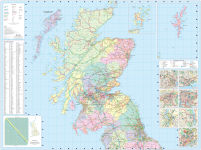
Full-color map of Scotland at 8.7 miles to 1 inch, with clear road network and administrative areas shown in color. The map covers the whole of Scotland and part of Northern England conveniently on one side, and is ideal for reference or route planning.
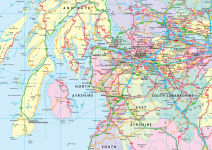
The map shows the road network in detail for easy route planning and has easily identifiable local council areas and boundaries.
The main features of this road map are:
- Fully updated
- Administrative areas shown in color
- Clear, detailed road network and road distances
- Town and city names, rivers, railway lines and canals are clearly shown
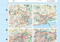
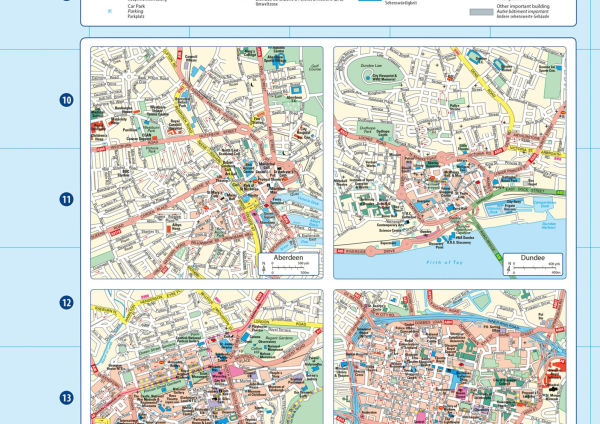
- 7 city/town center street plans showing places of interest
- Index to place names
- Mileage chart
- Car ferry routes
- Key in English, French and German
Full-color map of Scotland at 8.7 miles to 1 inch, with clear road network and administrative areas shown in color. The map covers the whole of Scotland and part of Northern England conveniently on one side, and is ideal for reference or route planning.
The map shows the road network in detail for easy route planning and has easily identifiable local council areas and boundaries.
The main features of this road map are:
- Fully updated
- Administrative areas shown in color
- Clear, detailed road network and road distances
- Town and city names, rivers, railway lines and canals are clearly shown
- 7 city/town center street plans showing places of interest
- Index to place names
- Mileage chart
- Car ferry routes
- Key in English, French and German
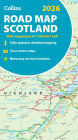

2026 Collins Road Map of Scotland: Folded Road Map
2


2026 Collins Road Map of Scotland: Folded Road Map
2
Product Details
| ISBN-13: | 9780008719265 |
|---|---|
| Publisher: | HarperCollins UK |
| Publication date: | 07/15/2025 |
| Series: | Collins Road Atlas |
| Pages: | 2 |
| Product dimensions: | 6.30(w) x 9.10(h) x 1.90(d) |