

60 Hikes Within 60 Miles: New York City: Including Northern New Jersey, Southwestern Connecticut, and Western Long Island
400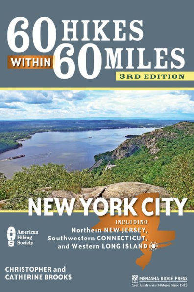
60 Hikes Within 60 Miles: New York City: Including Northern New Jersey, Southwestern Connecticut, and Western Long Island
400Paperback(Third Edition)
-
PICK UP IN STORECheck Availability at Nearby Stores
Available within 2 business hours
Related collections and offers
Overview
With so many superb trails in the area, planning a hike can be a frustrating endeavor, but with this newly revised and updated edition of 60 Hikes Within 60 Miles: New York City from Christopher and Catherine Brooks, finding the right trail is a snap. From secluded woods and sun-struck seashores, to lowland swamps and rock-strewn mountain tops, these hikes showcase Paleolithic rock shelters, ruins from the Revolutionary and Civil War periods, a bat cave, ghostly ruins, and much, much more.
Unbounded by state lines, the trails awaiting hikers in the updated edition of 60 Hikes Within 60 Miles: New York City include a meandering ascent of Jenny Jump Mountain in Hope, New Jersey, a deep exploration of Trout Brook Valley near Weston, and a scenic section of the Appalachian Trail that runs by Fitzgerald Falls in New York. Packed with valuable tips and humorous observations, the guide prepares both novices and veterans for the outdoors and includes all the information hikers need to get the most out of the trails, including driving directions and GPS coordinates for all 60 trailheads to take the guesswork out of the trip.

Product Details
| ISBN-13: | 9780897327145 |
|---|---|
| Publisher: | Menasha Ridge Press |
| Publication date: | 06/18/2013 |
| Series: | 60 Hikes Within 60 Miles |
| Edition description: | Third Edition |
| Pages: | 400 |
| Sales rank: | 403,297 |
| Product dimensions: | 6.00(w) x 8.90(h) x 0.70(d) |
About the Author
Read an Excerpt
WALT WHITMAN SAMPLER
- LENGTH: 3.6 miles
- ELEVATION GAIN: 473 feet
- CONFIGURATION: Loop
- DIFFICULTY: Easy
- SCENERY: Rolling, mixed deciduous forest hiding a quiet pond, gnarly laurel thickets, and Long Island’s highest point
- EXPOSURE: Lush canopy protection
- TRAFFIC: Light on weekdays; can get really busy on weekends
- TRAIL SURFACE: Dirt, roots, and pebbles
- HIKING TIME: 2 hours
- DRIVING DISTANCE: 35 miles SEASON: Year-round, sunrise–sunset
- ACCESS: $6 parking fee for Suffolk County residents Memorial Day– Labor Day ($13 for nonresidents), free rest of year; no bicycles on most trails, pets on leash
- MAPS: At Walt Whitman Birthplace; USGS Huntington
- FACILITIES: Restrooms, water, and public phone at picnic area
- COMMENTS: Horse riders share most trails. For further information, call the park office at 631-854-4423 or visit tinyurl.com/westhillspark.
GPS COORDINATES
N40°48.100' W73°25.278'
Directions
Follow the Long Island Expressway/I-495 East and take Exit 42, merging onto the Northern State Parkway East. Drive to Exit 40 and merge onto Walt Whitman Road/NY 110 South. After 0.3 mile, turn right on Old Country Road and continue 0.4 mile, then go right again on Sweet Hollow Road. Proceed 0.5 mile to the parking lot and picnic area on the right.
IN BRIEF
The seaside vistas are overgrown from when Walt Whitman roamed this historic woodland, but the densely forested hills still provide a poetic setting for a short hike. A labyrinth of trails snakes by a picturesque pond amid laurels, white pines, and rhododendrons—as well as a full complement of hardwoods—on the way to Jayne’s Hill, the highest point on Long Island.
DESCRIPTION
“West Hills is a romantic and beautiful spot. It is the most hilly and elevated part of Long Island . . . afford[ing] an extensive and pleasant view,” Walt Whitman wrote in 1850 of the hills that rise above his boyhood home. In Whitman’s day it was possible to view the Connecticut shore from atop the highest peak, Jayne’s Hill, and watch schooners sailing by Fire Island to the south. Those vistas are gone now—overgrown by mountain laurel, beech, and birch trees—but this remains a delightful place, no less hilly and inspiring today than it once was to one of our country’s great poets.
In 1825, when Silas Wood, an early historian of Long Island, had “High Hill” surveyed, its top crested at 354 feet of elevation. While paltry by Western standards, that was enough to rank this mount as highest on the island. Its name was later changed to Jayne’s Hill, after the family that lived here, and having been resurveyed a number of times since, it now officially tops out at 400.9 feet above sea level. This meandering hike circles through the colorful forests of the West Hills, crossing the top of Jayne’s Hill about halfway out. Many maverick bike and bridle trails intersect your route, but the main path is well blazed and fairly easy to follow.
The trail begins at the far side of the picnic grounds, by the edge of the woods. Keep to the right, walking toward the fenced field, looking for white blazes on a few of the oak trees. Stay with those as the markings glide to the left (or wooded) side of the sports field–cum–dog walking area. Just past the corner of the fence is a path to the left, blazed with blue paint. Turn there and then left again on the sandy bridle path. Stick with the blue blazes as they veer right at the Y, and right another time in an additional 10 steps. Now drifting among birches, oaks, and an occasional dogwood—to say nothing of scads of mountain laurel— the well-indicated, pebbly track shifts left at a T. It then passes a number of spurs as it ascends steadily to higher ground, swinging left in 3 minutes at the T-junction with a bridle trail. For hikers with a good sense of orientation, the many side trails in this forest offer great bushwhacking possibilities.
In due time, the clearly blazed trail loops to the left of a gray house. About a minute later, it meets a wide crossing with another bridle path, where it continues straight ahead, single-file, until it merges with a horse track, where you pivot left. Bear left once more at the next broad fork, steering away from the private dwellings. With laurels now the dominant plant, the blue blazes swerve sharply right off the main route in 150 feet, adhering closely to the line of a ridge. Vault to the right when you hit the T with still another bridle path and, a couple of minutes after passing a horse stable to the right, just beyond the park boundary, you will come to a set of erosion-control piling steps.
The access lane to Jayne’s Hill is at the top of that staircase. Instead of following the road, though, stroll across the pavement, picking up the white blazes on its opposite side near a chain-link fence. With that barrier to the right and white pines towering overhead, you have now started the more enjoyable half of the hike. On reaching a small rise, the path descends sharply away from the majestic conifers, moving swiftly into a beech-and-birch-shaded gully. The trail levels off briefly, trots right at a Y, goes right at the ensuing crossing, then dives downhill again among a green carpet of false lilies of the valley. The white blazes hop left at the succeeding fork and in a few paces guide you to Toad Pond. Though marred by a metal fence stretched over its right end, this is an attractive (albeit gradually silting up) body of water, shaped like a crooked, elongated smile.
Ignore the steps that lead away from the pond and proceed along its boggy bank. A few strides later, the white blazes branch to the left, with the path fording a small stream in another moment or two via a log corduroy. With the track running beside a bog, the next several yards can be quite wet in spring, but soon enough the ground grows steadily steeper, plugging upward toward Jayne’s Hill.
(There were a number of trees down the last time we passed through, with one low-hanging trunk requiring a limbolike effort to continue.) It only takes a minute to get by the most precipitous part of that climb—one breathtaking, heart-pounding minute. From there the elevation gain is more gradual, almost imperceptible. Heave to the left on the bridle path, and in a few dozen strides the trail spits you out at the Jayne’s Hill parking lot.
Hug the right side of the lot, rounding a pine tree and hewing hard to the right when a swing set and dilapidated latrine come into view. Stick with this wide, white-blazed track, which is lined with lavender-flowering myrtle, dogwoods, and oaks, as it cruises to the right at the subsequent fork and left at the one after that. The terrain grows more lush with every step you take, as mountain laurels, white pines, and black birches creep back into the forested mix. The top of Jayne’s Hill lies just ahead, a site marked by two benches, a rock (sadly stained with graffiti) with a plaque on it, and a pale-blue water tower. Second-growth trees now block out the view that Whitman enjoyed from this, the highest ground on Long Island, but you may still derive pleasure from the tranquility of the spot, as well as the Whitman quote that adorns the plaque.
The trail continues to the right of the rock, down several steps through an overgrown tangle of briar, chokeberry, and poison ivy. It levels off in a minute among ferns and oaks, then rolls with the undulating texture of the hillside. This pleasantly secluded, moss-sided track ends at a split-rail fence, where you scoot right onto a bridle path. In 45 yards, the white-blazed foot trail scuttles to the left at a four-way crossing, descends through briar, maples, birches, and cedars, and then crosses another four-way intersection. From a leveling off, the path rises negligibly, culminating in a left turn at a T. Pull to the left at the ensuing fork, and with the white blazes clearly visible, hang a right at the next major turn, in about 25 feet. Some 100 yards later, the track diverges to the right—then left in 30 paces—and, having descended briefly, darts through a narrow livestock barrier.
You remain on this ridge for a while, slightly above the trees of the surrounding hills, as rhododendrons make a surprise appearance, blanketing the sides of the slope. A further descent over log steps leads to a second livestock barrier. Once through that, the white blazes shift to the left, crossing the bridle path and slipping through a rail fence (look for spotted wintergreen in springtime). In a few minutes of walking, you should see the roof of the riding stables to the right. A short descent follows, delivering you to yet another set of rails. The horse trails here trot left, right, and straight ahead, with your route running between the right and straight options. A few furlongs more and the path ends, dropping you off by the picnic grounds, with the parking lot directly beyond.
NEARBY ACTIVITIES
What better place to start (or unwind from) this hike than the Walt Whitman Birthplace State Historic Site? Displays in this recently renovated early-19th-century farmhouse, at 246 Old Walt Whitman Rd., include portraits of Whitman, his poetry, letters, a tape recording of his voice, and more. Call 631-427-5240 for details, or visit waltwhitman.org.
Table of Contents
Overview MapOverview-Map Key
Dedication
Acknowledgments
Foreword
About the Authors
Preface
60 Hikes by Category
Introduction
NEW YORK: EAST OF THE HUDSON RIVER
- Angle Fly Amble
- Anthony’s Nose Ascent
- Butler Outer Loop Trail
- Fahnestock Catfish Loop
- Fahnestock Greater Hidden Lake Tour
- Fahnestock Wilderness Trail
- Fishkill Ridge Trail
- Hudson Highlands Breakneck Ridge Loop
- Mianus River Gorge Trail
- Pelham Bay Islands Loop
- Rockefeller Medley
- Teatown Triple
- Ward Pound Ridge Star Loop
- Westchester Wilderness Walk
- Westmoreland Grand Tour
NEW YORK: WEST OF THE HUDSON RIVER
- Bear Mountain Doodletown Circuit
- Black Rock Forest Peaks to Ponds Trail
- Fitzgerald Falls to Little Dam Lake (Appalachian Trail)
- Harriman Highlands Trail
- Harriman Seven Hills Loop
- Hook Mountain Heights
- Schunemunk Mountain Ridge Loop
- Storm King Summit Trail
- Tors’ Thunder Tour
NEW YORK: LONG ISLAND AND STATEN ISLAND
- Caleb Smith Full Circuit
- Caumsett Neck Loop
- Clay Pit Ponds Connector
- Connetquot Continuum
- David Weld Sanctuary Tour
- Jamaica Bay West Pond Trail
- Muttontown Mystery Trail
- Sunken Meadow to Nissequogue River Trail
- Walt Whitman Sampler
NEW JERSEY: NORTH OF INTERSTATE 80
- Abram Hewitt’s Bearfort Ridge
- Farny Highlands Hike
- High Point Duet
- Mahlon Dickerson Discovery Trail
- Norvin Green’s Heart and Soul
- Ramapo-Ringwood Rally
- Sterling Ridge Trail
- Stokes Select
- Turkey-Egypt Connection
- Wawayanda 1: Way Way Yonder
- Wawayanda 2: Terrace Pond
NEW JERSEY: SOUTH OF INTERSTATE 80
- Allamuchy Natural Area Amble
- Black River Trail
- Cheesequake Natural Area Trail
- Great Swamp Wilderness Trail
- Hartshorne Woods Grandest Tour
- Jenny Jump Ghost Lake Loop
- Jockey Hollow Run
- Lewis Morris Loop
- Sandy Hook Hiking Trail
- Sourland Mountain Track
- Watchung Sierra Sampler
CONNECTICUT
- Babcock Circumference Trail
- Bennett’s Pond and Beyond
- Devil’s Den Concourse
- Trout Brook Valley Circuit
- Weir Pond and Swamp Loops
Appendix B: Trail-Map Resources
Appendix C: Hiking Clubs and Organizations
Appendix D: Green-Space Organizations
Index
Map Legend
Related Subjects
Customer Reviews
Explore More Items


: A Novel")


