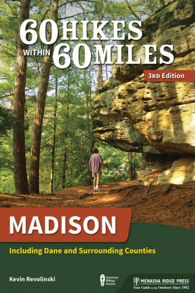
60 Hikes Within 60 Miles: Madison: Including Dane and Surrounding Counties

60 Hikes Within 60 Miles: Madison: Including Dane and Surrounding Counties

by Kevin Revolinski
60 Hikes Within 60 Miles: Madison: Including Dane and Surrounding Counties

60 Hikes Within 60 Miles: Madison: Including Dane and Surrounding Counties

by Kevin Revolinski

Paperback(3rd Revised ed.)

$22.95 
  • SHIP THIS ITEM
    Qualifies for Free Shipping
  • PICK UP IN STORE
    Check Availability at Nearby Stores

Related collections and offers


Overview

This guide to 60 of the best hikes in the Madison area leads you to scenic overlooks, wildlife hot spots, and historical settings.


Product Details

ISBN-13: 9781634041201
Publisher: Menasha Ridge Press
Publication date: 06/09/2020
Series: 60 Hikes Within 60 Miles
Edition description: 3rd Revised ed.
Pages: 328
Sales rank: 142,755
Product dimensions: 5.60(w) x 8.30(h) x 1.20(d)

About the Author

Kevin Revolinski's love for the outdoors came from frequent childhood fishing trips and hikes with his father in the woods of northern Wisconsin. He is the author of more than a dozen books, including The Yogurt Man Cometh: Tales of an American Teacher in Turkey, Wisconsin's Best Beer Guide: A Travel Companion (also Michigan and Minnesota versions), and Backroads and Byways of Wisconsin. He is coauthor of Best Tent Camping: Wisconsin. He has written for Rough Guides guidebooks, and his articles and photography have appeared in a variety of publications, including The New York Times, Chicago Tribune, Wisconsin Trails, and the Miami Herald. He has lived abroad in several places, including Turkey, Italy, Guatemala, Panama, and Thailand, but he currently makes camp back in the homeland in Madison, Wisconsin.

Read an Excerpt

Arboretum: Greene Prairie

  • Distance & Configuration: 2.6-mile loop
  • Difficulty: Easy, some moderate
  • Scenery: Mixed woods, prairie
  • Exposure: Half exposed, half shaded
  • Traffic: Light
  • Trail Surface: Packed dirt, crushed stone, exposed rocks and roots, a few narrow boardwalks, potential wet areas
  • Hiking Time: 1 hour
  • Driving Distance: 0.3 mile south of Beltline Highway (US 12/18) westbound or 1.1 miles west of Beltline Highway eastbound
  • Elevation Change: 934'–1,007'
  • Access: Trails are open 7 a.m.–10 p.m., and parking is from sunrise to sunset.
  • Maps: USGS Madison West; maps in wooden box at the parking lot or at the visitor center across the highway
  • Wheelchair Access: None
  • Facilities: None
  • Contact: arboretum.wisc.edu, 608-263-7888
  • Location: 1800 Seminole Hwy., Madison
  • Comments: No pets allowed. Check park schedule for free guided tours on weekends. This portion of the park has many trail combinations. Plus, the Arboretum section on the north side of the lake and the central section of the park are listed herein as separate hikes (Arboretum: Wingra Marsh and Arboretum: Wingra Woods).

HIKE THIS SOUTHERNMOST PORTION of the Arboretum and explore oak savanna, pine forest, and one of the finest prairie restorations there is to see.

Description

The centerpiece of this portion of the 1,260-acre University of Wisconsin–Madison Arboretum is Greene Prairie, named for Henry Greene, a UW botanist who, during the 1940s and 1950s, did almost all of the restoration himself, returning what was once farmland to its original role in the landscape. But the towering pines and oak savanna are no less impressive, and this hike offers a nice mix of all of them.

Take a map from the wooden box at the gate in the parking lot, and then take the packed dirt trail to the left straight into the trees. This first segment takes you through Evjue Pine Forest, parallel to the Beltline Highway, down a lane carpeted with pine needles. The hum of tires will annoy some hikers, but the pine forest has a pleasant airiness to it and should not be missed. The rest of this hike is plotted to avoid the nearby urban world.

At 200 feet, you will pass the T2 trail marker, and another 450 feet later, the T3 junction. Both of these trails break to the right, heading deeper into the pines. Continue straight along here until you arrive at a clearing and trail junction T5, a total of 0.25 mile from the trail entrance. Straight across is the trail that will take you about 600 feet to T6 and T7 and a trail that goes left under the Beltline Highway through a tunnel. This is a good way to connect with other great hikes in the Arboretum, in particular Arboretum: Wingra Woods (page 29), and the visitor center, which is found in the central portion of the Arboretum.

By going right (south) at T5, you start to distance yourself from the traffic and avoid the trail along the edge of the Arboretum, which borders a residential neighborhood. Continue through mixed forest; on your right, the pines will eventually give way to oak and other deciduous trees after about 400 feet.

The trail here is a dirt access road. Another 700 feet brings you to the U4 junction on your right and its trail all the way back to T3. To the left (east) is a trail back to that perimeter path and back to the highway underpass tunnel. Continue straight and you will arrive at a crossroads outside the tree cover 300 feet later at U3. Go left on the crushed stone path and pass scattered trees in savanna as you cross West Grady Knoll. Three hundred feet on, there is a fork in the road. Take the trail that branches to the right at Y1, and to your right you will see prairie grass.

Less than 200 feet in, turn right at the Y2 junction and, just beyond that at Y3, go right again. The two trails after Y3 are hiking only (no skiing) and run parallel to where they connect a short distance later at Y4. These footpaths are just wide enough for your feet and run through the tall grass and fragile vegetation. You are at the very center of the park, and this little patch of sunlight is a great place to find pasqueflowers and bird’s-foot violets in the spring. No matter how tempting, do not pick the flowers.

At the southern end of this segment at Z1, the path rejoins the ski trail. Turn left here (passing what will be your return trail just a few steps from where you just joined this path) and follow the gently curving trail through the southern edge of Grady Oak Savanna. At the next junction 500 feet later, pass the trail at Z2, which connects back up the hill to Y2 where you left it. Continue straight across, pass a connecting trail into the prairie at Z3, and hike 0.2 mile along the bottom of the slope of the savanna and just south of East Knoll, bringing you to the Z4 junction. Go right and you will come to a path just 200 feet farther on that enters into the heart of Greene Prairie. (A spur trail on the left leads into nearby Knollwood Conservation Park.)

Held up as one of the finest examples of prairie restoration in the world, the prairie receives periodic controlled burns in spring, which park administrators hope will protect that restoration. Urban development to the south has affected water runoff, and, unfortunately, the park is now faced with losing the prairie to reed canary grass, an invasive species. This is best to visit in spring, when a wide variety of wildflowers bloom. But also during this time and in rainy periods, the trail can get soggy here and you might get your feet wet.

The trail does a 0.4-mile half loop through this southeastern corner of the park. When you come to Z6 at 0.3 mile, take the two-plank boardwalk to your left. This takes you back across the prairie and leaves you at the packed-earth trail that reenters the oak savanna through pussy willows. Go left here at Z1. To your left are quaking aspens. You pass through 750 feet of younger trees before arriving at X3, heading left, and crossing 500 feet of the northernmost finger of Greene Prairie to arrive at the X5 junction. If you continue straight, you can hike all the way to the southernmost edge of the park, follow the trail west around Southwest Grady Oak Savanna, and then head north through the forest along Seminole Highway. This adds only about a quarter mile to the hike, but this area is also prone to sogginess. Going right takes you through the woods on a very rudimentary and sometimes muddy trail. Make no mistake: This is not oak savanna but mixed forest.

When you arrive at X6, go right and follow the trail through the woods all the way back to the trailhead and parking lot. Along the way, you will pass the V1 and X1 trail outlets and finally the U1 outlet just 500 feet from the end.

Nearby Activities

Just 1 mile south of here on the right on Seminole Highway is a nicely paved bike trail at Dunn’s Marsh. Continue south to the next traffic light intersection to find McKee Road/County Road PD.

GPS Trailhead Coordinates N43° 02' 2.99" W89° 26' 36.24"

Directions Follow the Beltline (US 12/18) west to the Seminole Highway exit. Go left on the overpass and through the four-way stop on the other side. The small gravel parking lot is immediately on your left at the corner. There is no exit from the Beltline here if you are going east. In this case, take the Todd Drive exit and take your first right to go back the opposite direction to the same Seminole Highway four-way stop. Turn left and immediately left again into the lot at the corner.

Table of Contents

Overview Map

Map Legend vii

Acknowledgments viii

Foreword ix

Preface x

60 Hikes by Category xii

Introduction 1

Madison Metro 18

1 Arboretum: Greene Prairie 20

2 Arboretum: Wingra Marsh 25

3 Arboretum: Wingra Woods 29

4 Capital Springs State Recreation Area: Lewis Nine Springs E-Way Trail 34

5 Capital Springs State Recreation Area: Lower Yahara River Trail 39

6 Cherokee Marsh North 43

7 Cherokee Marsh South 48

8 Edna Taylor Conservation Park (with Aldo Leopold Nature Center and Woodland Park) 54

9 Elver Park 59

10 MMSD Wildlife Observation Area: Lagoons Trails 63

11 Olin Park and Turville Point Conservation Park 67

12 Owen Conservation Park 71

13 Pheasant Branch Conservancy (with Pheasant Branch Creek Trail) 76

14 Picnic Point 81

15 Pope Farm Park 86

16 Tenney Park to Schenk's Corners 91

17 Token Creek County Park 96

18 Tom George Greenway 101

Northwest 106

19 Black Hawk Unit: Lower Wisconsin State Riverway 108

20 Devil's Lake State Park: East Bluff 113

21 Devil's Lake State Park: West Bluff 117

22 Ferry Bluff State Natural Area 121

23 Gibraltar Rock State Natural Area 125

24 Governor Nelson State Park 129

25 Ice Age Trail: Cross Plains Segment 135

26 Ice Age Trail: Devil's Lake Segment 139

27 Ice Age Trail: Fern Glen Segment 145

28 Ice Age Trail: Gibraltar Rock Segment 149

29 Ice Age Trail: Lodi Marsh Segment 153

30 Ice Age Trail: Table Bluff Segment 157

31 Indian Lake County Park 162

32 Mirror Lake State Park 167

33 Natural Bridge State Park 172

34 Rocky Arbor State Park 177

35 Rowan Creek Trail 182

36 Swan Lake State Wildlife Area 186

Southwest 192

37 Blue Mound State Park 194

38 Donald County Park 199

39 Governor Dodge State Park: Lost Canyon and Beyond 203

40 Governor Dodge State Park: White Oak Trail 207

41 Ice Age Trail: Brooklyn Wildlife Segment 211

42 Ice Age Trail: Montrose Segment 216

43 Ice Age Trail: Verona Segment 220

44 Magnolia Bluff Park 225

45 New Glarus Woods State Park 229

46 Stewart County Park 234

47 Yellowstone Lake State Park 239

Northeast 244

48 Horicon Marsh State Wildlife Area 246

49 Horicon National Wildlife Refuge 250

Southeast 254

50 Aztalan State Park 256

51 Badfish Creek State Wildlife Area 261

52 CamRock Park: Area 2 265

53 Glacial Drumlin State Trail 270

54 Ice Age Trail: Devil's Staircase Segment 274

55 Ice Age Trail: Whitewater Lake Segment 278

56 Kettle Moraine State Forest: John Muir Trail 283

57 Kettle Moraine State Forest: Lapham Peak Unit 287

58 Kettle Moraine State Forest: Nordic Trails 292

59 Kettle Moraine State Forest: Scuppernong Trail 296

60 Lake Kegonsa State Park 300

Appendix A Outdoors Stores 305

Appendix B Hiking Clubs 305

Index 306

About the Author 312

From the B&N Reads Blog

Customer Reviews