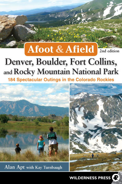
Afoot & Afield: Denver, Boulder, Fort Collins, and Rocky Mountain National Park: 184 Spectacular Outings in the Colorado Rockies
Discover more than 180 great hikes in the Denver area

From the Wyoming border to Pikes Peak, authors Alan Apt and Kay Turnbaugh present a comprehensive collection of 184 boot-tested hikes. Ranging from easy day hikes to weekend excursions and even far-flung mountaineering adventures, all the trips are accessible from Denver, Boulder, and other Front Range communities.

Afoot & Afield Denver, Boulder, Fort Collins, and Rocky Mountain National Park has abundant choices for everyone, from families with small children, to hikers looking for a relaxing trip, to experienced hikers and mountaineers.

This guide encompasses the millions of acres of public lands in the Denver area, including Rocky Mountain National Park; Pike, Roosevelt, Arapaho, and White River National Forests; Lory, Eldorado Canyon, Golden Gate Canyon, Roxborough, and Mueller State Parks; and numerous county and city parks.

For every trip you’ll find:

  • Complete trip description and hiking directions
  • An easy-to-read map
  • Key information such as distance, elevation gain, and difficulty
  • Highlights summarizing its best features
  • Notes on which trails are suitable for hiking, mountain biking, horseback riding, dogs, and kids
1137615470
Afoot & Afield: Denver, Boulder, Fort Collins, and Rocky Mountain National Park: 184 Spectacular Outings in the Colorado Rockies
Discover more than 180 great hikes in the Denver area

From the Wyoming border to Pikes Peak, authors Alan Apt and Kay Turnbaugh present a comprehensive collection of 184 boot-tested hikes. Ranging from easy day hikes to weekend excursions and even far-flung mountaineering adventures, all the trips are accessible from Denver, Boulder, and other Front Range communities.

Afoot & Afield Denver, Boulder, Fort Collins, and Rocky Mountain National Park has abundant choices for everyone, from families with small children, to hikers looking for a relaxing trip, to experienced hikers and mountaineers.

This guide encompasses the millions of acres of public lands in the Denver area, including Rocky Mountain National Park; Pike, Roosevelt, Arapaho, and White River National Forests; Lory, Eldorado Canyon, Golden Gate Canyon, Roxborough, and Mueller State Parks; and numerous county and city parks.

For every trip you’ll find:

  • Complete trip description and hiking directions
  • An easy-to-read map
  • Key information such as distance, elevation gain, and difficulty
  • Highlights summarizing its best features
  • Notes on which trails are suitable for hiking, mountain biking, horseback riding, dogs, and kids
24.95 In Stock
Afoot & Afield: Denver, Boulder, Fort Collins, and Rocky Mountain National Park: 184 Spectacular Outings in the Colorado Rockies

Afoot & Afield: Denver, Boulder, Fort Collins, and Rocky Mountain National Park: 184 Spectacular Outings in the Colorado Rockies

Afoot & Afield: Denver, Boulder, Fort Collins, and Rocky Mountain National Park: 184 Spectacular Outings in the Colorado Rockies

Afoot & Afield: Denver, Boulder, Fort Collins, and Rocky Mountain National Park: 184 Spectacular Outings in the Colorado Rockies

Paperback(Second Edition)

$24.95 
  • SHIP THIS ITEM
    Qualifies for Free Shipping
  • PICK UP IN STORE

    Your local store may have stock of this item.

Related collections and offers


Overview

Discover more than 180 great hikes in the Denver area

From the Wyoming border to Pikes Peak, authors Alan Apt and Kay Turnbaugh present a comprehensive collection of 184 boot-tested hikes. Ranging from easy day hikes to weekend excursions and even far-flung mountaineering adventures, all the trips are accessible from Denver, Boulder, and other Front Range communities.

Afoot & Afield Denver, Boulder, Fort Collins, and Rocky Mountain National Park has abundant choices for everyone, from families with small children, to hikers looking for a relaxing trip, to experienced hikers and mountaineers.

This guide encompasses the millions of acres of public lands in the Denver area, including Rocky Mountain National Park; Pike, Roosevelt, Arapaho, and White River National Forests; Lory, Eldorado Canyon, Golden Gate Canyon, Roxborough, and Mueller State Parks; and numerous county and city parks.

For every trip you’ll find:

  • Complete trip description and hiking directions
  • An easy-to-read map
  • Key information such as distance, elevation gain, and difficulty
  • Highlights summarizing its best features
  • Notes on which trails are suitable for hiking, mountain biking, horseback riding, dogs, and kids

Product Details

ISBN-13: 9780899977553
Publisher: Wilderness Press
Publication date: 07/07/2015
Series: Afoot & Afield
Edition description: Second Edition
Pages: 416
Sales rank: 1,013,713
Product dimensions: 6.00(w) x 8.90(h) x 0.90(d)

About the Author

Alan Apt has been roaming Colorado’s hills and dales for more than 30 years. He is the author of the best-selling guidebook “Snowshoe Routes: Colorado’s Front Range.” He is a somewhat reformed peak bagger who has climbed many of the state’s highest summits but also thoroughly enjoys the lakes, vales, and rivers. Alan is an avid hiker, biker, snowshoer, backcountry skier, kayaker, and backpacker and has trekked in the Andes, Alps, Himalayas, and Sierra Nevada. Alan is a member of the Colorado Mountain Club and a Sierra Club trip leader, as well as a member of Friends of the Poudre. He is a former Fort Collins city council member and worked to create the city’s Wind Power Program. He also served on the city’s Natural Resources Board. He is a National Ski Patrol volunteer member with the Bryan Mountain Nordic Ski Patrol. Formerly a technical book publisher, he is now a freelance writer and editor living in Nederland, Colorado. Kay Turnbaugh, an avid hiker, mountain biker, road biker, snowshoer, and skier, has lived in the small mountain town of Nederland, Colorado, for almost all of her adult life. She was the editor and publisher of “The Mountain-Ear,” an award-winning weekly newspaper in Nederland, for 27 years. She has written three books: “The Mountain Pine Beetle—Tiny but Mighty,” a book for 8- to 12-year-olds that is also enjoyed by many adults; “Around Nederland,” a book about Nederland’s history; and “The Last of the Wild West Cowgirls,” a biography of Goldie Griffith, who rode bucking broncos for Buffalo Bill, trained war dogs, ranched near Nederland, ran restaurants, and reinvented herself whenever necessary. “The Last of the Wild West Cowgirls” won a Willa Literary Award in 2010 for creative nonfiction.

Read an Excerpt

Jones Pass

  • Distance Up to 8 miles, out-and-back
  • Difficulty Easy–challenging
  • Elevation Gain 2,600' (starting at 10,000')
  • Trail Use Hiking, mountain biking, snowshoeing, skiing, leashed dogs OK
  • Agency Clear Creek Ranger District, Arapaho National Forest
  • Map(s) Latitude 40° Summit County Trails
HIGHLIGHTS
This beautiful mountain valley is close to Denver and doesn’t require a drive over Berthoud Pass. There are several trails you can explore at this popular location near the Henderson Mine, but you share this trail with some off-road vehicles (all-terrain vehicles and motorcycles). Enjoy a hike of any length, and soak in the views. You can combine this hike with Butler Gulch, and make it a loop hike. The Butler half will be vehicle-free.

DIRECTIONS
Take I-70 west from Denver and exit at Empire for Berthoud Pass/Winter Park. Drive through Empire toward the pass. When you come to the first sharp bend to the right, exit to the left for Henderson Mine. Continue north on the mine road until you reach the designated parking area. The road is closed at the trailhead that serves both the Jones Pass trail and the Butler Gulch trail. Travel west through the trees on the joint trail until a junction at approximately 0.25 mile. Bear right for the Jones Pass trail or left for the more difficult and advanced Butler Gulch trail.

DESCRIPTION
You have some glimpses of the ridgeline as you travel through the trees. At a little less than 0.5 mile you break out of the trees and enjoy the panorama of the valley and soaring ridgeline. Avalanche runout zones are observable on the steep slopes to the west. The trail/road steepens as it switchbacks. It then travels through a varied landscape of high mountain meadows and trees. You can go all the way to the summit of the pass or turn around whenever you wish. If you continue to the top of the pass, you will see a trail that goes south. You can take this to the top of Butler Gulch for a loop hike. Route-finding is easier if you start with Butler Gulch and travel clockwise.

Table of Contents

Overview Map

Preface

Acknowledgments

Introducing the Front Range Area

Comfort, Safety, & Etiquette

Using this Book

Overview of Hikes

The Hikes by Area

  • Denver Area: Plains & Foothills
  • Boulder Area: Plains & Foothills
  • Denver Area: Mountains
  • Boulder Area: Indian Peaks
  • Nederland Area
  • Rocky Mountain National Park: South
  • Rocky Mountain National Park: East
  • Rocky Mountain National Park: West
  • Fort Collins Area
  • Poudre Canyon & Cameron Pass Areas
  • Red Feather Lakes Area
  • Colorado State Forest
  • Colorado Springs Area

Best Trails For

Recommended Reading

Agencies and Information Sources

Conservation & Hiking Groups

Index

About the Authors

From the B&N Reads Blog

Customer Reviews