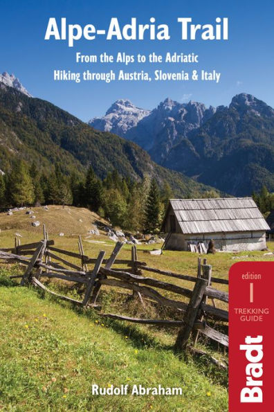
Alpe-Adria Trail: From the Alps to the Adriatic: Hiking through Austria, Slovenia & Italy

This is the first English-language guide to the epic new 750-km hiking route through the mountains of Austria, Slovenia and Italy, from the foot of the Grossglockner (at 3,798m, the highest peak in Austria and the Eastern Alps) to Muggia near Trieste on the Adriatic coast. Detailed maps and route descriptions for all 43 stages of the route are included, with a clear breakdown of time, distance and ascent for each stage. Published in a small, handy-sized format which is easy to pack and carry, it is written by an expert who has authored over half a dozen hiking guides and who specialises in Eastern and Central Europe. He has been a regular visitor to the borderlands of Slovenia, Austria and Italy for over 15 years, as well as living for two years in neighbouring Croatia.

The Alpe-Adria route is well marked, relatively easy to walk and is suitable for hikers of all abilities as well as families - a point which is emphasised in the guide. The route takes in spectacular, unspoilt mountain scenery, alpine lakes, rolling coastal hills, beautiful villages and several national parks and nature reserves. An introduction covering the history, wildlife, flora and geography of the area is included, along with accommodation details for each stage and information on local public transport, culture, food and language.

1123611825
Alpe-Adria Trail: From the Alps to the Adriatic: Hiking through Austria, Slovenia & Italy

This is the first English-language guide to the epic new 750-km hiking route through the mountains of Austria, Slovenia and Italy, from the foot of the Grossglockner (at 3,798m, the highest peak in Austria and the Eastern Alps) to Muggia near Trieste on the Adriatic coast. Detailed maps and route descriptions for all 43 stages of the route are included, with a clear breakdown of time, distance and ascent for each stage. Published in a small, handy-sized format which is easy to pack and carry, it is written by an expert who has authored over half a dozen hiking guides and who specialises in Eastern and Central Europe. He has been a regular visitor to the borderlands of Slovenia, Austria and Italy for over 15 years, as well as living for two years in neighbouring Croatia.

The Alpe-Adria route is well marked, relatively easy to walk and is suitable for hikers of all abilities as well as families - a point which is emphasised in the guide. The route takes in spectacular, unspoilt mountain scenery, alpine lakes, rolling coastal hills, beautiful villages and several national parks and nature reserves. An introduction covering the history, wildlife, flora and geography of the area is included, along with accommodation details for each stage and information on local public transport, culture, food and language.

19.16 In Stock
Alpe-Adria Trail: From the Alps to the Adriatic: Hiking through Austria, Slovenia & Italy

Alpe-Adria Trail: From the Alps to the Adriatic: Hiking through Austria, Slovenia & Italy

by Rudolf Abraham
Alpe-Adria Trail: From the Alps to the Adriatic: Hiking through Austria, Slovenia & Italy

Alpe-Adria Trail: From the Alps to the Adriatic: Hiking through Austria, Slovenia & Italy

by Rudolf Abraham

eBook

$19.16 

Available on Compatible NOOK devices, the free NOOK App and in My Digital Library.
WANT A NOOK?  Explore Now

Related collections and offers

LEND ME® See Details

Overview

This is the first English-language guide to the epic new 750-km hiking route through the mountains of Austria, Slovenia and Italy, from the foot of the Grossglockner (at 3,798m, the highest peak in Austria and the Eastern Alps) to Muggia near Trieste on the Adriatic coast. Detailed maps and route descriptions for all 43 stages of the route are included, with a clear breakdown of time, distance and ascent for each stage. Published in a small, handy-sized format which is easy to pack and carry, it is written by an expert who has authored over half a dozen hiking guides and who specialises in Eastern and Central Europe. He has been a regular visitor to the borderlands of Slovenia, Austria and Italy for over 15 years, as well as living for two years in neighbouring Croatia.

The Alpe-Adria route is well marked, relatively easy to walk and is suitable for hikers of all abilities as well as families - a point which is emphasised in the guide. The route takes in spectacular, unspoilt mountain scenery, alpine lakes, rolling coastal hills, beautiful villages and several national parks and nature reserves. An introduction covering the history, wildlife, flora and geography of the area is included, along with accommodation details for each stage and information on local public transport, culture, food and language.


Product Details

ISBN-13: 9781784771904
Publisher: Bradt Travel Guides Ltd
Publication date: 06/29/2016
Sold by: Barnes & Noble
Format: eBook
File size: 35 MB
Note: This product may take a few minutes to download.

About the Author

Rudolf Abraham is an award-winning travel writer and photographer specialising in Eastern and Central Europe. He has been a regular visitor to the borderlands of Slovenia, Austria and Italy for over 15 years, and lived for two years in neighbouring Croatia. He is the author of more than half a dozen hiking guides (including the first English language guidebooks to hiking in Croatia and Montenegro) as well as several other books, and has contributed to many more, including several books on art and architecture. His work is published widely in magazines.

Table of Contents

Introduction

PART ONE - GENERAL INFORMATION

Chapter 1 Background Information

Geography and geology

Climate

Wildlife

Plants

History

Language

Chapter 2 Practical Information

The Alpe-Adria Trail - a summary

When to hike

Highlights and route planning

Alpe-Adria Trail booking offices

Tourist offices

Tour operators

Red tape

Embassies

Getting there and away

Public transport

Accommodation

Eating and drinking

Money

Budgeting

Opening hours

Telephone numbers and mobile phones

Internet

Public holidays and festivals

Other outdoor activities

Travelling with kids

Maps and apps

Trail markings

Long-distance hiking: travelling light

Using the AAT app

Health

Emergency phone numbers

Safety in the mountains

Low-impact trekking

PART TWO - THE ROUTE

Stage 1. Kaiser-Franz-Josefs-Höhe - Heiligenblut

Stage 2. Heiligenblut - Döllach

Stage 3. Döllach - Marterle

Stage 4. Marterle - Stall

Stage 5. Stall - Innerfragant

Stage 6. Innerfragant - Mallnitz

Stage 7. Mallnitz - Obervellach

Stage 8. Obervellach - Danielsberg

Stage 9. Danielsberg - Hühnersberg

Stage 10. Hühnersberg - Gmünd

Stage 11. Gmünd - Seeboden

Stage 12. Seeboden - Millstätter Alpe

Stage 13. Millstätter Alpe - Döbriach

Stage 14. Döbriach - Langalmtal

Stage 15. Langalmtal - Falkerthaus

Stage 16. Falkerthaus - Bad Kleinkirchheim

Stage 17. Bad Kleinkirchheim - Arriach

Stage 18. Arriach - Gerlitzen Alpe

Stage 19. Gerlitzen Alpe - Ossiach

Stage 20. Ossiach - Velden

Stage 21. Velden - Baumgartnerhöhe

Stage 22. Baumgartnerhöhe - Kranjska Gora

Stage 23. Kranjska Gora - Trenta

Stage 24. Trenta - Bovec

Stage 25. Bovec - Dreznica

Stage 26. Dreznica - Tolmin

Stage 27. Tolmin - Tribil di Sopra

Stage 28. Tribil di Sopra - Cividale

Stage 29. Cividale - Breg

Stage 30. Breg - Smartno

Stage 31. Smartno - Cormons

Stage 32. Cormons - Gradisca d'Isonzo

Stage 33. Gradisca d'Isonzo - Duino

Stage 34. Duino - Prosecco

Stage 35. Prosecco - Lipica

Stage 36. Lipica - Bagnoli della Rosandra

Stage 37. Bagnoli della Rosandra - Muggia

Stage C1. Faak am See - Warmbad Villach

Stage C2. Warmbad Villach - Notsch im Gailtal

Stage C3. Notsch im Gailtal - Valbruna

Stage C4. Valbruna - Tarvisio

Stage C5. Tarvisio - Rifugio Zacchi

Stage C6. Rifugio Zacchi - Kranjska Gora

Stage C7. Kranjska Gora - Faak am See

Appendices

Appendix 1: Gateway cities

Appendix 2: Language

Appendix 3: Further reading

Appendix 4: Websites and apps

Index

From the B&N Reads Blog

Customer Reviews