
ARIZONA EASY TO READ
Rand McNally's Easy To Read State Folded Map is a must-have for anyone traveling in and around Arizona, offering unbeatable accuracy and reliability at a great price. Our trusted cartography shows all Interstate, U.S., state, and county highways, along with clearly indicated parks, points of interest, airports, county boundaries, and streets. The easy-to-use legend and detailed index make for quick and easy location of destinations. You'll see why Rand McNally folded maps have been the trusted standard for years. -Regularly updated, full-color maps. -Larger map with a bigger type size than the Rand McNally Folded Map. - Clearly labeled Interstate, U.S., state, and county highways. -Indications of parks, points of interest, airports, county boundaries, and more. -Mileage and driving times map. Coverage Area: Detailed maps of: Flagstaff, Grand Canyon National Park, Lake Havasu City, Petrified Forest National Park, Phoenix & Vicinity, Phoenix, Downtown Prescott, Tucson & Vicinity, Tucson Downtown, Yuma. Product Details: Dimensions (unfolded): 28 x 40. 1:722,300 or 1 inch represents approx. 11.4 miles.
1139916417
ARIZONA EASY TO READ
Rand McNally's Easy To Read State Folded Map is a must-have for anyone traveling in and around Arizona, offering unbeatable accuracy and reliability at a great price. Our trusted cartography shows all Interstate, U.S., state, and county highways, along with clearly indicated parks, points of interest, airports, county boundaries, and streets. The easy-to-use legend and detailed index make for quick and easy location of destinations. You'll see why Rand McNally folded maps have been the trusted standard for years. -Regularly updated, full-color maps. -Larger map with a bigger type size than the Rand McNally Folded Map. - Clearly labeled Interstate, U.S., state, and county highways. -Indications of parks, points of interest, airports, county boundaries, and more. -Mileage and driving times map. Coverage Area: Detailed maps of: Flagstaff, Grand Canyon National Park, Lake Havasu City, Petrified Forest National Park, Phoenix & Vicinity, Phoenix, Downtown Prescott, Tucson & Vicinity, Tucson Downtown, Yuma. Product Details: Dimensions (unfolded): 28 x 40. 1:722,300 or 1 inch represents approx. 11.4 miles.
7.99
In Stock
5
1


ARIZONA EASY TO READ
2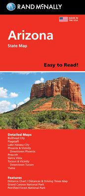
ARIZONA EASY TO READ
2
7.99
In Stock

Product Details
| ISBN-13: | 9780528024436 |
|---|---|
| Publisher: | Rand McNally |
| Publication date: | 08/27/2021 |
| Pages: | 2 |
| Product dimensions: | 4.25(w) x 9.00(h) x 0.25(d) |
From the B&N Reads Blog