Read an Excerpt
Bighorn Pass & Sportsman Lake Loop
RATINGS: Scenery: 8, Solitude: 5 Difficulty: 6
MILES: 45.7 (54.7), including a 3.9-mile roadwalk
ELEVATION GAIN: 6550´ (9750´)
DAYS: 3–5
MAP: Trails Illustrated Mammoth Hot Springs-NW Yellowstone National Park
USUALLY OPEN: Mid-July to October
BEST: Late July to mid-September
CONTACT: Yellowstone National Park
SPECIAL ATTRACTIONS: Good mountain scenery; plenty of wildlife
PERMITS A permit is required. Advanced reservations are recommended. The nearest location to pick up a permit is the Mammoth Hot Springs Ranger Station.
RULES Fires are allowed only at specified camps. All food and other odorous items must be stored away from bears at all times. Most of this trip is in the Gallatin Bear Management Area, where off-trail travel is prohibited from May 1 to November 10. Because of the bears, a minimum group size of four is recommended and solo hiking is discouraged.
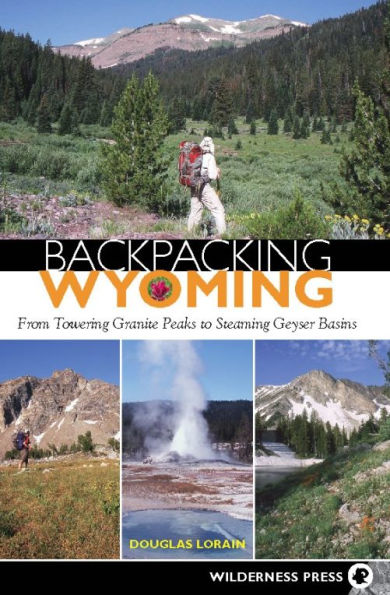
TAKE THIS TRIP Some of the best mountain scenery in Yellowstone National Park is in the Gallatin Range, a cluster of 10,000-foot peaks filled with snowy summits, colorful wildflowers, sparkling lakes, and all the other attractions typically found in the mountains of the American West. This being Yellowstone, however, these mountains also boast a higher concentration of wildlife than places not protected in a national park. So not only can hikers enjoy the usual wildflower-covered meadows and impressively tall peaks, they will also probably see elk, bison, moose, and possibly bears and wolves, along with many smaller animals. The loop described here visits many of the Gallatin Range’s most outstanding scenic attractions, including lovely Sportsman Lake, miles of beautiful lower-elevation meadows, and wonderful viewpoints at Bighorn Pass and Electric Divide. It also provides access to side trips to such places as Electric Peak and Cache Lake and visits a wide variety of habitats. All in all this is perhaps the most diverse, scenic, and enjoyable longer backpacking trip in the park.
CHALLENGES Grizzly bears are very common—camp and act accordingly.
HOW TO GET THERE The trailhead is in the northwest part of Yellowstone National Park along the spur road into Indian Creek Campground. The campground turnoff can be reached either by driving north 12.9 miles from the Norris Geyser Basin junction or south 8.9 miles from Mammoth Hot Springs. In either case, turn west at the sign for Indian Creek Campground, drive over a bridge, and almost immediately thereafter reach the signed Bighorn Trailhead. Parking is on the right.
DESCRIPTION The slightly uphill trail begins by going west through a forest of young lodgepole pines that are slowly recovering from the massive fires of 1988. Most of the trees are only about 15 feet tall, so shade is something of a rarity. The extra sunshine allowed in by the shorter trees, however, has led to fine wildflower displays from late June to early August and generally better views. After 0.1 mile you come to a junction. Go right on Bighorn Loop and soon walk past several car campsites in Indian Creek Campground. At 0.3 mile follow the campground’s loop road for 10 yards before veering left back onto the trail.
The path soon comes to an unsigned junction with an abandoned section of the Howard Eaton Trail near the edge of a huge rolling meadow. Keep left on Bighorn Pass Trail, which stays along the south edge of the lovely meadow not far from meandering Indian Creek. Looking straight ahead across the meadow to the west you can see (from left to right) Antler Peak, the gap of Bighorn Pass, Bannock Peak, and the long sloping ridge of Quadrant Mountain. To the right (north-northwest) is the more pointed summit of Electric Peak. Wildlife is common in this meadow with lots of elk and perhaps even a moose or two if you are lucky.
At 0.9 mile you pass Camp 1B1, then keep going west, mostly in meadows, to an ankle- to calf-deep ford of Indian Creek at 2.3 miles. The trail then crosses about 1.5 miles of rolling country covered with sagebrush, grasses, and wildflowers where you have fine views to the west of the Gallatin Range and a good chance of seeing bison. About halfway into this lovely section you ford Panther Creek, a stream you will follow for the next few miles. Once the rolling meadow ends, you head gradually uphill in a wide canyon that features increasingly forested terrain. Unlike most of Yellowstone, the forest here has very few lodgepole pines, with lots of Engelmann spruces, subalpine firs, and some western white pines instead. Panther Creek is always nearby and the forest is broken by several small meadows. Both moose and elk are common here and, with binoculars, you may spot a few of the bighorn sheep that call nearby Quadrant Mountain home. The vegetation mix is also excellent bear habitat. This fact, along with the frequent piles of bear scat on the trail, is a useful reminder to stay alert and make plenty of noise while you hike. While not looking for wildlife, you will probably notice the fine views of bulky Bannock Peak to the southwest.
As you gradually gain elevation, the meadows become larger so that eventually the forest comes only in scattered clumps. At 7.2 miles you pass a shallow, marshy pond, then the pace of the climb increases until you reach 9110-foot Bighorn Pass at 8.4 miles. This high point has superb views of the distant Absaroka Range to the east and the sweeping valley of the Gallatin River to the northwest, the upper reaches of which are covered with a skeleton forest of burned snags.
Making your way down into the aforementioned Gallatin River Valley, descend fairly steeply past sheer cliffs on your right for about 1 mile before things level out beside the joyful Gallatin River. From here you enjoy a gentle and pleasant walk, never far from the small stream and mostly in attractive meadows or unburned forest. A quick look at that forest demonstrates that here on the west side of the park, the climate is somewhat wetter than elsewhere in Yellowstone, resulting in thicker greenery and more undergrowth. At about 4.5 miles from Bighorn Pass, as you enter a particularly large meadow, is Camp WB6, a very pleasant spot with nice views of Crowfoot Ridge to the south-southwest. In September, campers can expect to be kept awake by bugling elk throughout the night. Wolves often follow the elk down to these meadows and may also be heard or seen by sharp-eyed hikers.
Below Camp WB6, and still mostly in nearly level meadows, the trail passes Camps WB4 and WB3, both designed for stock users. About 60 yards after you pass less attractive Camp WB1 is a junction. Turn right and steadily climb an open slope of grasses and burned snags for 0.8 mile to a junction with the Fawn Pass Trail. Go left (west) and gradually descend through huge meadows where you may see elk and will certainly have good views of the forested ridges in all directions.
At 19.7 miles turn right at a junction onto the Fan Creek Trail. This route heads up the wide, gentle valley of its namesake stream initially in open areas amid sagebrush, scrubby willows, and assorted wildflowers. After 0.4 mile the trail leaves the meadows and gradually climbs the partly forested hillside above the creek. You pass pleasant Camp WC2 and then it’s another 0.5 mile, often in muddy areas flooded by beaver activity, to a relatively easy ford of Fan Creek. Moose are a common sight amid the willow flats along the creek.
Sticking with the hillside just above the west side of Fan Creek, the trail takes you northeast to a junction with the side trail to Camp WC3. Immediately after this junction you splash across an unnamed side creek, then continue going gradually uphill to very nice Camp WC4 opposite where East Fork Fan Creek joins the North Fork of that stream. Beyond this camp, you hike uphill through forest for 1.5 miles to a junction.
Turn right, continue climbing to the top of a minor divide, and then descend through the snags and regrowing forest of a 1988 burn zone. About halfway down are a set of switchbacks with fine views of pointed Electric Peak to the east.