

Paperback
-
PICK UP IN STORECheck Availability at Nearby Stores
Available within 2 business hours
Related collections and offers
Overview
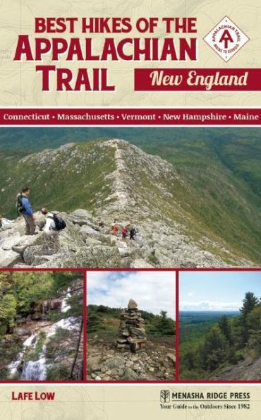
Spanning from southern Connecticut up to the top of the mighty Katahdin, Best Hikes of the Appalachian Trail: New England, by local author Lafe Low, is a thorough reference to 45 day hikes on the Appalachian Trail in New England. This is the only guide that specifically covers the best day hikes (suitable for expert hikers to families with kids) along the AT as it passes through Connecticut, Massachusetts, Vermont, New Hampshire, and Maine. The profiles include everything one would need to plan and proceed with a day hike on the AT: trailhead location, hiking time, hiking intensity, full description, directions, and maps.

Product Details
| ISBN-13: | 9780897324762 |
|---|---|
| Publisher: | Menasha Ridge Press |
| Publication date: | 03/15/2016 |
| Series: | Best Hikes of the Appalachian Trail |
| Pages: | 296 |
| Sales rank: | 1,102,877 |
| Product dimensions: | 5.00(w) x 8.00(h) x (d) |
About the Author
Read an Excerpt
Mount Algo
SCENERY: ★★★
TRAIL CONDITION: ★★★
CHILDREN: ★★★
DIFFICULTY: ★★★
SOLITUDE: ★★★
GPS TRAILHEAD COORDINATES: N41° 43.864' W73° 29.439'
DISTANCE & CONFIGURATION: 2-mile out-and-back
HIKING TIME: 2.5 hours
HIGHLIGHTS: Scenic, short, steep hike
ELEVATION: 1,370' at summit, 470' at trailhead
ACCESS: Unrestricted (trail open 24/7, no fees), roadside parking for three or four vehicles
MAPS: Appalachian Trail Conservancy MA–CT Map 4 and DeLorme CT RI Atlas & Gazetteer Map 40
CONTACT: Connecticut chapter of Appalachian Mountain Club: ct-amc.org
Overview
Mount Algo is a classic New England drumlin. It’s quite steep in spots as you ascend the side but then much more flat and rounded near the top. There’s not much of a defined peak and no real views to speak of, but it’s a pleasant, surprisingly aggressive, and rocky hike.
Route Details
If there were one phrase to describe most of the Appalachian Trail hikes in southern New England, it would be short and steep. Mount Algo is certainly no exception to that. The trailhead is right off the road, on the left as you’re heading west out of Kent, Connecticut, on CT 341. To the right, there is a small footbridge over which hikers can cross a small electric fence encircling the field on the north side of the road. From there, the trail continues up through the rest of New England and on to Katahdin.
The trail starts off quite steeply, even just feet from the trailhead on the road. If you need to warm up, you might want to do it before you actually hit the trail. The trail continues to ascend quickly through a fairly dense forest of mixed deciduous and coniferous trees, with moderate levels of undergrowth. The trail surface is uneven and rocky right off the bat, and it stays that way.
While the trail is fairly well marked by the white blazes early on in this section, it’s not all that well-defined. Keep your eyes open for the series of white blazes to ensure that you do indeed stay on the trail. After about 10 minutes into the hike, the trail crosses over an old fire road. The Appalachian Trail is across the road and down about 20 feet or so.
After crossing over the fire road, the trail winds to the right. It continues its steep and rocky ascent. Considering the steep pitch of the trail and the rocky trail surface, this trail may not be suitable for the youngest hikers. Bring along the kids, but only if they already have some hiking experience. Because the trail maintains a moderate pitch in this section, it’s good to see well-constructed water bars made of overlapped flat rocks.
The trail surface here is quite rocky, so watch your step. The trail flattens out a bit as it crosses over the remnants of an old stone wall. It almost feels like you’re hiking along a ridgeline here, as the trail follows a long switchback to the right. As you continue to gain altitude following the consistently aggressive ascent, the views to the north begin to emerge through the trees.
The trail continues to follow the ridgeline to the west. The trail surface is still quite rocky here, so proper hiking footwear is essential. After the initial elevation gain and a relatively consistent climb for approximately 20 minutes, the trail gives you a break and the grade softens briefly. Shortly after that respite, the trail pitch becomes more moderate. At this point, the white-blazed Appalachian Trail intersects with the blue-blazed state trail. There’s also a sign here for the Mount Algo shelter.
The trail winds around to the left here and once again begins to steepen. The trail passes through a dramatically scenic open grove of tall maples and beech trees. The trail is very well-defined here as it cuts through the forest. The trail continues to gain in pitch as the switchback continues. The trail continues east, climbing more steeply along the ridgeline. The forest gets denser and the trees taller as the trail winds to the right and heads in a more southerly direction.
The trail is more well-defined here by the dense forest and undergrowth on both sides. After moving through the dense undergrowth and coming up over a brief rise, the trail flattens out a bit as you near the summit of Mount Algo. As the trail veers a bit to the right and south, it pitches up for the final stretch.
Right near to the top of Mount Algo, the trail becomes a bit steeper and rockier. There’s almost a false summit here before you get to the real top. You make your way up through a very scenic natural rock garden toward the final few paces to the summit. At the summit, which isn’t really all that well-defined, there are large boulders on either side of the trail. This is often the case with these smaller, southern New England mountains. You might not even realize you’ve made it to the top until you start descending on the other side. Nevertheless, the summit plateau of Mount Algo is marked by those two good-size boulders on either side of the trail.
Mount Algo is a classic New England drumlin—steep on the sides and fairly flat and rounded at the top where the glaciers shaved off the rest of the peak during the last ice age. The Mount Algo hike is a relatively steep hike in certain portions to the fairly rounded summit, with a nice spot to stop at the top for lunch or a snack break before heading back down the trail.
Nearby Attractions
The town of Kent, Connecticut, is right nearby. It’s a fairly quiet town but a pleasant place to visit after hiking. You will also be fairly close to Danbury, Connecticut, if you need more options for lodging or dining.
Directions
From US 7 in Kent, Connecticut, follow CT 341 (also called Macedonia Road) west 1 mile. The small roadside parking area will be on the left. You’ll see a wooden footbridge on the right that crosses over a wire fence. The parking and trailhead are right across the street.
Table of Contents
Overview MapOverview Map Key
Dedication
Acknowledgments
Preface
Hiking Recommendations
Introduction
Connecticut
1 Mount Algo
2 St. Johns Ledges
3 Pine Knob
4 Mount Easter
5 Mount Prospect
Massachusetts
6 Mount Everett
7 Jug End State Reservation
8 East Mountain
9 Benedict Pond and The Ledges
10 Cobble Hill
11 Baldy Mountain
12 Becket Mountain
13 Warner Hill
14 Tully Mountain
15 Mount Williams
Vermont
16 Harmon Hill
17 Maple Hill
18 Bromley Mountain
19 Styles Peak
20 Little Rock Pond
21 White Rock Ledge
22 Bear Mountain
23 Pico Peak
24 Dana Hill
25 Dupuis Hill
New Hampshire
26 Holts Ledges
27 Smarts Mountain
28 Mount Cube
29 Ore Hill
30 Mount Mist
31 Townline Trail
32 Mount Moosilauke
33 Cascade Brook Trail
34 Mount Liberty
35 Rattle River Trail
Maine
36 Old Speck
37 Baldpate Mountain
38 Moody Mountain
39 Old Blue Mountain
40 Bates Ledge
41 South Pond
42 West Carry Pond
43 Pleasant Pond Mountain
44 Little and Big Niagara Falls
45 Katahdin
APPENDIX A: Contact Information
APPENDIX B: Appalachian Trail Communities
INDEX
ABOUT THE AUTHOR
ABOUT THE APPALACHIAN TRAIL CONSERVANCY