


Paperback(Fifth Edition)
-
PICK UP IN STORECheck Availability at Nearby Stores
Available within 2 business hours
Related collections and offers
Overview
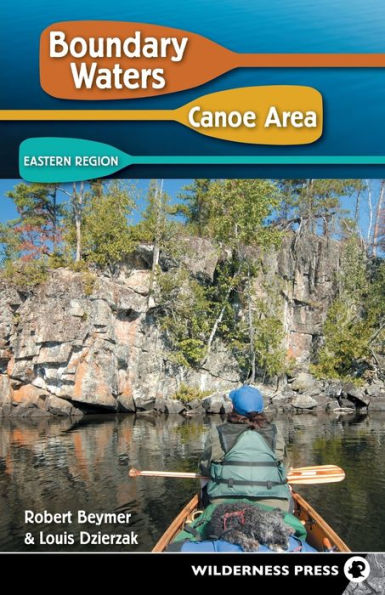
The Boundary Waters Canoe Area Wilderness (BWCAW) in northeastern Minnesota—over a million acres of wilderness on the US-Canada border—is a magnet for visitors seeking to explore some of the most beautiful waterways in the world. With a canoe or kayak, you can paddle its remote lakes, rivers, waterfalls, forests, and trails. Boundary Waters Canoe Area: Eastern Region by Robert Beymer and Louis Dzierzak helps you select the perfect trip for your schedule, ability, and interests.
This classic guide—along with its companion volume, Boundary Waters Canoe Area: Western Region—has been the trusted source for more than 40 years on where to go in the BWCAW and its 1,000+ lakes. Now fully updated, it’s the bible to the 1,200 miles of canoe routes and 154 miles of portage trails in the wilderness.
The guide describes 28 entry points in the eastern part of the BWCAW—those accessible near Grand Marais, Minnesota, from the Sawbill Trail and the Gunflint Trail. For each entry point, both a short and a long route are described, along with all the information you’ll need to plan a successful trip.
Inside you’ll find:
- Complete trip data, including total distance, time, difficulty, required Fisher maps, and permit and quota requirements
- Day-by-day details, such as number and difficulty of portages and recommended campsites
- Fishing recommendations for surrounding lakes and rivers
- Wise advice on navigation and points of interest
- Added bonus: “Lake Index for Fishing,” covering the 242 lakes that lie on this book’s described routes

Product Details
| ISBN-13: | 9780899974613 |
|---|---|
| Publisher: | Wilderness Press |
| Publication date: | 07/09/2009 |
| Series: | Boundary Waters Canoe Area |
| Edition description: | Fifth Edition |
| Pages: | 280 |
| Sales rank: | 522,074 |
| Product dimensions: | 5.40(w) x 8.40(h) x 0.70(d) |
About the Author
Read an Excerpt
Route 36-1: The Perent River Route
3 Days, 15 Miles, 3 Lakes, 1 Creek, 1 River, 15 Portages
Difficulty: Easier Fisher Maps: F-4, F-5
Introduction: This fascinating route takes you along the south perimeter of the BWCAW from Hog Creek to Isabella Lake. From the parking lot at FR 354, you’ll first meander 3 miles down Hog Creek to Perent Lake. After you paddle 3 more miles across that big lake, the Perent River will carry you west from Perent Lake to Isabella Lake. There you will exit the Boundary Waters and end your excursion at a parking lot just south of the lake, 32 miles by road from your origin (via CR 7 and forest routes 369, 373, and 377).
Spread over three full days, this route is quite easy, even though you’ll encounter 15 portages along the way. The longest carry is only 61 rods; most are less than 30 rods. All combined, the trails total less than 1.5 miles—an average of just 28 rods per carry. Strong trippers could complete the route in just two days. Because of the scarcity of campsites on the Perent River, however, to paddle the route in just two days would require one long day covering 10 miles of travel by combining either days 1 and 2 or days 2 and 3 described below. Either way, you would cross most of the portages on just one of the two days. If you take three days, you can travel slowly enough to savor the experience.
Although this route may not appeal to dedicated anglers, there is some good fishing along the way. Perent and Isabella lakes are both known for their abundant populations of walleyes and northern pike. That’s probably why most anglers are satisfied to stay on those two lakes and not explore the fascinating river in between. Motorboats are not permitted anywhere along this route.
Day 1 (5 miles): P. 15 rods, Hog Creek, p. 15 rods, creek, Perent Lake. Hog Creek is barely wide enough in places to carry a canoe, but there is always sufficient depth. You may feel as if you are on an African safari as you wind your way through the dense vegetation that borders the creek. In addition to the two 15-rod portages near the road, small beaver dams may also occasionally require quick lift-overs.
This area is noted for some unique bird sightings. The only record of a nesting Wilson’s Warbler in the state was made here. Other unique species include the Rusty Blackbird and the Virginia Rail, both of which were found nesting near Hog Creek. At least one pair of bald eagles has also nested in the Perent Lake area.
Perent Lake was named after a trapper who worked this area in the early part of the 20th century. Beavers, muskrats, wolves, and other furbearing animals trapped by Perent are still common in this region. Moose are also abundant, though not as commonly seen today as they were some years ago, when the adjacent area had been recently logged off.
Grab a good campsite along the center stretch of Perent Lake for a 5-mile day of travel. There are many good campsites on the lake from which to choose. Then grease your frying pan and cast a line. Perent Lake is a good source of walleyes and large northern pike.
Day 2 (5 miles): Perent Lake, p. 61 rods, Perent River, p. 31 rods, river, p. 25 rods, river, p. 33 rods, river, rapids, river, p. 17 rods, river, p. 39 rods, river, rapids, river, p. 22 rods, river, p. 16 rods, river. The Perent River offers a lovely route for anyone who enjoys stream paddling. It descends only 64 feet during its 7-mile journey from Perent Lake to Isabella Lake. The Civilian Conservation Corps constructed most of the portages in this region during the late 1930s and the 1940s. These extremely well made portages have survived the years with very little maintenance. They were built to a standard that would be very expensive, labor-intensive, and probably not possible today. The paths are easy to negotiate, and you’ll be walking between towering ancient pines on some of the portages, stepping on terrain only recently vacated by moose and over which bald eagles are frequently sighted.
There are only four designated campsites along the Perent River. The first two are near the 10-mile point in your expedition. The first is located adjacent to the 16-rod portage. The portage intersects an old abandoned foot trail that was once part of the Pow Wow Hiking Trail. A wooden footbridge still spans the rapids there.
Day 3 (5 miles): Perent River, p. 40 rods, river, p. 22 rods, river, p. 16 rods, river, Boga Lake, p. 26 rods, Isabella Lake, p. 35 rods. If your map shows a portage just after the second campsite, it should not be necessary. You should be able to paddle through the narrow channel just prior to the 40-rod portage. Be prepared for a slow and choppy crossing of Isabella Lake if there is a strong wind out of the west this day.
The parking lot just south of Isabella Lake where this route ends was once part of a large logging camp. From 1949 to 1964, 250 people called Forest Center their home. In addition to a sawmill there were 53 homes, a two-room schoolhouse, a recreation center, and a restaurant. There were also barracks and a mess hall for the lumbermen. Timber was hauled away by railroad. Most of Forest Center is now covered with a young growth of pine trees, but explorers may still find evidence of the logging era near the parking lot.
Table of Contents
Acknowledgmentslocator Map of Boundary Water Canoe Area: Eastern Region
Prefaces
Chapter 1: introduction to the BWCA Wilderness
Chapter 2: How to Plan a Wilderness Canoe trip
Chapter 3: Entry from the Sawbill Trail
- Entry Point 36—Hog Creek
- Entry Point 37—Kawishiwi Lake
- Entry Point 38—Sawbill Lake
- Entry Point 39—Baker Lake
- Entry Point 40—Homer Lake
- Entry Point 41—Brule Lake
Chapter 4: Entry from the Gunflint Trail—West
- Entry Point 43—Bower Trout Lake
- Entry Point 44—Ram Lake
- Entry Point 45—Morgan Lake
- Entry Point 47—Lizz Lake & Swamp Lake
- Entry Point 48—Meeds Lake
- Entry Point 49—Skipper Lake & Portage Lake
- Entry Point 50—Cross Bay Lake
- Entry Point 51—Missing Link Lake
- Entry Point 52—Brant Lake
- Entry Point 54—Seagull Lake
- Entry Point 55—Saganaga Lake
Chapter 5: Entry from the Gunflint Trail—East and Arrowhead trail
- Entry Point 80—Larch Creek
- Entry Point 57—Magnetic Lake
- Entry Point 58—South Lake
- Entry Point 60—Duncan Lake
- Entry Point 61—Daniels Lake
- Entry Point 62—Clearwater Lake
- Entry Point 64—East Bearskin Lake
- Entry Point 66—Crocodile River
- Entry Point 68—Pine Lake
- Entry Point 69—John Lake
- Entry Point 70—North Fowl Lake
Appendix i: Routes Categorized by Difficulty and Duration
Appendix ii: Commercial Canoe trip outfitters
Appendix iii: lake index for fishing
Appendix iV: BWCAW Hiking trails in the Eastern Region
Appendix V: More Resources
Photo Credits
Index