
Cheltenham Pocket Street Map
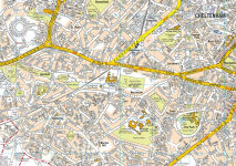
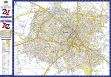
This up-to-date detailed A-Z street map includes more than 2,000 streets in and around Cheltenham. As well as the Cheltenham Racecourse, the other areas covered include Badgeworth, The Reddings, Up Hatherley, Charlton Kings, Montpellier, Battledown, Hayden, Swindon and Prestbury.The large-scale street map includes the following: • Places of interest • Postcode districts, one-way streets and car parks • Index to streets, places of interest, place and area names, park and ride sites, national rail stations, hospitals and hospicesThe perfect reference map for finding your way around Cheltenham.
1139210824
Cheltenham Pocket Street Map
This up-to-date detailed A-Z street map includes more than 2,000 streets in and around Cheltenham. As well as the Cheltenham Racecourse, the other areas covered include Badgeworth, The Reddings, Up Hatherley, Charlton Kings, Montpellier, Battledown, Hayden, Swindon and Prestbury.The large-scale street map includes the following: • Places of interest • Postcode districts, one-way streets and car parks • Index to streets, places of interest, place and area names, park and ride sites, national rail stations, hospitals and hospicesThe perfect reference map for finding your way around Cheltenham.
6.95
In Stock
5
1


Cheltenham Pocket Street Map
1


Cheltenham Pocket Street Map
1Hardcover
$6.95
6.95
In Stock

Product Details
| ISBN-13: | 9780008445256 |
|---|---|
| Publisher: | HarperCollins UK |
| Publication date: | 07/01/2021 |
| Pages: | 1 |
| Product dimensions: | 3.54(w) x 5.51(h) x 0.20(d) |
About the Author
From the B&N Reads Blog