
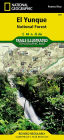
Let National Geographic's Trails Illustrated map of El Yunque National Forest guide you as you explore this tropical rain forest on the eastern side of Puerto Rico. Created in cooperation with the U.S. Forest Service and others, this expertly researched bilingual map (English and Spanish) is a comprehensive guide to the area for all outdoor enthusiasts, novice and experienced alike. Not only is there an abundance of recreation information, but also background information about the forest, its history, plant and animal life, climate, points of interest, safety tips and accommodations. A trail guide will help you select a suitable area to explore, with trail descriptions, length and hiking time.
The map covers the entire forest, including the Baño de Oro Natural Area, enhanced by an inset map showing the El Yunque Recreation Area in greater detail. Clearly pinpointed trailheads and mapped trails will lead you on your adventure. Other marked facilities and recreation features include picnic areas, drinking water stations, restrooms, parking areas. scenic overlooks and lookout towers. Your navigation will be aided by the map's contour lines, elevations, water features, selected waypoints and clear boundaries between public and private land, as well as a complete road network of the area.
Every Trails Illustrated map is printed on "Backcountry Tough" waterproof, tear-resistant paper. A full UTM grid is printed on the map to aid with GPS navigation.
Other features found on this map include: El Toro Wilderness, El Yunque National Forest, Sierra de Luquillo.
- Map Scale = 1:25,000
- Sheet Size = 37.75" x 25.5"
- Folded Size = 4.25" x 9.25"

El Yunque National Forest
2
El Yunque National Forest
2(2020th ed.)

Product Details
| ISBN-13: | 9781566950343 |
|---|---|
| Publisher: | National Geographic Maps |
| Publication date: | 01/01/2020 |
| Series: | National Geographic Trails Illustrated Map , #790 |
| Edition description: | 2020th ed. |
| Pages: | 2 |
| Product dimensions: | 4.30(w) x 9.20(h) x 20.00(d) |