
National Geographic's Europe Adventure Map provides global travelers with the perfect combination of function and perspective. Designed to meet the needs of adventure travelers with its detailed, accurate information, this map includes the location of cities and towns with a user-friendly index and a clearly marked road network complete with distances and designations for roads/motorways, plus secondary routes for those seeking to explore off the beaten path.
Europe is home to hundreds of UNESCO World Heritage Sites with both cultural and natural significance. Each of these sites is shown on the map and also listed in a handy index to help you quickly find your next voyage into the historic past.
The north side of the printed map includes the northern extents of Europe including Scandinavia, Finland and Iceland. The southern side of the printed map includes the majority of mainland Europe and the countries of the Mediterranean with each country highlighed in its own color. Major roads and ferry routs help you navigate this densely populated continent with thousands of towns from mega-cities such as London and Paris to small towns in the hinterlands of Bulgaria.
Every Adventure Map is printed on durable synthetic paper, making them waterproof, tear-resistant and tough — capable of withstanding the rigors of international travel.
- Map Scale = 1:3,600,000
- Sheet Size = 25.5" x 37.75"
- Folded Size = 4.25" x 9.25"

Europe (National Geographic Adventure Map, 3328)
2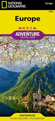
Europe (National Geographic Adventure Map, 3328)
2(2023rd ed.)

Product Details
| ISBN-13: | 9781566957342 |
|---|---|
| Publisher: | National Geographic |
| Publication date: | 07/16/2024 |
| Series: | National Geographic Adventure Map , #3328 |
| Edition description: | 2023rd ed. |
| Pages: | 2 |
| Product dimensions: | 4.00(w) x 9.00(h) x 0.25(d) |