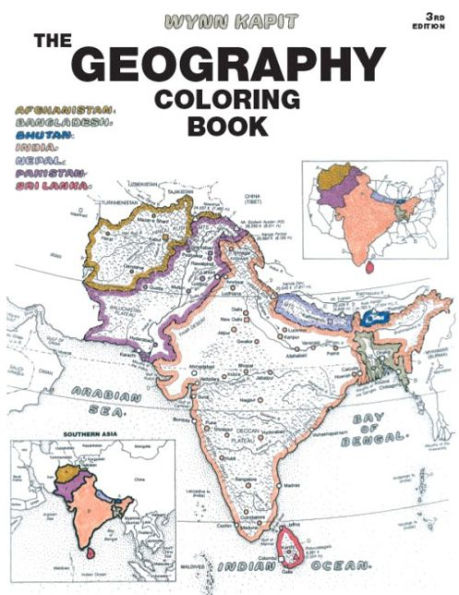
Geography Coloring Book

Geography Coloring Book

by Wynn Kapit
Geography Coloring Book

Geography Coloring Book

by Wynn Kapit

Paperback(3rd ed.)

$24.00 
  • SHIP THIS ITEM
    Qualifies for Free Shipping
  • PICK UP IN STORE
    Check Availability at Nearby Stores

Related collections and offers


Overview

For introductory courses in Geography.

This unique educational tool introduces the countries of the world and the states of the United States to students. Each section begins with a plate containing a political map, a physical map, and regional maps. Through active participation, by coloring in countries, rivers, regions, etc. (and their respective names), students gain a broader understanding of the material and retain more information. A highly effective, but also enjoyable, way to learn.


Product Details

ISBN-13: 9780131014725
Publisher: Pearson Education
Publication date: 10/11/2002
Edition description: 3rd ed.
Pages: 208
Sales rank: 381,663
Product dimensions: 8.40(w) x 10.80(h) x 0.60(d)

Table of Contents

How to Use and Color This Book.
A Glossary of Geographical Terminology.

THE CONTINENTS.

1. The Hemispheres and Earth Zones.

2. Continental Activity.

NORTH AMERICA.

3. The Countries.

4. The Physical Land.

5. Canada and Greenland.

6. United States.

7. Northeastern United States.

8. Southeastern United States.

9. Southcentral United States, Alaska and Hawaii.

10. Northcentral United States.

11. Western United States,

12. Mexico and Central America.

13. West Indies.

SOUTH AMERICA.

14. The Countries.

15. The Physical Land.

16. Northern Countries and Brazil.

17. Andean Countries, River Plate Countries.

EUROPE.

18. The Countries.

19. The Physical Land.

20. Northern Europe.

21. Western Europe.

22. Central Europe.

23. Southeastern Europe I.

24. Southeastern Europe II.

25. Eastern Europe I.

26. Eastern Europe II.

27. Eastern Europe III and Asia.

ASIA.

28. The Countries.

29. The Physical Land.

30. Asia: Middle East I.

31. Asia: Middle East II.

32. Southern Asia.

33. Eastern Asia.

34. Southeastern Asia.

OCEANIA.

35. Oceania I.

36. Oceania II.

AFRICA.

37. The Countries.

38. The Physical Land.

39. Northern Africa.

40. Western Africa.

41. Central Africa.

42. Eastern Africa.

43. Southern Africa.

POLAR REGIONS.

44. The Arctic, The Antarctic.

HISTORIC LAND EMPIRES.

45. Persian Empire, Alexander the Great.

46. Roman Empire, Byzantine Empire.

47. Islamic Empire, Ottoman Empire.

48. Mongol Empire, Mogul Empire.

FLAGS AND REVIEW OF NATIONS.

49. Introduction, Flags and Review of North America.

50. Flags and Review of the West Indies, Flags and Review of South America.

51. Flags and Review of Europe.

52. Flags and Review of Africa.

53. Flags and Review of Asia.

54. Flags and Review of Oceania.

WORLD THEMATIC MAPS.

55. World Climate Regions.

56. Annual Rainfall.

57. Regional Temperature.

58. Prevailing Winds.

59. Major Ocean Currents.

60. Natural Vegetation Regions.

61. Major Use of Land.

62. Population Distribution.

63. Racial Distribution.

64. Major Official Languages.

65. Major Religions.

COMPARATIVE SIZES OF NATIONS.

66. Largest Nations Compared by Area.

67. Largest Nations Compared by Population.

INDEX.

Geographical Dictionary.

Review and Quiz.

Preface

The third edition organizes the coloring book in a more user-friendly way. Each section is introduced by a non-colorable page on which the various plates (map and text pages) of the section are outlined. This provides an overview of what lies ahead, and in the process makes the individual plates more meaningful.

The use of a very bold, non-colorable type face for various headings make identification of subject matter much easier—the balloon lettering of names and places, that is an essential part of the coloring system, is now used strictly for coloring purposes.

A dramatic new plate (67) has been added to the size comparisons section in which 20 of the most populated nations are listed. The previous plate just dealt with size based on area comparisons. Population figures are estimates through 2003, based on current rates of growth. At best, these are rough estimates; accurate figures, particularly in less-developed nations are unavailable, and birth rates are beginning to drop in almost all nations. There is still considerable population growth in the non-industrialized world, but increasingly at unexpectedly lower levels.

Space accorded to world thematic plates has been doubled to allow the reader to concentrate on a single theme for each plate. Although these plates appear in the rear of the book, they are important enough for you to consider reading them first, even if you don't wish to color them at the outset. Much of the terminology used throughout the book regarding weather, climate, wind patterns, ocean currents, varieties of vegetation, land use, population, race, languages, and religions, is given special attention in these thematic plates. Familiarization with their meaning can only enhance the use of the book.

The eight historic land empires—particularly the Islamic and Ottoman empires—take on additional importance in the age of international terrorism, which is currently a threat from militant groups within Islamic nations. The tenets of the Islamic religion are described in the text accompanying the maps. The use of modern maps in conjunction with empire boundaries helps the reader understand current cultural distinctions and conflicts.

The index / dictionary /quiz at the end of the book has been opened up with additional space inserted between each entry. This improvement makes the use of material that much easier when using the dictionary entries as the basis of a two-way quiz: trying to identify names associated with the definitions, or trying to define the entry names.

From the B&N Reads Blog

Customer Reviews