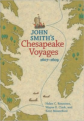
John Smith's Chesapeake Voyages, 1607-1609
402
John Smith's Chesapeake Voyages, 1607-1609
402Paperback(New Edition)
-
PICK UP IN STORECheck Availability at Nearby Stores
Available within 2 business hours
Related collections and offers
Overview
Beginning with a description of the land and waterways as they were then, the book also provides a portrait of the native peoples who lived and worked on them—as well as the motives, and the means, the recently arrived English had at their disposal for learning about a world only they thought of as "new." Readers are then taken along on John Smith's two expeditions to map the bay, an account drawn largely from Smith's own journals and told by the coauthor, an avid sailor, with a complete reconstruction of the winds, tides, and local currents Smith would have faced.
The authors then examine the region in more detail: the major river valleys, the various parts of the Eastern Shore, and the head of the Bay. Each area is mapped and described, with added sections on how the Native Americans used the specific natural resources available, how English settlements spread, and what has happened to the native people since the English arrived. The book concludes with a discussion on the changes in the region's waters and its plant and animal life since John Smith's time—some of which reflect the natural shifts over time in this dynamic ecosystem, others the result of the increased human population and the demands that come with it.
Published by the University of Virginia Press in association with Chesapeake Bay Gateways Network, and the U.S. National Park Service, Virginia Department of Historic Resources, and Maryland Historical Trust.

Product Details
| ISBN-13: | 9780813927282 |
|---|---|
| Publisher: | University of Virginia Press |
| Publication date: | 11/05/2008 |
| Edition description: | New Edition |
| Pages: | 402 |
| Sales rank: | 673,015 |
| Product dimensions: | 6.50(w) x 9.20(h) x 1.00(d) |
| Age Range: | 18 Years |
About the Author
Table of Contents
Preface vii
Acknowledgments ix
The Chesapeake Environment in the Early Seventeenth Century 1
The World of Algonquian-Speaking Peoples 25
Englishmen in the Chesapeake 53
John Smith's First Voyage up the Chesapeake Bay: June 2-July 21, 1608 75
John Smith's Second Voyage up the Chesapeake Bay: July 24-September 7, 1608 107
The Powhatan River, Becoming "King James His River," and Hampton Roads 136
The "Pamunkey": The York River Drainage 164
The Farmers and Fishermen of the Lower Eastern Shore 185
The Middle Eastern Shore: Land of Marsh and Merchants 200
The Head of the Bay: The Iroquoian Speakers' Northwest Passage 222
The Patuxent River Basin: "Good Cheer" and "Infinite Kinds of Fish" 239
The Potomac River: Conduit and Boundary 262
The Rappahannock River Basin and the Piedmont Peoples 286
Epilogue 305
Notes 323
Bibliography 365
Index 391
