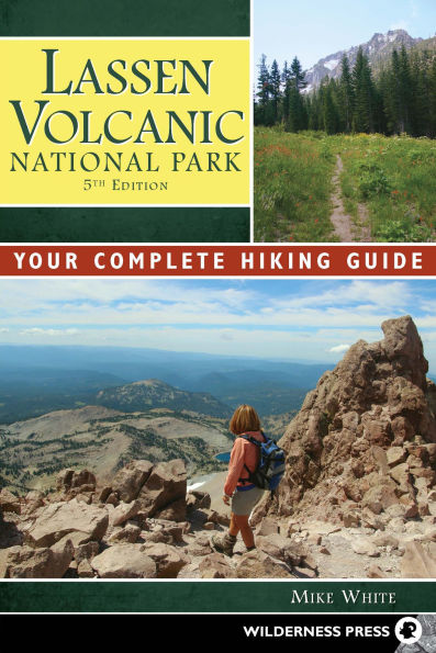
Lassen Volcanic National Park: Your Complete Hiking Guide
Discover some of Northern California's best-kept secrets in the most comprehensive guide to Lassen Volcanic National Park, by experienced author Mike White. Explore bubbling mudpots, wildflower-carpeted meadows, forest-rimmed lakes, and view-packed summits on trails ranging from easy to strenuous. This essential guide features more than 90 day hikes and backpacking trips to popular destinations, such as Lassen Peak, Bumpass Hell, and Manzanita Lake, plus lesser-known areas like Boiling Springs Lake, Terminal Geyser, and Cinder Cone.

In addition to Lassen Volcanic National Park, there are trips in the Hat Creek Reservation Area, the greater Susanville-Chester region, Warner Valley, Butte Lake, Drakesbad, and McArthur-Burney Falls Memorial State Park.

Completely updated from the previous edition, this guide gives detailed trip narratives and easy-to-scan icons highlighting the best spots for views, hydrothermal features, wildflowers, camping, and swimming.
1124390164
Lassen Volcanic National Park: Your Complete Hiking Guide
Discover some of Northern California's best-kept secrets in the most comprehensive guide to Lassen Volcanic National Park, by experienced author Mike White. Explore bubbling mudpots, wildflower-carpeted meadows, forest-rimmed lakes, and view-packed summits on trails ranging from easy to strenuous. This essential guide features more than 90 day hikes and backpacking trips to popular destinations, such as Lassen Peak, Bumpass Hell, and Manzanita Lake, plus lesser-known areas like Boiling Springs Lake, Terminal Geyser, and Cinder Cone.

In addition to Lassen Volcanic National Park, there are trips in the Hat Creek Reservation Area, the greater Susanville-Chester region, Warner Valley, Butte Lake, Drakesbad, and McArthur-Burney Falls Memorial State Park.

Completely updated from the previous edition, this guide gives detailed trip narratives and easy-to-scan icons highlighting the best spots for views, hydrothermal features, wildflowers, camping, and swimming.
41.95 In Stock
Lassen Volcanic National Park: Your Complete Hiking Guide

Lassen Volcanic National Park: Your Complete Hiking Guide

by Mike White
Lassen Volcanic National Park: Your Complete Hiking Guide

Lassen Volcanic National Park: Your Complete Hiking Guide

by Mike White

Hardcover(Fifth Edition)

$41.95 
  • SHIP THIS ITEM
    In stock. Ships in 1-2 days.
  • PICK UP IN STORE

    Your local store may have stock of this item.

Related collections and offers


Overview

Discover some of Northern California's best-kept secrets in the most comprehensive guide to Lassen Volcanic National Park, by experienced author Mike White. Explore bubbling mudpots, wildflower-carpeted meadows, forest-rimmed lakes, and view-packed summits on trails ranging from easy to strenuous. This essential guide features more than 90 day hikes and backpacking trips to popular destinations, such as Lassen Peak, Bumpass Hell, and Manzanita Lake, plus lesser-known areas like Boiling Springs Lake, Terminal Geyser, and Cinder Cone.

In addition to Lassen Volcanic National Park, there are trips in the Hat Creek Reservation Area, the greater Susanville-Chester region, Warner Valley, Butte Lake, Drakesbad, and McArthur-Burney Falls Memorial State Park.

Completely updated from the previous edition, this guide gives detailed trip narratives and easy-to-scan icons highlighting the best spots for views, hydrothermal features, wildflowers, camping, and swimming.

Product Details

ISBN-13: 9780899979250
Publisher: Wilderness Press
Publication date: 07/01/2018
Edition description: Fifth Edition
Pages: 528
Product dimensions: 6.00(w) x 9.00(h) x (d)

About the Author

MIKE WHITE was raised in the suburbs of Portland, Oregon, in the shadow of Mount Hood. His mother didn’t drive, so walking was a way of life for her, as it became for her young son in tow. When Mike reached driving age, he began to explore farther afield, hiking, backpacking, and climbing in the Cascades of Oregon and Washington. He further honed his outdoor skills while attending Seattle Pacific University. After earning a bachelor’s degree in political science, Mike and his wife, Robin, relocated to the high desert of Reno, Nevada, where he was drawn to the beautiful and sunny Sierra. In the early 1990s, Mike left his last “real” job (with an engineering firm) and began writing full time. His first project for Wilderness Press was an update and expansion of Luther Linkhart’s classic guide, The Trinity Alps. His first solo project was Nevada Wilderness Areas and Great Basin National Park. He is the author of the popular Snowshoe series, whose books include Snowshoe Trails Tahoe, Best Snowshoe Trails of California, and Snowshoe Trails of Yosemite. Mike’s other titles include Kings Canyon National Park, Sequoia National Park, Backpacking Nevada, and 50 Classic Hikes in Nevada (University of Nevada Press). Recently, he ventured hundreds of miles around Lake Tahoe and wrote Afoot & Afield: Tahoe–Reno and Top Trails Lake Tahoe. Mike has also written for Sunset and Backpacker magazines and for the Reno Gazette Journal. Mike also teaches hiking, backpacking, and snowshoeing classes at Truckee Meadows Community College and is a frequent speaker for nonprofit groups. In addition, he can be found dispensing trail information while working part-time at REI in Reno, where he lives with Robin and their youngest son, Stephen, along with their two labs, Barkley and Griffin. David, his oldest son, resides in the area with his wife, Candace.

Read an Excerpt

Southwest Entrance Trailheads

Trip 1: BROKEOFF MOUNTAIN

  • DIFFICULTY: MS
  • DIRECTION: out-and-back
  • TRIP TYPE: Day hike
  • DISTANCE: 7-mile out-and-back
  • ELEVATIONS: 6,635'/9,235', +2,700'/–2,700'
  • SEASON: Mid-July–October
  • USE: Moderate
  • MAP: Lassen Peak

INTRODUCTION A stiff, 3.5-mile climb (which may feel more like 5 miles) leads to one of Lassen Volcanic’s more dramatic vistas, from the summit of 9,235-foot Brokeoff Mountain, so named for the ruggedly sheer north face of the peak. Not only will successful summiteers enjoy a superb view of Lassen Peak; this is also the best vantage point for examining the remnants of ancient Mount Tehama’s caldera. The scenery extends to the southern Cascades (including Mount Shasta), northern Sierra, Sacramento Valley, and the coastal mountain ranges. Also notable is the trail itself, which travels through serene forest, passes by flower-covered meadows, visits dancing streams, and offers a short side excursion to the quiet surroundings of shallow Forest Lake.

Although this route is far less popular than the Lassen Peak Trail, plenty of hikers set their sights on Brokeoff Mountain, whose small summit can seem a bit crowded with more than a handful of hikers. Snow lingers on the upper slopes of the mountain until midsummer—if you plan to climb earlier in the season, consider bringing an ice ax. Water is available from tributaries of Mill Creek along the first half of the route only; make sure to pack plenty of water for the second half of the ascent, which is exposed to the sun at relatively high altitudes. Valley dwellers should watch for signs of altitude sickness, and everyone should make a hasty retreat from the upper slopes when thunderstorms are threatening. A 1.25-mile trail connecting the Brokeoff Mountain and Heart Lake Trails is shown on some maps, but it has long been abandoned. These cautions aside, the trip to Brokeoff Mountain is one of the park’s best adventures.

DIRECTIONS TO TRAILHEAD Follow the Main Park Road 0.5 mile from the south boundary (5.0 miles from CA 36) to the well-marked parking area on the east shoulder. The parking area is 0.4 mile south of the southwest entrance station, so self -registration is required for entry into Lassen Volcanic National Park; fee envelopes are provided at the parking area.

GPS N40° 25.851' W121° 32.166'

DESCRIPTION On the opposite shoulder from the parking area, wood steps lead west up the hillside and past a trailhead signboard before a singletrack trail continues the climb through verdant patches of wildflowers and tall thickets of alders, well watered by spring-fed tributaries of an unnamed creek that drains Forest Lake and the southeast slopes of Brokeoff Mountain. The trail crosses these rivulets a few times while proceeding up the slope through a mixed forest of Western white pines, lodgepole pines, and firs. The grade momentarily eases near a pond/meadow in a shallow depression on the left. Resuming the climb, you eventually reach a small, flower-filled meadow, where Brokeoff Mountain makes the first in a series of fleeting appearances. Just before the path bends to cross the main branch of the creek, an unmarked, lesser-used trail veers right (north) to Forest Lake, 1.2 miles from the trailhead.

Side Trip to Forest Lake Without any remarkable scenery, decent swimming, or trout, Forest Lake won’t make anyone’s list of must-see destinations. However, in early summer, the short stroll may attract wildflower enthusiasts who don’t mind dealing with the corresponding hordes of mosquitoes. Follow the right-hand path north from the unmarked junction alongside a tiny stream about 200–250 yards to the shallow, log-strewn lake. As few of the hikers bound for Brokeoff Mountain’s summit take this diversion, Forest Lake’s principal attraction may be a healthy dose of solitude. End Side Trip

From the junction, hop across the main branch of the creek and continue the steady climb up the left side of the drainage onto the southeast slope of Brokeoff Mountain. Wind up the slope through diminishing forest, which now includes mountain hemlocks, to gain the south ridge. Although the route up the pinemat manzanita–covered south ridge would seem to be the most logical line to the summit, the trail follows the steep ridge for only a short stretch before beginning a lengthy, ascending traverse across the virtually shadeless, gravelly southwest side of the peak. Along with a few stunted whitebark pines, tufts of subalpine and alpine plants higher upslope maintain a foothold in the otherwise sterile looking soil; in early season, a colorful display of widely scattered wildflowers lines the trail. The trail eventually switchbacks near the mountain’s west ridge and then proceeds on another traverse, nearly as long as the previous one, above timberline to the ridge crest, where you’ll have a prelude to the incredible vista at the top. A short climb from there leads to the summit.

Not surprisingly, the dominant feature of the 360-degree view from the summit is Lassen Peak, situated at the culmination of a sinuous ridge that winds northeast from your viewpoint. Other notable peaks to the northeast include Mount Diller, Pilot Pinnacle, Ski Heil Peak, and Eagle Peak. Geologists theorize that this ridge is what remains of a collapsed caldera, a remnant of ancient Mount Tehama, an 11,000-foot stratovolcano that once dominated the surrounding landscape. However, Lassen Peak is not one of Tehama’s leftovers, but a plug dome volcano that formed on the ancestral mountain’s northern flank. Additional points of interest visible from the top of Brokeoff Mountain include Chaos Crags and Mount Shasta to the north, giant Lake Almanor to the south, and, on clear days, the Sacramento Valley backdropped by the Coast Range to the west and Klamath Mountains to the northwest.

Table of Contents

Acknowledgments     xiii
Preface     xiii
Introduction     1
Human History     2
Flora and Fauna     8
Geology     14
Climate     18
Locator Map     20
Traveling the Backcountry     21
Fees     21
About Lassen and Surrounding Lands     22
Wilderness Ethics and Trail Courtesy     25
Maps     27
Wilderness Permits     27
Wilderness Use Regulations for Lassen Volcanic National Park     28
Backpacking Equipment Checklist     29
Winter in the Lassen Area     29
About This Guide     31
Symbols     31
Trip Information     32
Map Legend     33
Lassen Scenic Byway Road Log     35
Main Park Road Through Lassen Volcanic National Park     36
Highway 44 from Crossroads Junction to Old Station     47
Highway 44 from Old Station to Highway 36 Junction     48
Highway 44 Junction to Highway 89 Junction West of Mineral     49
Highway 89 from Old Station through Hat Creek Valley     50
Lassen Scenic Byway Trips     53
Introduction to theMain Park Road     53
Southwest Entrance Trailheads
Brokeoff Mountain     56
Mill Creek Falls     58
Ridge Lakes     60
Sulphur Works     61
Road Summit Trailheads
Bumpass Hell to Kings Creek Picnic Area     62
Lassen Peak     65
Paradise Meadow     70
Terrace, Shadow, and Cliff Lakes     72
Kings Creek Meadows Trailheads
Cold Boiling Lake and Crumbaugh Lake     73
Kings Creek to Southwest Campground     74
Twin Meadows     76
Upper Kings Creek     77
Sifford Lakes     78
Kings Creek Falls     80
Kings Creek Falls and Bench Lake Loop     81
Summit Lake Trailheads
Summit Lake     83
Corral Meadow     84
Corral Meadow-Swan Lake Loop     85
Echo and Twin Lakes     87
Cluster and Twin Lakes Loop     89
Dersch Meadows to Cliff Lake     92
Emigrant Pass Trailheads
Nobles Trail to Badger Flat     94
Hat Lake to Paradise Meadow     96
Devastated Area Interpretive Trail     97
Manzanita Lake Trailheads
Crags Lake     98
Manzanita Creek      100
Manzanita Lake     102
Lily Pond Nature Trail     104
Nobles Trail to Lost Creek     105
Introduction to the Hat Creek Recreation Area and Thousand Lakes Wilderness     106
Bunchgrass Trailhead
Durbin and Barrett Lakes     109
Hat Creek Trailheads
Spattercone Nature Trail     111
Subway Cave     112
Pacific Crest Trail: Subway Cave to Hat Creek Rim     114
Hat Creek Trail     116
Forest Road 22 Trailhead
Pacific Crest Trail to Hat Creek Rim Lookout     119
Mud Lake Trailhead
Pacific Crest Trail: Hat Creek Rim     121
Tamarack Trailhead
Barrett Lake-Lake Eiler Loop     123
Cypress Trailhead
Upper Twin, Everett, and Magee Lakes, and Magee Peak     125
Magee Trailhead
Magee Peak     128
Introduction to Butte Lake and Caribou Wilderness     130
Butte Lake Trailheads
Bathtub Lake Loop     132
Prospect Peak     134
Cinder Cone Nature Trail     136
Lower Twin-Horseshoe-Snag Lakes Loop     138
Widow-Jakey-Snag Lakes Loop     143
Cone Lake Trailhead
Widow Lake     147
Triangle, Twin, and Turnaround Lakes     149
Caribou Lake Trailhead
Middle Caribou Lakes Loop      151
Emerald, Rim, and Cypress Lakes     154
Silver Lake Trailhead
Trail Lake from Silver Lake     155
Echo Lake Trailhead
Trail Lake from Echo Lake     157
Hay Meadow Trailhead
Beauty, Evelyn, Long, and Hidden Lakes Loop     158
Introduction to the Greater Susanville-Chester Area     160
Eagle Lake Trailheads
Eagle Lake Recreation Trail     162
Osprey Overlook Trail     164
Susanville Trailhead
Bizz Johnson Trail     166
Lake Almanor Trailhead
Lake Almanor Recreation Trail     167
Introduction to Juniper Lake     168
Juniper Lake Trailheads
Mount Harkness     171
Juniper Lake Loop     174
Crystal Lake     176
Inspiration Point     177
Horseshoe and Indian Lakes Loop     179
Horseshoe, Snag, and Swan Lakes Loop     181
Cameron Meadow-Grassy Creek Loop     185
Jakey Lake     187
Jakey Lake-Widow Lake Loop     189
Introduction to Warner Valley and Drakesbad     193
Warner Valley Trailhead
Warner Valley to Mount Harkness     194
Lower Kings Creek to Corral Meadow     197
Drakesbad Trailheads
Boiling Springs Lake      199
Terminal Geyser and Little Willow Lake     201
Drake Lake     204
Dream Lake and Devils Kitchen     207
Sifford Lakes     209
Kings Creek Falls     211
Corral Meadow Loop     213
Introduction to the Southern Borderlands     216
Willow Lake Trailhead
Willow Lake to Terminal Geyser     218
Domingo Springs Trailhead
Pacific Crest Trail: Northbound to Drakesbad     220
Highway 36 Trailhead
Pacific Crest Trail: Highway 36 to Domingo Springs     223
Spencer Meadow Trailhead
Spencer Meadow Loop     226
Blue Lake     229
Martin Creek Trailhead
Heart Lake via Glassburner Meadow     231
South Fork Digger Creek Trailhead
Heart Lake via South Fork Digger Creek     233
Mill Creek Trailhead
Mill Creek Trail     234
Deer Creek Trailhead
Deer Creek Trail     237
Black Rock Trailhead
Mill Creek Trail-Ishi Wilderness     239
Bucks Lake Wilderness Trips     243
Introduction to Bucks Lake Wilderness     243
Highway 70 Trailhead
Pacific Crest Trail to Three Lakes     245
Silver Lake Trailhead
Gold Lake     247
Silver Lake to Spanish Peak     248
Bucks Summit Trailhead
Bucks Summit to Spanish Peak     250
Bucks Creek Trailhead
Bucks Creek Loop     252
Bucks Creek to Mill Creek Campground     253
Mill Creek Campground Trailhead
Bucks Lake Wilderness Loop     255
Mill Creek Trailhead
Three Lakes     259
McArthur-Burney Falls Trips
Introduction to McArthur-Burney Falls Memorial State Park     263
Burney Falls Trailhead
Falls Loop     264
Headwaters Pool-Pacific Crest Trail Loop     265
Burney Creek-Rim Trail Loop     266
Pioneer Trailhead
Pioneer Cemetery Trail     267
Appendices     269
Backpacks and Dayhikes Features Chart     269
The Bear Facts and Other Animal Concerns     273
Minimum-Impact Stock Regulations     276
Nonprofit Organizations     277
Quick Guide to Frequently Used Numbers and Websites     278
Suggested Reading     280
Index     281
About the Author     285

From the B&N Reads Blog

Customer Reviews