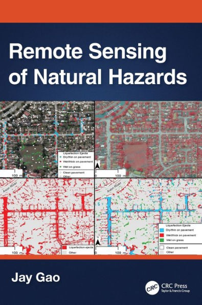
Remote Sensing of Natural Hazards
This book presents a comprehensive coverage of remote sensing technology used to gather information on 12 types of natural hazards in the terrestrial sphere, biosphere, hydrosphere, and atmosphere. It clarifies in detail how to yield spatial and quantitative data on a natural hazard, including its spatial distribution, severity, causes, and the likelihood of occurrence. The author explains multiple methods of attaining data, describes the pros and cons of each method, and encourages readers to choose the best method applicable to their case. The author offers a practical approach to data analysis using the most appropriate methods and software.

1. Covers all major natural hazards including hurricanes, tornadoes, wildfires, and avalanches.

2. Studies each natural hazard holistically, ranging from spatial extent, severity, impact assessment, causes, and prediction of occurrence.

3. Explains different remotely sensed data and the most appropriate method used.

4. Compares different ways of sensing and clarifies the pros and cons of any selected data or their analysis.

5. Provides ample examples of each aspect of a natural hazard studied augmented with graphic illustrations and quality assurance information.

All professionals working in the field of natural hazards, senior undergraduate, and graduate students, will find in-depth approaches and sufficient information to become knowledgeable in the methods of yielding and analyzing data provided with remote sensing technology, ultimately providing a deeper understanding of natural hazards.

1142378813
Remote Sensing of Natural Hazards
This book presents a comprehensive coverage of remote sensing technology used to gather information on 12 types of natural hazards in the terrestrial sphere, biosphere, hydrosphere, and atmosphere. It clarifies in detail how to yield spatial and quantitative data on a natural hazard, including its spatial distribution, severity, causes, and the likelihood of occurrence. The author explains multiple methods of attaining data, describes the pros and cons of each method, and encourages readers to choose the best method applicable to their case. The author offers a practical approach to data analysis using the most appropriate methods and software.

1. Covers all major natural hazards including hurricanes, tornadoes, wildfires, and avalanches.

2. Studies each natural hazard holistically, ranging from spatial extent, severity, impact assessment, causes, and prediction of occurrence.

3. Explains different remotely sensed data and the most appropriate method used.

4. Compares different ways of sensing and clarifies the pros and cons of any selected data or their analysis.

5. Provides ample examples of each aspect of a natural hazard studied augmented with graphic illustrations and quality assurance information.

All professionals working in the field of natural hazards, senior undergraduate, and graduate students, will find in-depth approaches and sufficient information to become knowledgeable in the methods of yielding and analyzing data provided with remote sensing technology, ultimately providing a deeper understanding of natural hazards.

180.0 In Stock
Remote Sensing of Natural Hazards

Remote Sensing of Natural Hazards

by Jay Gao
Remote Sensing of Natural Hazards

Remote Sensing of Natural Hazards

by Jay Gao

Hardcover

$180.00 
  • SHIP THIS ITEM
    In stock. Ships in 3-7 days. Typically arrives in 3 weeks.
  • PICK UP IN STORE

    Your local store may have stock of this item.

Related collections and offers


Overview

This book presents a comprehensive coverage of remote sensing technology used to gather information on 12 types of natural hazards in the terrestrial sphere, biosphere, hydrosphere, and atmosphere. It clarifies in detail how to yield spatial and quantitative data on a natural hazard, including its spatial distribution, severity, causes, and the likelihood of occurrence. The author explains multiple methods of attaining data, describes the pros and cons of each method, and encourages readers to choose the best method applicable to their case. The author offers a practical approach to data analysis using the most appropriate methods and software.

1. Covers all major natural hazards including hurricanes, tornadoes, wildfires, and avalanches.

2. Studies each natural hazard holistically, ranging from spatial extent, severity, impact assessment, causes, and prediction of occurrence.

3. Explains different remotely sensed data and the most appropriate method used.

4. Compares different ways of sensing and clarifies the pros and cons of any selected data or their analysis.

5. Provides ample examples of each aspect of a natural hazard studied augmented with graphic illustrations and quality assurance information.

All professionals working in the field of natural hazards, senior undergraduate, and graduate students, will find in-depth approaches and sufficient information to become knowledgeable in the methods of yielding and analyzing data provided with remote sensing technology, ultimately providing a deeper understanding of natural hazards.


Product Details

ISBN-13: 9781032404028
Publisher: CRC Press
Publication date: 06/16/2023
Pages: 463
Product dimensions: 7.00(w) x 10.00(h) x (d)

About the Author

Jay Gao used to be an associate professor affiliated with the School of Environment, University of Auckland. He received his Bachelor of Engineering degree in the field of photogrammetry and remote sensing from the Wuhan Technical University of Survey and Mapping in 1984. Four years later he obtained his MSc in geography from University of Toronto, Canada, and his PhD in geography from University of Georgia in the US in 1992. Upon graduation he became a faculty member of the current university. His research interest spreads widely among different disciplines of geoinformatics, including remote sensing, digital image analysis, and spatial analysis and modelling. Over his academic career he has completed numerous projects on the applications of remote sensing to the management of natural resources and the studies of natural hazards using remote sensing and GIS. So far he has published nearly 200 papers in international journals, authored two books, and edited several more. His solely authored book on Digital Analysis of Remotely Sensed Data was published by McGraw-Hill in 2009, and his second book on The Fundamentals of Spatial Analysis and Modelling was published by CRC Press in 2021.

Table of Contents

Preface. Acknowledgments. About the Author. List of Acronyms. Introduction. Earthquakes. Landslides. Land Degradation. Land Desertification. Land Subsidence. Droughts. Dust Storms. Hurricanes and Tornados. Floods. Wild and Coalmine Fires. Volcanoes. Avalanches. Index.

From the B&N Reads Blog

Customer Reviews