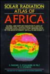
Solar Radiation Atlas of Africa: Global and diffuse radiation fluxes at ground level derived from imaging data of the geostationary satellite METEOSAT 2
Observations cover the continents Africa and Europe, the Middle East and wide regions of the Atlantic and Indian Oceans. Results for the time period (1985-1986) are presented as coloured images and in the form of tables. To ensure the accuracy of these retrieved solar radiation fields at ground level, a comparison with all available ground based pyranometer measurements was made.
1128478195
Solar Radiation Atlas of Africa: Global and diffuse radiation fluxes at ground level derived from imaging data of the geostationary satellite METEOSAT 2
Observations cover the continents Africa and Europe, the Middle East and wide regions of the Atlantic and Indian Oceans. Results for the time period (1985-1986) are presented as coloured images and in the form of tables. To ensure the accuracy of these retrieved solar radiation fields at ground level, a comparison with all available ground based pyranometer measurements was made.
600.0
In Stock
5
1

Solar Radiation Atlas of Africa: Global and diffuse radiation fluxes at ground level derived from imaging data of the geostationary satellite METEOSAT 2
172
Solar Radiation Atlas of Africa: Global and diffuse radiation fluxes at ground level derived from imaging data of the geostationary satellite METEOSAT 2
172Hardcover
$600.00
600.0
In Stock

Product Details
| ISBN-13: | 9789054101093 |
|---|---|
| Publisher: | Taylor & Francis |
| Publication date: | 01/01/1991 |
| Pages: | 172 |
| Product dimensions: | 8.25(w) x 11.69(h) x (d) |
About the Author
From the B&N Reads Blog
