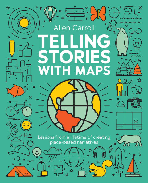
Telling Stories with Maps: Lessons from a Lifetime of Creating Place-Based Narratives
Bring data to life with this essential guide to storytelling with maps. 

From scraping patterns in sand to drawing intricate lines on vellum and paper, to charting every place on the planet, humans have used maps as a powerful storytelling medium. The advent of the digital age has revolutionized the creation, distribution, and consumption of maps. The web created enormous opportunities for storytelling, enabling maps to dance and weave, partnering with other multimedia elements—photos, video, audio, text—to tell countless tales about our world. 

Featuring a foreword by renowned travel writer and cofounder of Lonely Planet Tony Wheeler, Telling Stories with Maps: Lessons from a Lifetime of Creating Place-Based Narratives bridges both the analog and digital realms, showcasing how maps themselves tell stories and enrich narratives by providing context and insight. Richly illustrated with examples from traditional maps to the latest digital visualizations, this book is an essential guide for anyone interested in the powerful storytelling potential of maps. 

Topics covered include: 

  • How storytelling is fundamental to our humanity  
  • Comparing and contrasting the use of words, images, and maps in storytelling 
  • How maps help us tackle the who, what, when, where, why, and how  
  • Considerations for the deep connection between maps and memory 
  • How cartography and location-based storytelling have changed during the digital age  
  • How the author and his collaborators refined storytelling techniques to create printed wall maps and atlas plates 
  • The roles that maps play in narrative context 

Readers will learn:  

  • 15 approaches to storytelling and place-based topics 
  • How exposure to maps and geography can change how we think 
  • Storytelling approaches suited for digital media yet honoring the centuries-old conventions of cartography 
  • How to develop multimedia stories with the ability to employ motion and interactivity for your audience 
  • Practical features and functions of ArcGIS StoryMaps, Esri’s storytelling platform, with insight and inspiration you can apply to your stories. 

Author Allen Carroll brings his experience from both the National Geographic Society and Esri into his writing. Carroll spent more than a decade of his 27-year career at National Geographic Society as chief cartographer. In 2010, Caroll joined Esri and founded its ArcGIS StoryMaps team, which developed web tools that enabled hundreds of thousands of individuals and organizations to tell place-based stories combining interactive maps and multimedia content. 

Telling Stories with Maps is a winding journey, from thoughts on how our brains process spatial information to practical tips on creating stories, that will guide and inspire you to create place-based narratives that intrigue readers. 

1147021298
Telling Stories with Maps: Lessons from a Lifetime of Creating Place-Based Narratives
Bring data to life with this essential guide to storytelling with maps. 

From scraping patterns in sand to drawing intricate lines on vellum and paper, to charting every place on the planet, humans have used maps as a powerful storytelling medium. The advent of the digital age has revolutionized the creation, distribution, and consumption of maps. The web created enormous opportunities for storytelling, enabling maps to dance and weave, partnering with other multimedia elements—photos, video, audio, text—to tell countless tales about our world. 

Featuring a foreword by renowned travel writer and cofounder of Lonely Planet Tony Wheeler, Telling Stories with Maps: Lessons from a Lifetime of Creating Place-Based Narratives bridges both the analog and digital realms, showcasing how maps themselves tell stories and enrich narratives by providing context and insight. Richly illustrated with examples from traditional maps to the latest digital visualizations, this book is an essential guide for anyone interested in the powerful storytelling potential of maps. 

Topics covered include: 

  • How storytelling is fundamental to our humanity  
  • Comparing and contrasting the use of words, images, and maps in storytelling 
  • How maps help us tackle the who, what, when, where, why, and how  
  • Considerations for the deep connection between maps and memory 
  • How cartography and location-based storytelling have changed during the digital age  
  • How the author and his collaborators refined storytelling techniques to create printed wall maps and atlas plates 
  • The roles that maps play in narrative context 

Readers will learn:  

  • 15 approaches to storytelling and place-based topics 
  • How exposure to maps and geography can change how we think 
  • Storytelling approaches suited for digital media yet honoring the centuries-old conventions of cartography 
  • How to develop multimedia stories with the ability to employ motion and interactivity for your audience 
  • Practical features and functions of ArcGIS StoryMaps, Esri’s storytelling platform, with insight and inspiration you can apply to your stories. 

Author Allen Carroll brings his experience from both the National Geographic Society and Esri into his writing. Carroll spent more than a decade of his 27-year career at National Geographic Society as chief cartographer. In 2010, Caroll joined Esri and founded its ArcGIS StoryMaps team, which developed web tools that enabled hundreds of thousands of individuals and organizations to tell place-based stories combining interactive maps and multimedia content. 

Telling Stories with Maps is a winding journey, from thoughts on how our brains process spatial information to practical tips on creating stories, that will guide and inspire you to create place-based narratives that intrigue readers. 

44.99 Pre Order
Telling Stories with Maps: Lessons from a Lifetime of Creating Place-Based Narratives

Telling Stories with Maps: Lessons from a Lifetime of Creating Place-Based Narratives

Telling Stories with Maps: Lessons from a Lifetime of Creating Place-Based Narratives

Telling Stories with Maps: Lessons from a Lifetime of Creating Place-Based Narratives

Paperback

$44.99 
  • SHIP THIS ITEM
    Available for Pre-Order. This item will be released on June 10, 2025

Related collections and offers


Overview

Bring data to life with this essential guide to storytelling with maps. 

From scraping patterns in sand to drawing intricate lines on vellum and paper, to charting every place on the planet, humans have used maps as a powerful storytelling medium. The advent of the digital age has revolutionized the creation, distribution, and consumption of maps. The web created enormous opportunities for storytelling, enabling maps to dance and weave, partnering with other multimedia elements—photos, video, audio, text—to tell countless tales about our world. 

Featuring a foreword by renowned travel writer and cofounder of Lonely Planet Tony Wheeler, Telling Stories with Maps: Lessons from a Lifetime of Creating Place-Based Narratives bridges both the analog and digital realms, showcasing how maps themselves tell stories and enrich narratives by providing context and insight. Richly illustrated with examples from traditional maps to the latest digital visualizations, this book is an essential guide for anyone interested in the powerful storytelling potential of maps. 

Topics covered include: 

  • How storytelling is fundamental to our humanity  
  • Comparing and contrasting the use of words, images, and maps in storytelling 
  • How maps help us tackle the who, what, when, where, why, and how  
  • Considerations for the deep connection between maps and memory 
  • How cartography and location-based storytelling have changed during the digital age  
  • How the author and his collaborators refined storytelling techniques to create printed wall maps and atlas plates 
  • The roles that maps play in narrative context 

Readers will learn:  

  • 15 approaches to storytelling and place-based topics 
  • How exposure to maps and geography can change how we think 
  • Storytelling approaches suited for digital media yet honoring the centuries-old conventions of cartography 
  • How to develop multimedia stories with the ability to employ motion and interactivity for your audience 
  • Practical features and functions of ArcGIS StoryMaps, Esri’s storytelling platform, with insight and inspiration you can apply to your stories. 

Author Allen Carroll brings his experience from both the National Geographic Society and Esri into his writing. Carroll spent more than a decade of his 27-year career at National Geographic Society as chief cartographer. In 2010, Caroll joined Esri and founded its ArcGIS StoryMaps team, which developed web tools that enabled hundreds of thousands of individuals and organizations to tell place-based stories combining interactive maps and multimedia content. 

Telling Stories with Maps is a winding journey, from thoughts on how our brains process spatial information to practical tips on creating stories, that will guide and inspire you to create place-based narratives that intrigue readers. 


Product Details

ISBN-13: 9781589487970
Publisher: Esri Press
Publication date: 06/10/2025
Pages: 244
Product dimensions: 7.50(w) x 9.25(h) x 0.00(d)

About the Author

During his 27-year career at the National Geographic Society, Allen Carroll designed scores of maps for its renowned magazine and other publications. Beginning his NGS career on the staff of the magazine’s art department, he became its art director, designing diagrams, infographics, and historical reconstructions. As the Society’s chief cartographer from 1998 to 2010, he was deeply involved in the creation of the Society’s renowned reference and wall maps, globes, and atlases, and oversaw creation of scores of page maps and large-format supplement maps for the magazine. He led the creation of the Seventh and Eighth editions of the World Atlas, incorporating satellite imagery and innovative thematic maps into the editions and integrating them for the first time with interactive Web resources. He spearheaded the publication of many new web resources and other special projects featuring biodiversity, conservation, and indigenous cultures.

After joining Esri in 2010, he founded its StoryMaps team, which developed web tools that enabled hundreds of thousands of individuals and organizations to tell place-based stories combining interactive maps and multimedia content. He continues to lead an editorial team that publishes ArcGIS StoryMaps and supports a global community of storytellers who have used StoryMaps to create millions of multimedia narratives.


English-born Tony Wheeler arrived in Australia with his wife Maureen in late 1972 after a six-month Asia overland trip from Europe with 27 cents between them. A year later they started Lonely Planet Publications to publish Across Asia on the Cheap, followed by South-East Asia on a Shoestring.  By 2011 when it was sold Lonely Planet had become the world’s largest independent guidebook publisher.  Today, Tony and Maureen support travel, health, education, and arts projects around the world through the Planet Wheeler Foundation.  Travel and discovery continue to drive Tony and he shares his adventures on his website.

Table of Contents

Foreword

Introduction

Chapter 1: Why Stories Matter

Chapter 2: Why Maps Matter

Chapter 3: Maps and Minds

Chapter 4: From Analog to Digital

Chapter 5: The Journey to Storytelling

Chapter 6: Maps in Dramatic Roles

Chapter 7: Nine Steps to Great Storytelling

Chapter 8: Plan, Produce, Polish, Publish

Epilogue

Acknowledgements

References

Credits

From the B&N Reads Blog

Customer Reviews