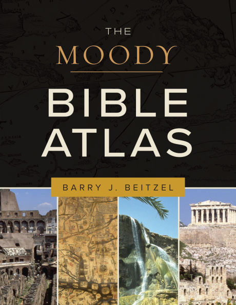
The Moody Bible Atlas

ECPA Medallion of Excellence
Winner—Cartography and Geographic Information Society (CaGIS) Annual Map Design Competition

The Bible is a Story. Do you know its setting?

Everything in the Bible has meaning, including its geography. Discover new insights about the biblical and historical sites, culture, and landscapes. God chose a certain land in a particular place. Many Bible passages involve journeys, wars, or other events in unfamiliar places in ancient times. The geographical context is important to understanding these passages.

More than just maps, The Moody Bible Atlas reveals the geographical and historical context of the biblical story. Marvel at God’s provision by journeying with Israel in the wilderness. Size up their enemies by studying portraits of the Egyptians, Canaanites, Assyrians, and others. View maps and pictures of the places Jesus walked. See Paul’s evangelistic zeal by learning the scope of his missionary journeys. Updates reflect the latest advances in biblical scholarship, linguistics, and archeology. Award-winning maps, new research, and additional commentary make this updated work an indispensable resource for sermon preparation, lessons, and personal Bible study.

Key features include:

  • 119 full-color maps of Canaan, the Mediterranean, the Near East, Sinai, Turkey, and more
  • Over 100 all-new color photos of various locations and artifacts
  • Comprehensive survey of every location in the Bible— from Eden to Jerusalem to Rome
  • Distinctive theological discussion of Bible geography
  • 800+ endnotes for in-depth study
  • A general reading list for continued research
  • A Map Citation Index, General Index, and Scripture Citation Index
1145991894
The Moody Bible Atlas

ECPA Medallion of Excellence
Winner—Cartography and Geographic Information Society (CaGIS) Annual Map Design Competition

The Bible is a Story. Do you know its setting?

Everything in the Bible has meaning, including its geography. Discover new insights about the biblical and historical sites, culture, and landscapes. God chose a certain land in a particular place. Many Bible passages involve journeys, wars, or other events in unfamiliar places in ancient times. The geographical context is important to understanding these passages.

More than just maps, The Moody Bible Atlas reveals the geographical and historical context of the biblical story. Marvel at God’s provision by journeying with Israel in the wilderness. Size up their enemies by studying portraits of the Egyptians, Canaanites, Assyrians, and others. View maps and pictures of the places Jesus walked. See Paul’s evangelistic zeal by learning the scope of his missionary journeys. Updates reflect the latest advances in biblical scholarship, linguistics, and archeology. Award-winning maps, new research, and additional commentary make this updated work an indispensable resource for sermon preparation, lessons, and personal Bible study.

Key features include:

  • 119 full-color maps of Canaan, the Mediterranean, the Near East, Sinai, Turkey, and more
  • Over 100 all-new color photos of various locations and artifacts
  • Comprehensive survey of every location in the Bible— from Eden to Jerusalem to Rome
  • Distinctive theological discussion of Bible geography
  • 800+ endnotes for in-depth study
  • A general reading list for continued research
  • A Map Citation Index, General Index, and Scripture Citation Index
44.99 In Stock
The Moody Bible Atlas

The Moody Bible Atlas

by Barry Beitzel
The Moody Bible Atlas

The Moody Bible Atlas

by Barry Beitzel

eBookThird Edition, New Edition (Third Edition, New Edition)

$44.99 

Available on Compatible NOOK devices, the free NOOK App and in My Digital Library.
WANT A NOOK?  Explore Now

Related collections and offers

LEND ME® See Details

Overview

ECPA Medallion of Excellence
Winner—Cartography and Geographic Information Society (CaGIS) Annual Map Design Competition

The Bible is a Story. Do you know its setting?

Everything in the Bible has meaning, including its geography. Discover new insights about the biblical and historical sites, culture, and landscapes. God chose a certain land in a particular place. Many Bible passages involve journeys, wars, or other events in unfamiliar places in ancient times. The geographical context is important to understanding these passages.

More than just maps, The Moody Bible Atlas reveals the geographical and historical context of the biblical story. Marvel at God’s provision by journeying with Israel in the wilderness. Size up their enemies by studying portraits of the Egyptians, Canaanites, Assyrians, and others. View maps and pictures of the places Jesus walked. See Paul’s evangelistic zeal by learning the scope of his missionary journeys. Updates reflect the latest advances in biblical scholarship, linguistics, and archeology. Award-winning maps, new research, and additional commentary make this updated work an indispensable resource for sermon preparation, lessons, and personal Bible study.

Key features include:

  • 119 full-color maps of Canaan, the Mediterranean, the Near East, Sinai, Turkey, and more
  • Over 100 all-new color photos of various locations and artifacts
  • Comprehensive survey of every location in the Bible— from Eden to Jerusalem to Rome
  • Distinctive theological discussion of Bible geography
  • 800+ endnotes for in-depth study
  • A general reading list for continued research
  • A Map Citation Index, General Index, and Scripture Citation Index

Product Details

ISBN-13: 9780802469694
Publisher: Moody Publishers
Publication date: 06/13/2025
Sold by: Barnes & Noble
Format: eBook
Pages: 352
File size: 225 MB
Note: This product may take a few minutes to download.

About the Author

BARRY J. BEITZEL (PhD, The Dropsie University; Fuller Theological Seminary; University of Pennsylvania) is professor emeritus of Old Testament and Semitic Languages at Trinity Evangelical Divinity School in Deerfield, IL. He obtained a postdoctorate in ancient Near Eastern geography from the Université de Li ge, Belgium, and has engaged in postdoctoral archaeological work in eastern Syria through UCLA. Dr. Beitzel is the editor and cartographer for Biblica, The Bible Atlas: A Social and Historical Journey Through the Lands of the Bible (Viking/Penguin Press), editor of the Lexham Geographical Commentary series (Logos/Lexham Press), and author of Where Was the Biblical Red Sea?: Examining the Ancient Evidence (Lexham Press). His published mapwork appears in Bibles produced by Moody Publishers, Zondervan, B. B. Kirkbride Bible Company, Tyndale House Publishers, Holman Bible Publishers, Crossway, Thomas Nelson Publishers, and Schuyler Publishers. He and his wife, Carol, reside in Mundelein, Illinois, and have three married children.
BARRY J. BEITZEL (PhD, The Dropsie University; Fuller Theological Seminary; University of Pennsylvania) is professor emeritus of Old Testament and Semitic Languages at Trinity Evangelical Divinity School in Deerfield, IL. He obtained a postdoctorate in ancient Near Eastern geography from the Universit de Li ge, Belgium, and has engaged in postdoctoral archaeological work in eastern Syria through UCLA. Dr. Beitzel is the editor and cartographer for Biblica, The Bible Atlas: A Social and Historical Journey Through the Lands of the Bible (Viking/Penguin Press), editor of the Lexham Geographical Commentary series (Logos/Lexham Press), and author of Where Was the Biblical Red Sea?: Examining the Ancient Evidence (Lexham Press). His published mapwork appears in Bibles produced by Moody Publishers, Zondervan, B. B. Kirkbride Bible Company, Tyndale House Publishers, Holman Bible Publishers, Crossway, Thomas Nelson Publishers, and Schuyler Publishers. He and his wife, Carol, reside in Mundelein, Illinois, and have three married children.
From the B&N Reads Blog

Customer Reviews