Use of Satellite and In-Situ Data to Improve Sustainability
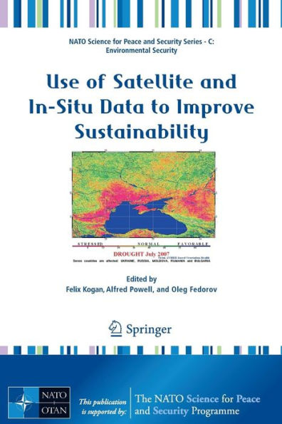
More than 30-year operational satellite data have already been used for monitoring land, ocean and atmosphere. These applications have contributed to improve sustainable economy, produce healthy environment and enhance human life. The Advanced Research Workshop sponsored by NATO and organized by the USA’s National Oceanic and Atmospheric Administration and Ukrainian’s Space Agency bring the scientists with the most mature research designed for practical use. The goals were to select those which is used for services today and identify the areas to expand research and services. Scientific and application results of the Workshop presented in this book can be used today in agriculture, forestry, water resources, healthy coastal life and fisheries, climate and land cover change, anthropogenic activities and others. The presented papers provide information on how to use operational satellites and in situ measurements for early detection of large-scale droughts, floods and fires, diagnose crop and pasture annual losses, predict periods with health/unhealthy vegetation based on such climate forcing events as ENSO, monitor air quality and geomagnetic activities, assess land cover trends in responce to global warming etc. The available satellite/ground information and method is currently warn with a lead time sufficient to respond, recover and protect.
1101672742
Use of Satellite and In-Situ Data to Improve Sustainability
More than 30-year operational satellite data have already been used for monitoring land, ocean and atmosphere. These applications have contributed to improve sustainable economy, produce healthy environment and enhance human life. The Advanced Research Workshop sponsored by NATO and organized by the USA’s National Oceanic and Atmospheric Administration and Ukrainian’s Space Agency bring the scientists with the most mature research designed for practical use. The goals were to select those which is used for services today and identify the areas to expand research and services. Scientific and application results of the Workshop presented in this book can be used today in agriculture, forestry, water resources, healthy coastal life and fisheries, climate and land cover change, anthropogenic activities and others. The presented papers provide information on how to use operational satellites and in situ measurements for early detection of large-scale droughts, floods and fires, diagnose crop and pasture annual losses, predict periods with health/unhealthy vegetation based on such climate forcing events as ENSO, monitor air quality and geomagnetic activities, assess land cover trends in responce to global warming etc. The available satellite/ground information and method is currently warn with a lead time sufficient to respond, recover and protect.
219.99 In Stock
Use of Satellite and In-Situ Data to Improve Sustainability

Use of Satellite and In-Situ Data to Improve Sustainability

Use of Satellite and In-Situ Data to Improve Sustainability

Use of Satellite and In-Situ Data to Improve Sustainability

Paperback(2011)

$219.99 
  • SHIP THIS ITEM
    In stock. Ships in 1-2 days.
  • PICK UP IN STORE

    Your local store may have stock of this item.

Related collections and offers


Overview

More than 30-year operational satellite data have already been used for monitoring land, ocean and atmosphere. These applications have contributed to improve sustainable economy, produce healthy environment and enhance human life. The Advanced Research Workshop sponsored by NATO and organized by the USA’s National Oceanic and Atmospheric Administration and Ukrainian’s Space Agency bring the scientists with the most mature research designed for practical use. The goals were to select those which is used for services today and identify the areas to expand research and services. Scientific and application results of the Workshop presented in this book can be used today in agriculture, forestry, water resources, healthy coastal life and fisheries, climate and land cover change, anthropogenic activities and others. The presented papers provide information on how to use operational satellites and in situ measurements for early detection of large-scale droughts, floods and fires, diagnose crop and pasture annual losses, predict periods with health/unhealthy vegetation based on such climate forcing events as ENSO, monitor air quality and geomagnetic activities, assess land cover trends in responce to global warming etc. The available satellite/ground information and method is currently warn with a lead time sufficient to respond, recover and protect.

Product Details

ISBN-13: 9789048196203
Publisher: Springer Netherlands
Publication date: 12/01/2010
Series: NATO Science for Peace and Security Series C: Environmental Security
Edition description: 2011
Pages: 314
Product dimensions: 6.10(w) x 9.00(h) x 0.90(d)

Table of Contents

Part I Large-Scale Weather Disasters: Early Detection & Monitoring from Space & in Situ Data

Monitoring Droughts and Impacts on Crop Yield in Ukraine from Weather and Satellite Data Tatyana Adamenko Anatoly Prokopenko 3

Early Detection and Monitoring Droughts From NOAA Environmental Satellites Felix Kogan Wei Guo 11

Flood Monitoring from SAR Data Nataliia Kussul Andrii Shelestov Sergii Skakun 19

Satellite Rainfall Information for Flood Preparedness and Response Robert J. Kuligowski 31

Monitoring Severe Weather in UKRAINE with Satellite Data Oleksiy Kryvobok Mykola Kulbida Ludmila Savchenko 41

Daily Fire Occurrence in Ukraine from 2002 to 2008 Wei Min Hao Shawn P. Urbanski Bryce Nordgren Alex Petkov 49

Satellite-Based Systems for Agro-meteorological Monitoring Alexander Kleschenko Oleg Virchenko Olga Martinenko 61

Part II Environment and Food Security: Diagnosis and Prediction

Monitoring Droughts and Pastures Productivity in Mongolia Using NOAA-AVHRR Data Leah Orlovsky Felix Kogan Eldad Eshed Chultem Dugarjav 69

Satellite-Derived Information on Snow Cover for Agriculture Applications in Ukraine Peter Romanov 81

Grain Yield Prediction in the Russian Federation Anna Strashnaya Tamara Maksimenkova Olga Chub 93

Satellite-Based Crop Production Monitoring in Ukraine and Regional Food Security Felix Kogan Tatiana Adamenko Mikola Kulbida 99

New Regression Models for Prediction of Grain Yield Anomalies from Satellite-Based Vegetation Health Indices Gennady Menzhulin Natalya Shamshurina Artyom Pavlovsky Felix Kogan 105

Phytosanitary Situation of Agrocenosis in Ukraine and New Technologies for Monitoring Harmful Organisms Vladimir Chayka Tatiana Neverovska Nelia Prokopiuk Olga Baklanova 113

Part III Climate Change, Environment and Socioeconomics

30-Year Land Surface Trend from AVHRR-Based Global Vegetation Health Data Felix Kogan 119

Global Warming, Atlantic Multi-decadal Oscillation, Thermohaline Catastrophe and Their Impact on Climate of the North Atlantic Region Alexander Polonsky 125

Global Warming and Possible Changes in the Recurrences of Grain Crops Anomalies Gennady Menzhulin Artyom Pavlovsky 145

Regime Shifts in the Atmosphere and Their Relationship to Abrupt Ocean Changes Alfred M. Powell, Jr Jianjun Xu Ming Chen 151

Glacier Degradation from GIS and Remote Sensing Data Azamat Tynybekov 159

ENSO Impact on Vegetation Felix Kogan 165

Bio-climatic Potential of Russia and Climate Change Alexander Kleschenko 175

Part IV Marine Ecosystem, Land Cover, Atmosphere & Anthropogenic Activities

Consequences of Land and Marine Ecosystems Interaction for the Black Sea Coastal Zone Vladimir Kushnir Gennady Korotaev Felix Kogan Alfred M. Powel, Jr 181

Utilizing Satellite Data to Highlight High Ozone Concentration Events During Fire Episodes Rasa Girgzdiene Steigvile Bycenkiene 191

Geomagnetic Disturbances and Seismic Events in the Vrancea Zone from in Situ Data Frina Sedova Vladimir Bakhmutov Tamara Mozgovaya 199

First Step Towards Monitoring Surface Ozone Dynamics at Ukrainian Stations Oleg Blum Vira Godunova Volodymyr Lapchenko Oleksiy Perekhod Yaroslav Romanyuk Mikhail Sosonkin 209

Satellite Monitoring of Nitrogen Oxide Emissions Igor Konovalov Matthias Beekmann Andreas Richter John Burrows 219

Detection of Desertification Zones Using Multi-year Remote Sensing Data Lev Spivak Irina Vitkovskaya Madina Batyrbayeva Alex Terekhov 235

Satellite Desertification Monitoring in Sahara Mikhail A. Popov Sergey A. Stankevich Alexei I. Sakhatsky Menny O. El Bah Daoud Mezzane Igor A. Luk'yanchuk 241

Part V Satellite & In Situ Long Records for Trend Analysis, Modeling & Monitoring

Global Vegetation Health: Long-Term data Records Felix Kogan Wei Guo Aleksandar Jelenak 247

Aero-Space Radar Online Monitoring of Disasters in Ukraine Mariya Belobrova Dmitry Bychkov Anatoly Boev Alexandre Gavrilenko Valentin Efimov Alexandre Kabanov Ivan Kalmykov Alexandre Matveev Valery Tsymbal 257

Comparison of AVHRR-Based Global Data Records Felix Kogan Marco Vargas Wei Guo 267

Merging Remote Sensing and In Situ Data for Estimation of Energy Balance Components Under Climate Change Conditions: Ukrainian Steppe Zone Tatiana Ilienko Elena Vlasova 273

Atmosphere Aerosol Properties Measured with AERONET/PHOTONS Sun-Photometer over Kyiv During 2008-2009 Vassyl Danylevsky Vassyl Ivchenko Gennadi Milinevsky Michail Sosonkin Philippe Goloub Zhengqiang Li Oleg Dubovik 285

Global Distribution of Magnetic Storm Fields and Relativistic Particles Fluxes Olga Maksimenko Galyna Melnyk 295

Appendix 1 305

Appendix 2 306

Appendix 3 307

Appendix 4 308

Appendix 5 309

From the B&N Reads Blog

Customer Reviews