
National Geographic's Vietnam North Adventure Map provides global travelers with the perfect combination of detail and perspective, highlighting hundreds of points of interest and the diverse and unique destinations within the country. Cities and towns are clearly indicated and easy to find in the user-friendly index. A road network complete with distances and designations for roads and secondary routes will help you find the route that's right for you. Hundreds of points of interest are highlighted including World Heritage sites, monuments, temples, beaches, museums, waterfalls, and more. The locations of airports, harbors, ferry routes, and railways take the guesswork out of travel around the region.
The front side of the print map details the north central region of the country, from its border with Laos to the west, to the Gulf of Tonkin to the east. The reverse side of the map details the northern region, from its border with Laos to the west, China's border to the north, and Gulf of Tonkin to the east. Expertly crafted and filled with specialty content, the Vietnam North Adventure Map is the perfect companion to a guidebook.
Every Adventure Map is printed on durable synthetic paper, making them waterproof, tear-resistant and tough — capable of withstanding the rigors of international travel.
- Map Scale = 1:650,000
- Sheet Size = 25.5" x 37.75"
- Folded Size = 4.25" x 9.25"

Vietnam North Map
2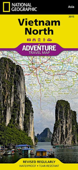
Vietnam North Map
2(2019th ed.)

Product Details
| ISBN-13: | 9781566956017 |
|---|---|
| Publisher: | National Geographic Maps |
| Publication date: | 01/01/2019 |
| Series: | National Geographic Adventure Map , #3015 |
| Edition description: | 2019th ed. |
| Pages: | 2 |
| Product dimensions: | 9.25(w) x 4.25(h) x 0.10(d) |