08/19/2013
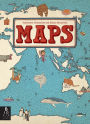
First published in Poland in 2012, this oversize world atlas from the Mizielinskis is packed with details about (some of) the nations of the world, encapsulated in clear-line cartoons. The book is organized by continent, and each featured nation gets its own spread; since less than 50 countries are featured in total, there are noticeable gaps—the Caribbean is left out entirely, and Jordan and Egypt are the sole representatives of the Middle East. Still, the nations that do get covered are a delight to explore, as the Mizielinskis fill their maps with tiny labeled images of local wildlife, cuisine, activities, and notable citizens (Moomin author Tove Jansson appears on the Finland pages, and Desmond Tutu and Nelson Mandela help represent the Republic of South Africa). Compelling, if not comprehensive. Ages 7–10. (Oct.)
[F]eatures playful line drawings of national and geographical attributes, including famous native folk (Freud, Kandinsky, Count Dracula). ... [A]n entertaining and informative choice for budding geographers or Eurail travelers-to-be.
—The New York Times Book Review
[A] delight to explore, as the Mizielinskis fill their maps with tiny labeled images of local wildlife, cuisine, activities, and notable citizens... Compelling.
—Publishers Weekly
Handsomely detailed illustrations include major industries, regional insects, birds, fish, and other animals, plants, crops and prepared food, and famous people. ... This book supports and encourages geographic literacy.
—Library Media Connection (highly recommended)
[R]ewarding fare ... for both young cartografiends and armchair travelers.
—Kirkus Reviews
This handsome and fun-to-browse volume will inspire armchair travelers. ... The artwork’s muted earth tones, decorative borders, and fine-lined drawings are reminiscent of an antique rendering, while the numerous small cartoon illustrations add a light, contemporary touch. ... [W]insome renderings.
—School Library Journal
At once a celebration of diversity and an investigation of the natural and cultural offerings that make each country unique, this expansive and impressive book of maps ... is richly detailed with dozens of extraordinary drawings... Hours of fascinating perusal await.
—Foreword Reviews
There is no dearth of atlases for children, but Aleksandra and Daniel Mizielinski's "Maps" is a standout. ... [The authors'] enthusiasm and love for facts kids might want to know shine forth in charming little illustrations.
—Newsday
[A] sumptuous illustrated children's atlas that combines chic, muted colors with witty and informative drawings on heavy matte paper that whispers under the fingers. ... The sort of book you can't help touching, "Maps" is as likely to engross adults as it is 7- to 10-year-olds. ... [I]t gives aesthetic pleasure all the way from the table of contents to the flags of the world at book's end.
—The Wall Street Journal
[A] nonfiction visual feast... [G]loriously portrays the world's profusion of creatures, mountains and man-made structures in chic, subdued shades of beige, mauve and eau de Nil.
—The Wall Street Journal
A visual extravaganza with fascinating trivia in pages as spacious and luxurious as a classic road atlas. It's an invitation to travel around the world one page at a time. ... "Maps" is a treat, with its richness of details catering to young readers in this electronic age who thrive on all kinds of visual stimuli. This book will also appeal to other members of the family. All will scour for details and trivia as obscure, fun and varied as where one might sandboard or see a yak.
—Shelf Awareness for Readers
Along with geographical features and pictures, you'll find amusing depictions of indigenous animals, native dress and characteristic architecture... Between the buildings, food and history, the maps will awaken a wanderlust for unfamiliar and exotic locale.
—Metro Philadelphia
Not exactly your library’s world atlas. These maps, illustrated in distinctive style by the authors, denote the culture and history of a place rather than its exact coordinates.
—Entertainment Weekly
11/01/2013
Gr 2–5—This handsome and fun-to-browse volume will inspire armchair travelers. The book is organized by continent, each represented by a double-page image and followed by maps of several highlighted countries (17 European nations; 8 Asian nations; 7 African nations; etc.). "North America" includes spreads on Canada, the U.S., and Mexico; "South America" features Ecuador, Peru, Brazil, and Chile. Spreads are also devoted to the Arctic and Antarctica. The artwork's muted earth tones, decorative borders, and fine-lined drawings are reminiscent of an antique rendering, while the numerous small cartoon illustrations add a light, contemporary touch. Each entry lists the capital, population, square mileage, language(s), and flag. Whether depicting an area as expansive as Russia or as small as Fiji, each outline map includes major cities, rivers, bodies of water, and mountains. A bounty of labeled images represents flora and fauna, important landmarks and locales, favorite foods and pastimes, historical figures and cultural icons, major industries, individuals in modern and traditional dress, and more. In fact, these winsome renderings often spill beyond the specified political borders, providing plenty to look at and perhaps inspiring further research. Although far from comprehensive, this oversize atlas is a delight to explore. Each country is presented with a dash of local flavor, and the wealth of natural, cultural, and historical details encourages children to appreciate wonders unique to a particular region and characteristics shared across the globe.—Joy Fleishhacker, School Library Journal
2013-09-15
A tourist atlas of sorts, in which maps of select countries are reduced to little more than natural and political borders to serve as backdrops for thousands of small images. Arranged by continent--with Europe's section first and by far the largest--the maps each fill an oversized spread. All are the same size, so that, without regard for scale, the illustrators allot Iceland and New Zealand the same space as, for instance, Antarctica and Russia (including Siberia). Every map teems with labeled, colored drawings of characteristic wildlife and local residents, renowned figures from history and legend, major cities and landforms, famous buildings, important industries, foods, foliage, works of art, musical instruments, and other place-linked sights and items. The images overflow into neighboring oceans and seas, where they share space with pictures of sea life, boats and water sports. Sidestepping the stereotypical tendencies common to older illustrated maps, here human figures sport modern dress as well as regional costume (with labels for most of the latter that note "traditional dress") and, often, specific tribal or cultural identifications. Flags and basic facts are tucked into the corners, but the intent here is plainly to present crazy-quilt impressions of each country's history and culture rather than systematic geophysical information. Not a complete world, but rewarding fare nonetheless for both young cartografiends and armchair travelers. (Informational picture book. 6-12)