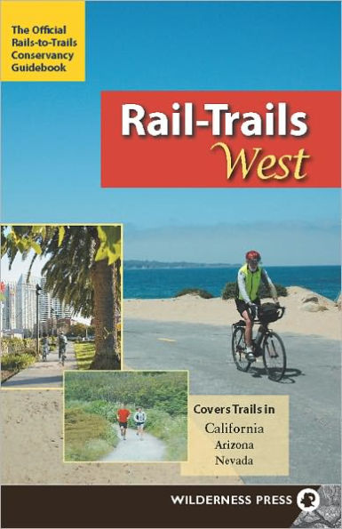
Rail-Trails West: California, Arizona, and Nevada
In this edition in the popular series, the Rails-to-Trails Conservancy presents the best of the West. With 70 rural, suburban, and urban trails threading through 1,050 miles, Rail-Trails West covers 60 trails in California, eight in Arizona, and two in Nevada. Many rail-trails offer escapes from city life, like the Mount Lowe Railway Trail, high above the buzzing Los Angeles basin on a rail line vacationers once took to a mountaintop resort. Others offer the pure sensory thrill of sweeping terrain, like Arizona's 7-mile Prescott Peavine Trail. Still more juxtapose the natural world with the railroad's industrial past, like Nevada's Historic Railroad Hiking Trail, which passes through five massive tunnels to reach Hoover Dam. Every trip has a detailed map, directions to the trailhead, and information about parking, restroom facilities, and other amenities. Many of the level rail-trails are suitable for walking, jogging, bicycling, inline skating, wheelchairs, and horses.
1135379067
Rail-Trails West: California, Arizona, and Nevada
In this edition in the popular series, the Rails-to-Trails Conservancy presents the best of the West. With 70 rural, suburban, and urban trails threading through 1,050 miles, Rail-Trails West covers 60 trails in California, eight in Arizona, and two in Nevada. Many rail-trails offer escapes from city life, like the Mount Lowe Railway Trail, high above the buzzing Los Angeles basin on a rail line vacationers once took to a mountaintop resort. Others offer the pure sensory thrill of sweeping terrain, like Arizona's 7-mile Prescott Peavine Trail. Still more juxtapose the natural world with the railroad's industrial past, like Nevada's Historic Railroad Hiking Trail, which passes through five massive tunnels to reach Hoover Dam. Every trip has a detailed map, directions to the trailhead, and information about parking, restroom facilities, and other amenities. Many of the level rail-trails are suitable for walking, jogging, bicycling, inline skating, wheelchairs, and horses.
15.99 In Stock
Rail-Trails West: California, Arizona, and Nevada

Rail-Trails West: California, Arizona, and Nevada

by Rails-to-Trails Conservancy
Rail-Trails West: California, Arizona, and Nevada

Rail-Trails West: California, Arizona, and Nevada

by Rails-to-Trails Conservancy

eBook

$15.99 

Available on Compatible NOOK devices, the free NOOK App and in My Digital Library.
WANT A NOOK?  Explore Now

Related collections and offers


Overview

In this edition in the popular series, the Rails-to-Trails Conservancy presents the best of the West. With 70 rural, suburban, and urban trails threading through 1,050 miles, Rail-Trails West covers 60 trails in California, eight in Arizona, and two in Nevada. Many rail-trails offer escapes from city life, like the Mount Lowe Railway Trail, high above the buzzing Los Angeles basin on a rail line vacationers once took to a mountaintop resort. Others offer the pure sensory thrill of sweeping terrain, like Arizona's 7-mile Prescott Peavine Trail. Still more juxtapose the natural world with the railroad's industrial past, like Nevada's Historic Railroad Hiking Trail, which passes through five massive tunnels to reach Hoover Dam. Every trip has a detailed map, directions to the trailhead, and information about parking, restroom facilities, and other amenities. Many of the level rail-trails are suitable for walking, jogging, bicycling, inline skating, wheelchairs, and horses.

Product Details

ISBN-13: 9780899977096
Publisher: Wilderness Press
Publication date: 06/02/2009
Series: Rail-Trails
Sold by: Barnes & Noble
Format: eBook
Pages: 264
File size: 43 MB
Note: This product may take a few minutes to download.

About the Author

Rails-to-Trails Conservancy is a nationwide nonprofit dedicated to converting former railroad corridors to public, multiuse recreational trails that offer easy access to runners, hikers, bicyclists, skaters, wheelchair users, and equestrians. It serves as the national voice for more than 160,000 members and supporters, more than 23,000 miles of open rail-trails across the country, and more than 8,000 miles of potential trails waiting to be built—with a goal of ensuring a better future for America made possible by trails and the connections they inspire. To find out more about Rail-Trails, check out the Conservancy's official website at railstotrails.org.

Read an Excerpt

Iron Horse Regional Trail

  • Location Alameda and Contra Costa counties
  • Endpoints Near Buchanan Airfield in Concord to Dublin/ Pleasanton BART station
  • Mileage 24.5
  • Roughness Index 1
  • Surface Asphalt
  • Uses Walking, cycling, inline skating, wheelchair access
The area surrounding the Iron Horse Regional Trail has an important history as part of the San Ramon Valley’s agricultural and ranching past. Today, the Iron Horse Trail connects two counties and twelve cities, and runs through quiet residential neighborhoods, lively business and commercial districts, and shady greenbelts. This popular and extensively used trail roughly follows Interstate 680, beginning in the city of Concord on its northern end, and passing through Pleasant Hill, Walnut Creek, Alamo, Danville, San Ramon and Dublin before ending at the Dublin/Pleasanton BART station. Plans call for the trail to be extended on the north end to Suisun Bay in Martinez, and on the south end to Stanley Boulevard in Pleasanton, where an existing bike trail leads west to Livermore. This southern extension is well underway, with a 1-mile section midway between the BART station and Stanley Boulevard dedicated in March 2008.

At the northern end, the trail begins just south of Highway 4, near the northeast corner of Buchanan Airfield in Concord. The trail nears the Pleasant Hill BART station at about mile 5. A rest stop across the street from the BART parking lot features picnic tables, a drinking fountain and benches. The northernmost part of the trail, as well as the proposed area around Suisun Bay, follows a marshy area, which is a haven for ducks and geese. Continuing south, the area becomes increasingly more urban, as the trail passes nearby downtown Walnut Creek. (The Walnut Creek BART station is about a half mile off the trail). A bike overpass bridge spans Ignacio Avenue in a congested section of Walnut Creek. South of Walnut Creek the trail passes under Interstate 680 at Rudgear Road to the west side of the freeway. A staging area here features parking, a drinking fountain, benches and tables.

From this point the trail meanders through residential areas, where the presence of many “doggy bag stations” testifies to the popularity of the trail among local residents. The trail crosses residential streets numerous times, typically in low traffic areas, and offers easy access to restaurants and shopping. Much of the trail in this section includes a dirt running path adjacent to the asphalt bike trail. In Danville, the trail passes directly behind the commercial downtown area. Nearby at the corner of Railroad and Prospect Avenues is the old Southern Pacific Depot, which is the only original depot remaining on the line. Just past the depot is a pleasant area featuring restaurants with outdoor seating overlooking the trail.

Picking up the trail again, you cross under I-680 to the east side and traverse Bishop Ranch Business Park, a commercial section that parallels the trail for about 2 miles. Next you reach the San Ramon Golf Club. The trail bisects the golf course, with chain-link fencing providing protection from errant golf balls. As the trail slices through Dublin, the environment is urban once more. The southern endpoint is at the BART parking lot on the Dublin side of the Dublin/Pleasanton BART station.

DIRECTIONS
To reach the northern trailhead, exit Highway 4 westbound at Arnold Industrial Way. Turn left onto Arnold Industrial Place and left again on Solano Way. Follow Solano Way as it crosses under Highway 4. Turn right onto Marsh Drive. The signed trailhead is on your left. Street parking is very limited.

To reach the southern trailhead, exit Interstate 580 at Hopyard Road. Turn right on Hopyard Road and proceed for 0.3 mile. Turn right on Dublin Boulevard and go 0.5 mile. Turn right on Demarcus Boulevard, which leads to the Dublin/Pleasanton BART station. The signed trailhead is at the north end of the parking lot.

CONTACT: www.ebparks.org/parks/trails/iron_horse

Table of Contents

About Rails-to-Trails Conservancy

Foreword

Introduction

How to Use This Book

The Trails

Staff Picks

Acknowledgments

Index

From the B&N Reads Blog

Customer Reviews