
Atlas of the World Coloring Book
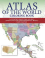
Learn about the continents and countries of the world with the 170 detailed maps featured in this book. Atlas of the World Coloring Book is organized by continents, regions, and individual countries. Each entry features the completed color original and an accompanying line drawing for you to color in. Following the line drawings, you can learn about the location of each country, the other countries they border, and their size in relation to them. Widen your geographical knowledge by coloring in topographical maps of Monaco, the Caucasus, the Mediterranean, Japan, and the Horn of Africa. Color in political maps of the 50 states of the USA, the municipalities of Puerto Rico, and the territories of the Caribbean. Discover interesting facts, such as: • Approximately 98 percent of Antarctica is covered by ice • Cuba is the largest Caribbean island • Germany shares borders with nine countries • Bangladesh is almost entirely flat • The Sahara Desert covers most of North Africa • Russia is the biggest country in the worldAtlas of the World Coloring Book is both an excellent reference guide and a relaxing learning tool.
1125581267
Atlas of the World Coloring Book
Learn about the continents and countries of the world with the 170 detailed maps featured in this book. Atlas of the World Coloring Book is organized by continents, regions, and individual countries. Each entry features the completed color original and an accompanying line drawing for you to color in. Following the line drawings, you can learn about the location of each country, the other countries they border, and their size in relation to them. Widen your geographical knowledge by coloring in topographical maps of Monaco, the Caucasus, the Mediterranean, Japan, and the Horn of Africa. Color in political maps of the 50 states of the USA, the municipalities of Puerto Rico, and the territories of the Caribbean. Discover interesting facts, such as: • Approximately 98 percent of Antarctica is covered by ice • Cuba is the largest Caribbean island • Germany shares borders with nine countries • Bangladesh is almost entirely flat • The Sahara Desert covers most of North Africa • Russia is the biggest country in the worldAtlas of the World Coloring Book is both an excellent reference guide and a relaxing learning tool.
10.0
In Stock
5
1

Atlas of the World Coloring Book
224
Atlas of the World Coloring Book
224Paperback
$10.00
10.0
In Stock

Product Details
| ISBN-13: | 9781782745259 |
|---|---|
| Publisher: | Amber Books |
| Publication date: | 02/22/2022 |
| Pages: | 224 |
| Sales rank: | 594,380 |
| Product dimensions: | 9.00(w) x 11.20(h) x 1.00(d) |
From the B&N Reads Blog
Customer Reviews
Explore More Items


